Slides
Out of West Yellowstone on US-287 .....the road to Ennis, Montana you can see stark visible evidence of earthquake activity. Along the north shore of Lake Hebgen (part of the Madison River) you can see fault scarps where past earthquakes have moved the earth on both sides of the fault. Reading about earthquakes and seeing where they have moved the earth is an exciting experience.
A little further to the west (west of Hebgen Lake) is Quake
Lake. An earthquake in August of 1959
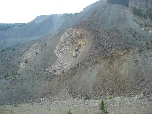
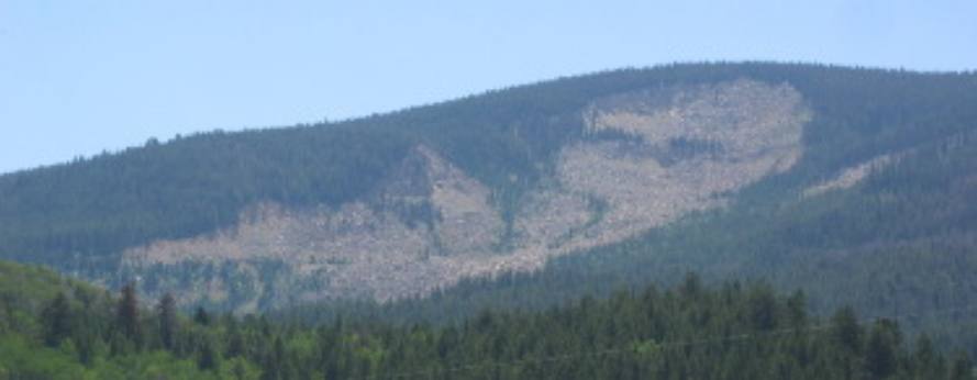
Earthquake slide from the big 1959 Earthquake
The entire mountainside fell not just that kinda bare spot. Remember that this quake and the resultant landslide took place in August of 1959 some 48 years ago. Only a few scattered trees have managed to find a foothold on the scar in those 48-years.
The bottom part of this landslide is what the U.S. Army Corps of Engineers removed in an effort to get the Madison River flowing again. Although the Corps of Engineers removed a lot of material there is still enough material remaining to create the dam that holds back Earthquake Lake. I suspect, from the looks of Earthquake Lake, that there is 50' to 100' of landslide material still in place.
When we were in this area 6-years ago we stopped and visited the Earthquake Visitor Center operated by the National Forestry Service. If you are ever in West Yellowstone, Montana you should take time to visit the Earthquake Visitor Center. It is located about 20-miles northwest of West Yellowstone, Montana on US 287.
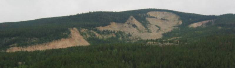
Earthquake slide of 1959 in Montana
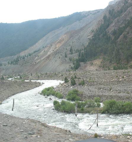
We are traveling east on US 287 about 20-miles northwest of West Yellowstone, Montana. The bare spot on the mountainside is where a magnitude 7.5 earthquake triggered a landslide in August of 1959 that completely covered the Madison River seen here.
In fact the landslide buried the river under several hundred feet of debris.
Look closely at this section of the river because much of that landslide material was removed in order to allow the Madison River to flow again thus removing the possibility of a major flood if that landslide dam gave way after water backed up behind it.
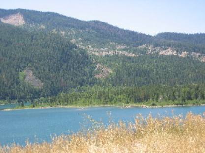
Quake Lake created by the earthquake induced slide of 1959 in Montana
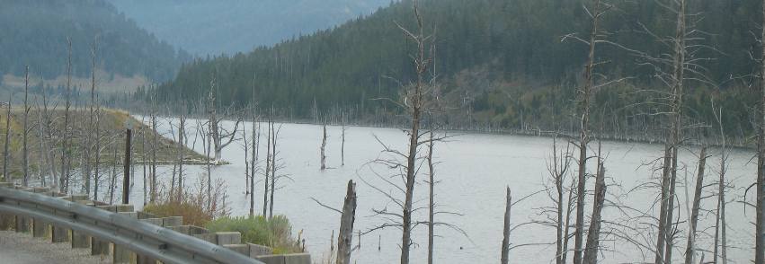
Earthquake Lake was formed in August of 1959 when a 7.5 magnitude earth quake triggered slide blocked flow of the Madison River. A 50 foot spillway was hurriedly cut through the slide by the U.S. Army Corps of Engineers to avert a possible flood downstream. Five miles of U.S. Highway 287 were flooded or outright destroyed. The dead trees along the lakeshore were drowned by high water 48-years ago.
Quake Lake several miles upstream from the dam created by the 1959 slide
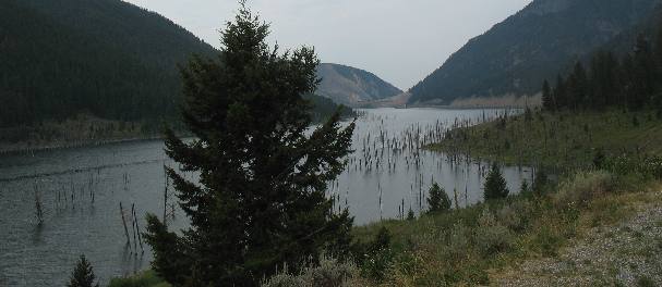
Quake Lake as seen several miles from the landslide that created the lake. Look in the center of the picture for the mountain with the bare spot on it. That is where the slide took place that dammed the Madison River creating this lake.
Another awesome slide area is located a hundred miles or so to the southeast of here near Jackson Hole, Wyoming. The Gros Ventre Slide area located in the southeast corner of Teton National Park is one of those geologic wonders that capture the imagination. From far off, everyone can see is this huge "bald-spot" in the side of a prominent mountain on the east side of the Teton Valley. For 20-miles or so when traversing the valley you can see this "alien" complete with eyes and mouth prominently featured. To just say that the Gros Ventre Slide area is unusual is just not enough. It is special, unique if you will.
Gros Ventre Slide
Many visitors see an "alien" in this slide, do you? The slide area looks a bit different from each angle. These pictures are from the west looking to the southeast.
Gros Ventre Slide
This is a look at the Gros Ventre Slide from many miles away looking to the southeast. Any way you look at it there was a lot of material that slid off that mountain.
Do you see the "ALIEN" in this picture of the Gros Ventre Slide?
Slide Lake on the Gros Ventre River in Wyoming
That low area with trees is where the slide crossed the valley and dammed up the Gros Ventre River. It was much higher until the "natural slide dam" gave away and 60' feet of water in the reservoir rushed downstream is a devastating flood that destroyed the town of Kelly in addition to scouring the sides of the canyon through which the Gros Ventre River flows.
Slide Lake is now much smaller than before the flood caused by some of the slide created dam giving away. That event will be discussed more below. Some 60' of the slide dam washed away so this lake was 60' deeper before the great flood.
More Geology PagesSome Miscellaneous Subjects ** Our Cute Signs
Mike & Joyce Hendrix
Mike & Joyce Hendrix who we are We hope you liked this page. If you do you might be interested in some of our other Travel Adventures: Mike & Joyce Hendrix's home page Travel Adventures by Year ** Travel Adventures by State ** Plants ** Marine-Boats ** Geology ** Exciting Drives ** Cute Signs ** RV Subjects ** Miscellaneous Subjects
We would love to hear from you......just put "info" in the place of "FAKE" in this address: FAKE@travellogs.us Until next time remember how good life is.
|
|
||

|
|||
|
|
|||
|
|
|||
|
|