Gros Ventre Landslide
Places Visited: Wyoming: The Gros Ventre Slide located a few miles east of Grand Teton National Park. July 30 through August 5, 2006: Colter Bay Campground in Grand Teton National Park near Moran Junction, Wyoming: N43° 54.659' W110° 38.526' $15.00 NO hookups with paved interior roads and gravel spots. Nice, clean park and you really do not need hookups in the summer. August 5, through August 12, Gros Ventre Campground in Grand Teton National Park near Jackson, Wyoming: N43° 36.979' W110° 40.000' $15.00 NO hookups with paved interior roads and gravel spots. Nice, clean park and you really do not need hookups in the summer. We moved the motorhome from Jackson Hole to Colter Bay Village in the northern part of Grand Teton National Park. That entire drive was through Grand Teton National Park Valley, with the mighty Tetons providing a backdrop on our western flank. A more scenic drive is hard to find. Eight days later we retraced our path and moved the motorhome south to Gros Ventre Campground just north of Jackson where we spent another week.
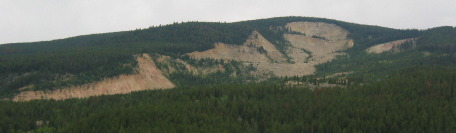
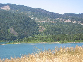
The Gros Ventre Slide area located just outside the southeast corner of Grand Teton National Park is one of those geologic wonders that capture the imagination. From far off, for everyone to see is this huge "bald-spot" in the side of a prominent mountain on the east side of the Teton Valley. For 20-miles or so when traversing the valley you can see this "alien" complete with eyes and mouth prominently featured. To just say that the Gros Ventre Slide area is unusual is just not enough. It is special, unique if you will.
Gros Ventre Landslide east of Grand Teton National Park
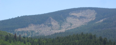
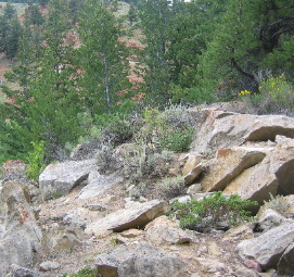
The slide area looks a bit different from each angle. These pictures are from the west looking to the southeast.
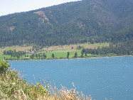
Gros Ventre Landslide near Grand Teton National Park
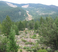
This is looking south at the gaping hole in the mountain from on top of the slide debris at the opposite side of the valley. From this angle you can not make out the "alien" like you can when looking at it from the west.
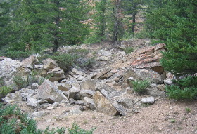
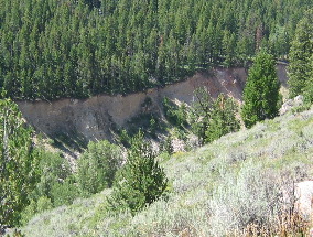
When you stand at the base of the slide (where these pictures were taken) the path of the slide can be clearly seen. This slide took place in 1924 yet the "scar" is still visible. Look closely at the picture. The slide material came not only from the bare spots but from the light green area as well. The light green area has actually started to recover and hide the scar left 81-years ago. As you can see a tremendous amount of earth and rocks moved down the mountainside and into the valley with much of it actually flowing up the other side of the valley. Young trees carried down hundreds of feet from higher elevations managed to survive in spite of the change of location (most are growing at awkward angles now). Englemann spruce and quaking aspen produced rings of different thickness in their growth layers indicating the time of the landslide and their relocation. New trees have have begun to grown on the landslide (both the scar area and debris field). Many colorful plants may be seen at certain times of the year. The slide's debris field, is the habitat of mice, chipmunks, conies, marmots and beaver, many of which rely on crevasses in rocks for protection and homes. An interpretive trail helped us understand this unique area.
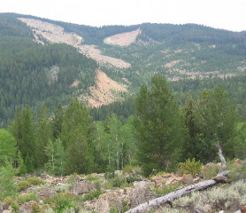
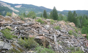
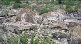
Remnants of Gros Ventre Landslide of 1925
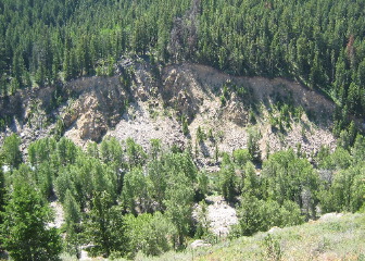
What you see is the remnants of one of the largest earth movements in the world. On June 23, 1925, earth, rock and debris moved rapidly from an altitude of 9,000 feet, across the valley bottom and up the slope of the red bluffs on the other side. The action lasted only minutes but a river (Gros Ventre River) was dammed and the landscape drastically change.
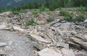
Remnants of Gros Ventre Landslide of 1925
The "red bluffs" are in the background of this picture. We are actually well up the mountainside on the opposite side of where the slide fell into the valley. Eyewitnesses said the debris rolled up the other side of the valley (where we are) much like water would do when falling from 9,000 feet.
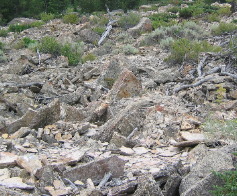
Remnants of Gros Ventre Landslide of 1925
When we are in the appropriate place on the interpretive trail, which is on the slide itself, we can see yellow gray rocks resting against the red bluffs on the far side of the slide (across the valley) from where they were originally. Eye witnesses of the slide likened it to a wave of water as it rushed down the mountainside, crossed the valley and dashed up the slope of the red bluffs. This is the spot where the wave of earth & rocks finally came to rest on the far side of the valley and part way up the mountain on the other side. Witnesses estimated the entire action took only two minutes.
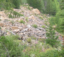
Gros Ventre Slide of 1925
Most of the wood debris seen here once floated on the lake formed by the slide. This natural dam failed some years later and the water level rapidly dropped about 60-feet, leaving the debris where you now see it. The debris was blocked from going downstream during the flood when this natural dam gave way.
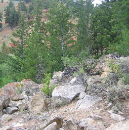
Gros Ventre Landslide debris on side of adjacent mountain
Large trees had little chance to survive the violent action of the landslide though some of the smaller trees survived and are still growing, although usually in a tilted position.
Lower Slide Lake on Gros Ventre River
That low area with trees is where the slide crossed the valley and dammed up the Gros Ventre River. It was much higher until the "natural slide dam" gave away and 60' feet of water in the reservoir rushed downstream is a devastating flood that destroyed the town of Kelly in addition to scouring the sides of the canyon through which the Gros Ventre River flows.
On May 18, 1927, a portion of the landslide dam failed, resulting in a massive flood that was 6 feet (2 m) deep for at least 25 miles (40 km) downstream.
Scoured Canyon walls of Gros Ventre River created when slide dam partially gave away
These pictures are taken about 1/2-mile below the slide/dam where the canyon walls were washed away when the dam created by the slide gave away years later. Actually the complete dam did not entirely give way but the top 60' did. The wall of water that escaped the reservoir washed away the sides of this valley as it rushed downstream. The town of Kelly downstream 5 to 10 miles was destroyed even though it was not situated in a narrow valley like this. Thankfully, the wall of water had room to spread out and dissipate some of the devastating energy by the time it reached Kelly. Still, six people in Kelly lost their lives in that flood.
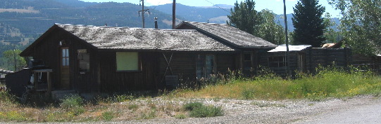
Kelly, Wyoming 6-miles downstream from Gros Ventre Landslide and dam
This is downtown Kelly today. I would guess that the population is less than 100 residents. Kelly is located about 3-miles east of the Gros Ventre Campground we were staying in.
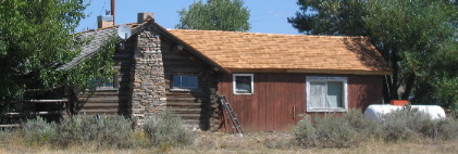
Private residence in Kelly, Wyoming 6-miles downstream from Gros Ventre Landslide |
| ||
|
| |||
|
| |||
|
|