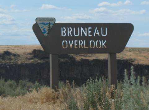
Bruneau Canyon Overlook
June
7, 2007.
We are staying at Three
Island Crossing State Park located in the town of Glynn's
Ferry. $4 entry fee plus $21 for RV site with water & elect. Very
nice campground and it is full. Mature trees with good shade and green grass.
If by chance the campground at Three
Island Crossing is full there is a nice commercial campground at a winery
located at the front gate to the State Park. They were $20 for FHU and they had
shade. Point being----they would be a good alternative and some would like it
better than the state park since is was $1 cheaper and it had FHU.

Our destination today is Bruneau
Canyon Overlook 18-miles south of the small crossroads town of Bruneau.
Large
stash of hay on way to Bruneau Canyon
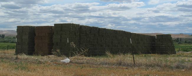
The
first 5 or so miles out of Bruneau was through
a well irrigated valley producing of all things ------------- alfalfa, and loads
of it as this huge stack of alfalfa hay attests.
From Bruneau
set your odometer on -0- then turn south on Hot Springs Road---there is also a
brown sign pointing toward "Bruneau Canyon Overlook".
About 10-miles down Hot Springs Road it turns into decently maintained gravel.
When the odometer reaches 18-miles you should see signage for Bruneau
Canyon Overlook where you turn right (west) one mile or so.
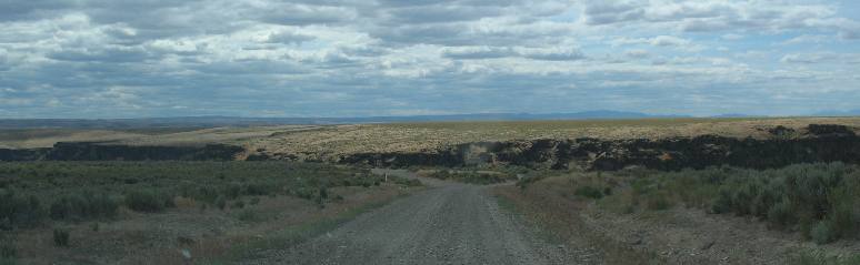
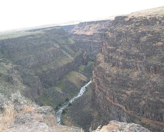
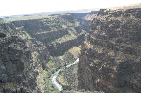
We
have been driving down a gravel road for over 10-miles when low and behold we
see the canyon overlook. It is hard to believe there is a canyon out here but
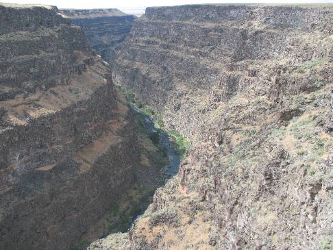
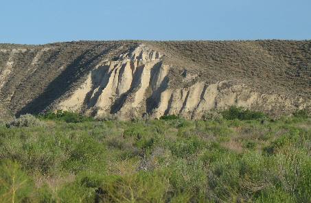
here it is. From here one can see the dark gash in the earth.
Awesome, is the only word that comes close to describing it. Totally
awesome! The Bruneau River has cut this canyon through what looks to me to be
600' of hard basalt.
Some places are over 1,200' deep but I can't say for certain this overlook is
over the portion of the 1,200' deep part of the chasm.
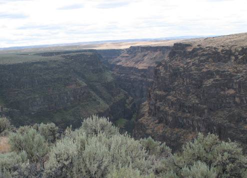
One
can only imagine the cataclysmic events over thousands of years that created lava
flow this deep.
By
looking at the strata it is fairly easy to tell that tremendous volumes of lava
would spill over this area then none would flow for hundreds of years. When lava
was not flowing a layer of ordinary sediment would be laid down. Then lava
would flow again covering the old lava
and the sediments covering it.
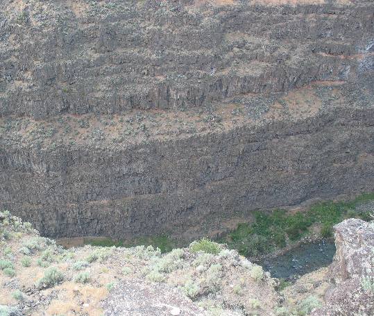
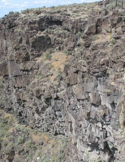
In the picture on the left
you can easily see the "bacon strips" clearly showing where the layers
of sediment covered one old lava
flow then that in turn was covered by yet another round of molten lava.
Layer upon layer upon layer of molten lava
is what the Bruneau River has cut through to carve the Bruneau
Canyon. My mind is having trouble even contemplating the events that created
Bruneau Canyon. How many years of lava
flow are represented in the walls of Bruneau Canyon?
How many years did it take for the Bruneau River to carve this canyon through
the hard basalt?
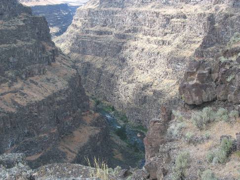
The
section of Bruneau Canyon visible from the
overlook is known as Five Mile Rapids. During the spring run-off, it is one of
the most challenging stretches of white waer in the nation for rafters and kayakers.
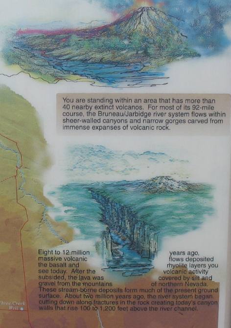
While
we can not see them, rhyolite canyons dominate the Bruneau/Jarbidge
landscape. These canyons are noted for nearly contnuous, vertical, monolithic
rock walls that rise directly from the river channel, and countless majestic rock
spires, called hoodoos.
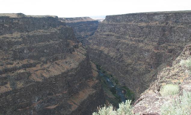
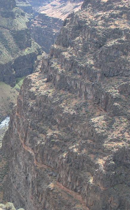
The
basalt flows
that stretch out from here were pushed up through large fissures in the earth's
crust. As the flows cooled, they began to shrink and formed vertical fractures.
This process is called columnar
jointing.
Eventually, these colums of rock fractured again horizontally
leaving large blocks. Eventually, the blocks break away and tumble to the base
of the cliffs or into the river channel, constricting the river's flow and creating
narrow, steep-gradient rapids such as those in the pictures.
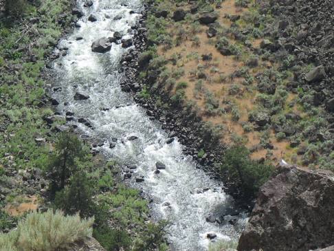
The
blocks of basalt
that tumble to the base of the cliffs are known as talus
thus creating talus
slopes at the bottom.
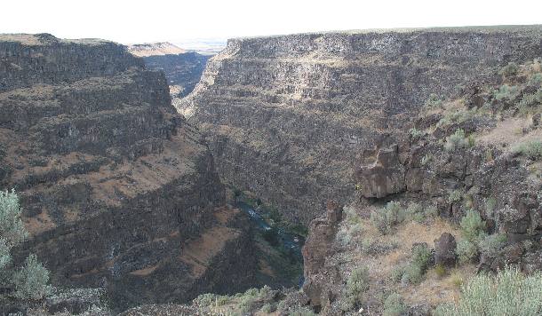
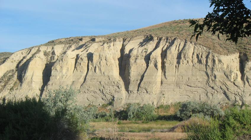
This
is a close-up of the basalt
wall of Brueneau Canyon in southern Idaho.
In
the picture to the right it is easy to see where layers of sediment were laid
down between successive layers of molten lava.
I
included this picture to show at least one thick layer of red sediment about 1/3
the way down this cliff face.
California
quail
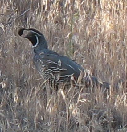
Evening around Three
Island Crossing State Park is a good time to spot California quail. They
are out moving around. During this time of year these birds are paired up. This
is one colorful male, his mate is not nearly as colorful.
California
quail
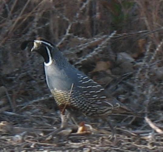
Male
California quail walking through Three
Island State Park in the Snake
River Valley of southern Idaho.
Evenings
is also a good time to take pictures of the setting sun highlighting bluffs on
the south side of the Snake
River Valley in southern Idaho
east of Brueneau..
This
is looking to the southeast across the Snake
River Valley from Three
Island Crossing State Park in the late afternoon. So much of the geography
in southern Idaho is lava
rock. Surprisingly along the south side of the river is this large river cut of
sedimentary rock.
Until next time remember how good life
is.
Until next time remember how good life is.
Some
Wyoming Adventures **
** More 2007 Travel Adventures
Mike
& Joyce Hendrix who we are
We
hope you liked this page. If you do you might be interested in some of our other
Travel Adventures:
Mike & Joyce Hendrix's
home page
Travel
Adventures by Year ** Travel
Adventures by State ** Plants **
Marine-Boats ** Geology
** Exciting Drives ** Cute
Signs ** RV
Subjects ** Miscellaneous
Subjects
We
would love to hear from you......just put "info" in the place of "FAKE"
in this address: FAKE@travellogs.us
Until next time remember how good life
is.