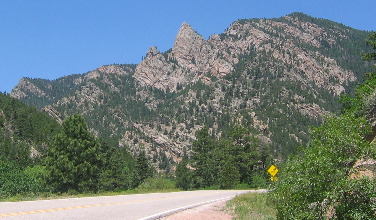
Mountain Valley Scenic Drive south of Royal Gorge in ColoradoSaturday June 10 through Tuesday June 13 2006: Pueblo, Colorado (On I-25 100-miles north of the New Mexico border). We are in Pueblo West Campground N38° 20.522 W104° 43.097'. Pueblo West Campground is located on US-50 about 5-miles west of I-25. It is totally gravel with huge pull-thru sites (trees are limited); 50-amps, water and sewer, $20 per-night 719-547-9887. This is a campground and equestrian facility. Tuesday, our last full day in this area was spent doing the Mountain
Valley scenic drive as suggested by a handout we obtained from the
Canon
City visitor center. This was a beautiful drive through some
awesome mountain valleys flanked by snow covered mountains. A local
we met somewhere along the way said that there were no stop lights
in the entire county "Comal County" and I think he said
18,000 residents. Sparsely populated would be an understatement. Wide
open spaces lush grazing areas and beautiful forested mountains. However,
many if not most of the mountains on the western flank of this beautiful
valley climb to over 14,000' which puts them 2,500' above the tree
line. Snow can still be seen on many of these peaks. Bunny at our campsite in Pueblo West Campground Pueblo, Colorado
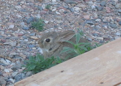
When I stepped out of the motorhome here was this cute little bunny that we had been seeing. It seemed to be adopting our motorhome. Where are your grandchildren in moments like this?
Buffalo Gord
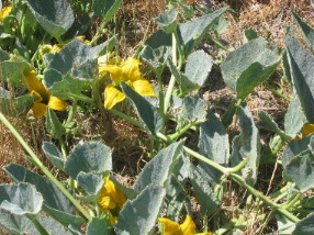
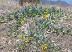
We traveled west on US-50 out of Pueblo about 20-miles to where we turned to the southwest on SR-115 to Florence that old gold processing town with all the old buildings. In Florence we turned south on SR-67 toward Wetmore & other small communities. Only a few miles past Florence we spotted these buffalo gourd growing in the right of way. They were blooming like crazy and putting on quiet a show with their yellow blooms.
Buffalo Gord
Buffalo gourd growing in the right of way. They were blooming like crazy and putting on quiet a show with their yellow blooms.
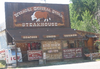
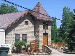
Westmore General Store
Wetmore was an interesting community. I wish we would have taken time to wander through this store.
Church in Westmore, Colorado
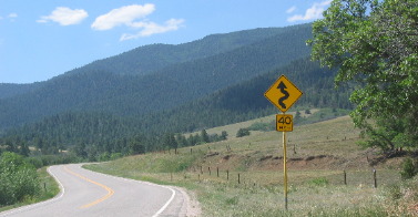
Small sandstone church in Westmore, Colorado. Mountain Valley Scenic Drive SR-67 in Colorado
On SR-67 the scenery was constantly changing but always in a valley of some sort. Evidence of the mountain building forces that played in this area 135 million years ago are evident in many places.
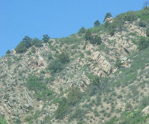
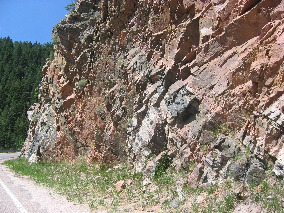
Uplift in this area has created some unusual rock formations
The uplift not only moved and displaced the sedimentary layers of soil it pushed up and moved asunder several layers of igneous rock deposited in previous mountain building episodes.
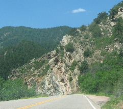
Mountain Valley Scenic Drive SR-67 in Colorado
Visual overload was taking hold. One moment we were mesmerized by the geologic wonders then around the corner would be this scene where someone had settled and was working the land. The next part of our Mountain Valley Scenic Drive is continued in Bigelow Divide Other Travel Adventures in this area that you may enjoy: Skyline Drive near Canon City, Colorado Victor & Cripple Creek two old gold mining towns Click here for some Colorado travellogsUntil next time remember how good life is. More Colorado AdventuresAdventures by State ** More 2006 Travel Adventures
Mike & Joyce Hendrix
Mike & Joyce Hendrix who we are We hope you liked this page. If you do you might be interested in some of our other Travel Adventures: Mike & Joyce Hendrix's home page Travel Adventures by Year ** Travel Adventures by State ** Plants ** Marine-Boats ** Geology ** Exciting Drives ** Cute Signs ** RV Subjects ** Miscellaneous Subjects
We would love to hear from you......just put "info" in the place of "FAKE" in this address: FAKE@travellogs.us Until next time remember how good life is.
|
| ||
|
| |||
|
| |||
|
|