South Pass on the Overland Trail in WyomingLander Cutoff on the Oregon Trail in southern Wyoming
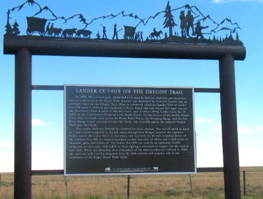
In 1858, an ancient path, which had been used by Indians, explorers and mountain men as a short cut to the Snake River country was developed by Frederick Lander into an alternate route on the Oregon Trail. What is commonly called the Lander Trail or Lander Cutoff starts near South Pass on the Oregon Trail and follows Lander Creek to the Continental Divide. Then follows Little Sandy Creek across the Green River Valley, the Wyoming Range and the Salt River Range before entering present-day Idaho. The Lander Cutoff rejoins the original Oregon Trail near Fort Hall in Idaho. This wagon road was favored by travelers for a variety of reasons. The cutoff saved as much as 7 days travel compared to the old route through Fort Bridger, avoided the expensive ferries across the Green River and bypassed the 50-mile waterless dessert of the Sublette Cutoff Its longest waterless section was only 10-miles, and it had access to abundant grass and firewood. The Lander Cutoff was used by an estimated 13,000 emigrants in its first year, with 9,000 of them signing a statement of support for the road at Fort Hall. While use dwindled after completion of the transcontinental railroad in 1869, the trail was still used by emigrants into the 20th century and played a role in the settlement of the Upper Green River Valley. South Pass is perhaps the most significant transportation-gateway through the Rocky Mountains. Indians, mountain men, Oregon Trail emigrants, Pony Express riders, and miners all recognized the value of this passageway straddling the Continental Divide. Bounded by the Wind River Range on the north and the Antelope Hills on the south, the pass offered overland travelers a broad, relatively level corridor between the Atlantic and Pacific watersheds.
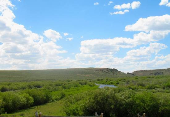
Mining plays a fundamental role, in the history of the South Pass region. Gold may have been discovered as early as 1842, but gold fever did not strike until 1867 when a sample of South Pass ore arrived in Salt Lake City. News of the discovery spread swiftly and hordes of expectant millionaires descended on the new towns of South Pass City, Atlantic City and Miner's Delight. The boom played out quickly. The easily obtained placer gold was rapidly exhausted and miners began leaving the area in the early 1870's. Despite the brief duration of the boom, mining activity did not cease. In 1884, a Frenchman named Amble Gainer operated a hydraulic gold mining system which employed many local residents over a ten year period. The Fisher Dredge Company recovered considerable gold ore from the bed of Rock Creed during the 1930's. More recently, the United States Steel iron ore mine operated near Atlantic City from the early 1960's until 1983. Hard rock mines also reopen periodically and some are presently operating. Until the next boom arrives travelers can experience the flavor of a Rock mountain mining town by visiting nearby South Pass City which has been restored by the State of Wyoming. The Sweetwater River in south-central Wyoming flows to the Atlantic
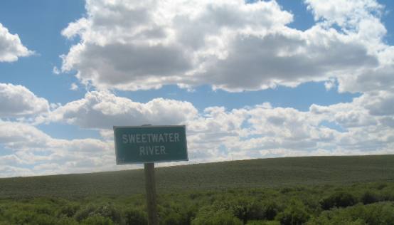
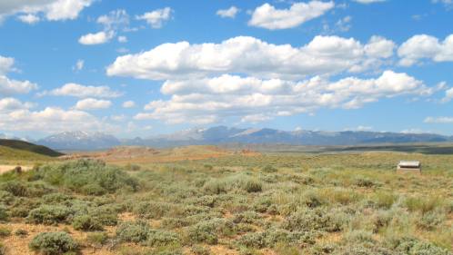
The Sweetwater River flows to the Atlantic Ocean. The Sweetwater River is the last water before crossing over the Continental Divide at South Pass. On the other side of South Pass all water flows to the Pacific Ocean.
Sweetwater River in southern Wyoming along the old Oregon Trail west of Atlantic City
Sweetwater River at South Pass in south central Wyoming.
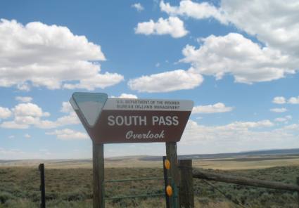
South Pass Overlook on SR 28 in southern Wyoming west of Atlantic City
This kiosk on Wyoming SR-28 about 10-miles west of South Pass City is the official marker for South Pass, the spot made so famous on the Oregon Trail. As you can see it is difficult to tell this is the Continental Divide. The change in elevation is very subtle in this area.
South Pass on the Oregon Trail in southern Wyoming near Atlantic City
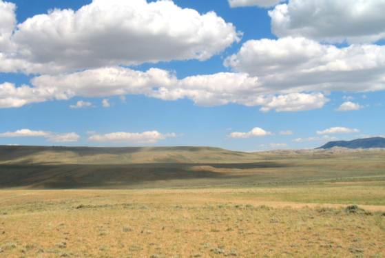
This is a view of the famous South Pass on the Oregon Trail. From here it does not look the part of a pass. But if you could see behind me the Wind River Range still has snow on the peaks and this is June. South of here is the Rocky Mountains, and they are not far south of here. South Pass is 7546 feet above sea level at its highest point. At the south end of the Wind River Mountains, the broad open sagebrush-covered pass is about twenty miles wide in this area.
Wind River Mountains north of South Pass along the old Oregon Trail in Wyoming
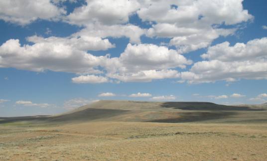
Like I said when we turn around and look north the Wind River Range is visible and there would probably be no way to navigate wagons over those mountains. Thus South Pass was the "route across the mountains". With South Pass behind them Oregon and California-bound travelers faced the second half of their journey. The roughest travel was yet to come. From Missouri to South Pass, emigrants were able to follow rivers. But from South Pass to Oregon and California, they faced dry stretches such as the high-altitude desert of the Green River Basin. The dry climate played havoc with wagon wheels they kept shrinking wood away from the iron rims. Approximately 20 miles on the trail west of South Pass emigrants arrived at the Sublette Cutoff, also known as the Parting- of-the-Ways. It was there that groups separated, some going to Oregon, some to Utah and others to California. Whatever their destination, every day they struggled with live along the trail. Lonely graves, most unmarked, are testimony to thousands of lives taken by cholera, accidents - especially at river crossings, and childbirth. Attacks by Native Americans were often feared, but almost never occurred. It may be hard to visualize the lives of those people, but a short walk into the landscape allows insight into some of their problems. It doesn't take but a few feet to know that I wouldn't want to walk the Oregon Trail.
View of South Pass looking south from SR-28 in southern Wyoming
Fur trapper & trader William Sublette traveled over South Pass in the 1820's but in 1830 he brought the first wagons to South Pass. While they may not have taken their wagons over South Pass they demonstrated that it was feasible to bring wagons to South Pass. William Ashley, another fur trapper, was the one that in 1824 took the first wheeled vehicle across the Continental Divide at South Pass. That vehicle was a "four-pounder" canon. Captain Bonneville took the first wagons over South Pass in 1832. But it was U.S. Government explorer, Lt. John Fremont, who was responsible for publicizing the South Pass route. Scattered references to an easy passage over the Rockies had appeared in newspapers for a decade, but in 1842 Fremont created enthusiasm for South Pass by explaining that a traveler could go through it without any "toilsome ascents". As knowledge of South Pass became widespread, a great western migration commenced. Thousands of Mormons, and future Oregonians and Californians, would cut a widespread, a great western migration commenced. Thousands of Mormons, and future Oregonians and Californians, would cut a wide swath along the route in the next twenty years. Looking north from South Pass at the Wind River Range in Wyoming
This is looking north at the Wind River Range. At this spot South Pass is approximately 20-miles wide and is the only way across the Continental Divide for wagon traffic.
Click here for more Wyoming travellogsUntil next time remember how good life is. More Wyoming AdventuresAdventures by State ** More 2010 Travel Adventures
Mike & Joyce Hendrix
Mike & Joyce Hendrix who we are We hope you liked this page. If you do you might be interested in some of our other Travel Adventures: Mike & Joyce Hendrix's home page Home ** Travel Adventures by Year ** Travel Adventures by State ** Plants ** Marine-Boats ** Geology ** Exciting Drives ** Cute Signs ** RV Subjects ** Miscellaneous Subjects
We would love to hear from you......just put "info" in the place of "FAKE" in this address: FAKE@travellogs.us Until next time remember how good life is.
|
| ||
|
| |||
|
| |||
|
|