Moki Dugway part fourMoki DugwayMay 19, 2007. We stayed in Cottonwood Campground in Bluff, Utah. Several private RV-Parks were available in Bluff. We chose Cottonwood. The others were just as nice. One mile west of town is Sand Island Department of the Interior Campground with no utilites. It was OK as well. Cottonwood was $20 for a FHU site.
Earlier today we visited Mexican Hat and the Great Goosenecks of the San Juan. Now we are about to encounter the famous and exciting Moki Dugway. The "Moki Dugway" what on earth is the "Moki Dugway". I will start by stating that a "dugway" is a means of traversing a steep hillside without sliding down the slope. The Moki Dugway was built by Texas Zinc and Minerals during the uranium boom as a way to accommodate ore trucks. The Moki Dugway is 3.5-miles of graded gravel that climbs the cliff at an 11% grade according to Utah tourist information. I don't know that I can adequately explain the Moki Dugway other than to say that it is an exciting drive 1,000 feet up the side of a sheer cliff involving 10% or 11% grades (depending on the info source) and switch backs on a gravel road. But it is better to show you than tell you. Keep in mind that this is PART FOUR of SIX my series covering the Moki Dugway, the other Moki Dugway pages can be accessed here:
part one ** part two ** part three ** part four ** part five ** part six
Switchbacks on the Moki Dugway
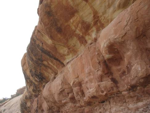
Sandstone cliff walls of the Moki Dugway
Both of us thought the road engineers could have removed more of this overhanging rock. Sandstone walls of the Moki Dugway.
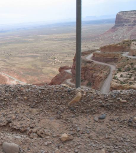
View of Valley & road approaching the Moki Dugway
If you look closely you can see a switch back in the picture on the right. Needless to say it is a long way to the bottom.
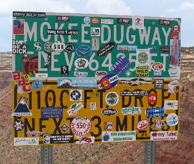
Sign at summit of Moki Dugway
Once at the top this sign provided a little levity to the moment. It seems that the elevation on top of the Moki Dugway is 6435 feet.
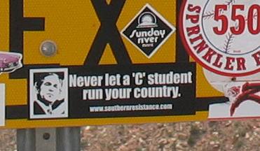
Never let a "C" student run your country
This is a blow up of one of the bumper stickers adorning the Moki Dugway sign. You can see this bumper sticker on the bottom left of the big Moki Dugway sign. Keep in mind this is 2007 and that is President Bush.
Continue to the next Moki Dugway page here
Moki Dugway part one ** part two ** part three ** part four ** part five ** part six
If you liked this Travel Adventure you might like one of these: Goosenecks on the San Juan River southern Utah Natural Bridges National Monument in southern Utah
Click here for more Utah Travel Adventures
More Utah AdventuresPlants Trees and Flowers ** More 2007 Travel Adventures
Mike & Joyce Hendrix
Mike & Joyce Hendrix who we are We hope you liked this page. If you do you might be interested in some of our other Travel Adventures: Mike & Joyce Hendrix's home page Travel Adventures by Year ** Travel Adventures by State ** Plants ** Marine-Boats ** Geology ** Exciting Drives ** Cute Signs ** RV Subjects ** Miscellaneous Subjects
We would love to hear from you......just put "info" in the place of "FAKE" in this address: FAKE@travellogs.us Until next time remember how good life is.
|
| ||
|
| |||
|
| |||
|
|