Hells Canyon Overlook in Oregon
June 16, 2007. We are staying at Mountain View Travel Park in Baker City. $24.79 FHU, shade and a nice enough RV-Park. It must be a former KOA (Keep On Adding)since they charge extra for everything, $2 extra for wifi, $ 2 extra for larger sites, you get the picture ---- KOA Keep On Adding..
This was our day to check out Hells Canyon. It is a 90-plus mile drive, one way, from Baker City to Hells Canyon on the Snake River. Eastern Oregon is an extension of the great desert. However, things change often and rapidly. Eastern Oregon is a region of contrasts, as in hills, mountains and valleys. These changes in elevation create changes in vegetation. Mountains play host to a variety of evergreen trees, quaking aspen, and other plants that respond to more water and cooler temperatures. Since this travel log is about Hells Canyon Overlook some directions are in order. For those of you that may want directions to Hells Canyon Overlook in Oregon here are directions from Baker City. Follow SR -86 east to (10-miles east of Halfway, Oregon) then turn north onto the Hells Canyon Scenic Byway (Forest Service Road 39). Drive approximately 20-miles to Forest Road 3965, which leads a short distance to the overlook.
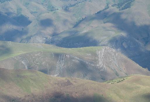
Hells Canyon Overlook in Oregon
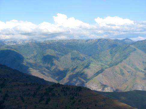
At this elevation we are in an evergreen forest but as you can see we are looking down into Hells Canyon that is surrounded by rugged desert. While you can not see the Snake River from this overlook it is out there in a steep canyon with 1,000 foot walls. The gray wave you see on the mountain wall in the distance is a layer of limestone that was laid down in an ancient ocean that has been uplifted and contorted by mountain building forces deep in the earth.
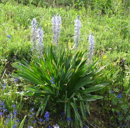
Is this the camas lily made famous by Louis & Clark?
Meadows and open areas at altitude were full of this flower that looked like it might be the Camas lily that produced the roots that Indians used to trade to emigrants on the Oregon Trail that were yearning for anything different in their diet. If anyone know what this plant is please let me know.
Hells Canyon Overlook in Oregon
We are at the Hells Canyon Overlook only we can not see the Snake River and can only guess where it is in this vast wilderness. Joyce took this picture facing east looking toward Idaho, the Snake River and Hells Canyon.
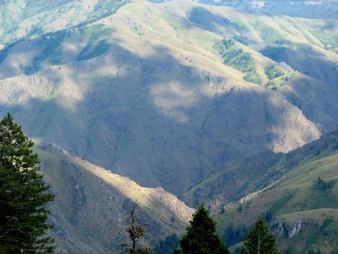
Hells Canyon Overlook in Oregon
For all I know Hells Canyon is at the bottom of this gorge. One thing I am certain of and that is we are located way above the Snake River.
Joyce took this picture facing east looking toward Idaho, the Snake River and Hells Canyon.
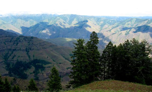
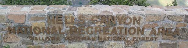
Hells Canyon Overlook in Hells Canyon National Recreation Area of Oregon
Joyce is taking pictures from this overlook in Hells Canyon National Recreation Area.
View from Hells Canyon Overlook in Hells Canyon National Recreation Area of Oregon
One last look at the rugged country surrounding Hells Canyon as viewed from the Oregon side of Hells Canyon. Once again Joyce took this picture facing east looking toward Idaho, the Snake River and Hells Canyon.
In case you missed these directions to Hells Canyon Overlook here they are again. For those of you that may want directions to Hells Canyon Overlook in Oregon here are directions from Baker City. Follow SR -86 east to (10-miles east of Halfway, Oregon) then turn north onto the Hells Canyon Scenic Byway (Forest Service Road 39). Drive approximately 20-miles to Forest Road 3965, which leads a short distance to the overlook.
More Oregon AdventuresSome of our Miscellaneous Subjects ** More 2007 Travel Adventures
Mike & Joyce Hendrix
Mike & Joyce Hendrix who we are We hope you liked this page. If you do you might be interested in some of our other Travel Adventures: Mike & Joyce Hendrix's home page Travel Adventures by Year ** Travel Adventures by State ** Plants ** Marine-Boats ** Geology ** Exciting Drives ** Cute Signs ** RV Subjects ** Miscellaneous Subjects
We would love to hear from you......just put "info" in the place of "FAKE" in this address: FAKE@travellogs.us Until next time remember how good life is.
|
|
||

|
|||
|
|
|||
|
|
|||
|
|