Baker City, Oregon & Oregon Trail
Interpretive Center
June 16, 2007.
We are staying at Mountain View Travel Park in Baker City. $24.79
FHU, shade and a nice enough RV-Park. It must be a former KOA ---
Keep On Adding since they charge extra for everything, $2 extra for
wifi, $2 extra for larger sites, you get the picture KOA Keep On Adding..
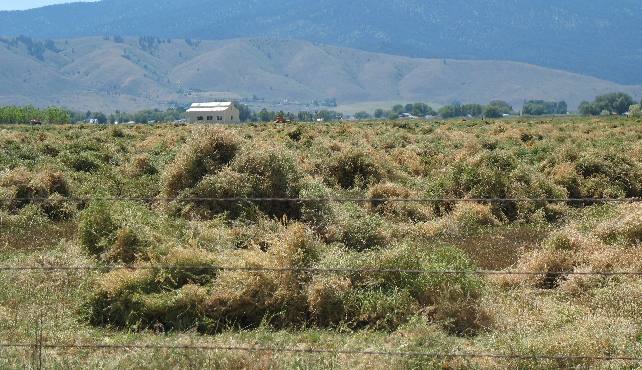
The Baker Valley produces
thousands of acres of hay. This alfalfa field has been mowed and raked
into rows of hay that is drying. Within a few days a bailing machine
will move down the rows creating giant bales of alfalfa.
At the turn of the century, Baker City was known as the "Queen
city" of the Pacific Northwest, the cultural center between Salt
Lake City and Portland, resplendent with several exquisite hotels
and restaurants, ballrooms for dancing, an opera house and neighborhoods
of elaborate homes.
Today, Baker City boasts one of the largest commercial national Register
Historic Districts in the state of Oregon with over 110 buildings
in the district.
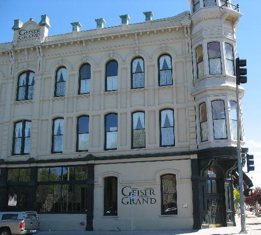
Geiser Grand Hotel Baker City, Oregon
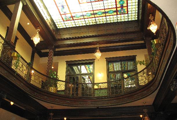
This is the Geiser Grand Hotel constructed here in Baker City in
1889. Originally the Warshauer House, the Geiser Grand Hotel was built
by local merchants Harry and Jake Warshauer for the then magnificent
sum of $65,000. The hotel was a gathering place for business travelers
from across the nation - and even Europe - many of whom had interests
in area gold mines. Local mine owner Al Geiser purchased the hotel
and extensively remodeled it at the turn of the century. The hotel
was closed for almost thirty years before being restored and reopened
again in 1997.
Geiser Grand Hotel Baker City, Oregon
Gold display in U.S. Bank of Baker City, Oregon
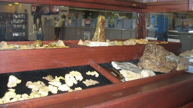
One of the stops on our walking tour of historic homes and businesses
in Baker City was the U.S. Bank where they have a gold display. Among
trays of gold flakes and gravel-sized nuggets on display is a heart-stopping
specimen that was pulled from a muddy stream in 1913.
The miner's name was George Armstrong, and he spotted the hunk of
gold as he followed his son out of a placer mine near Susanville in
Grant County.
The nugget weighed 80.4 ounces --that's 6 and 3/4 pounds --- and
was worth more than $1,400 at the 1913 gold price of $17.50 an ounce.
That's more than $25,000 in today's dollars.
The nugget sits front and center in the bank's gold display that
features metals mined from the Baker Mining District.
Luther B. Ison home Baker City, Oregon
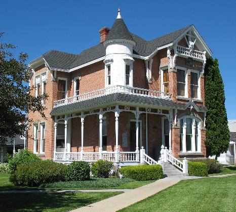
When Luther B. Ison built this home in 1887 he directed that only
the finest materials be used. The bricks were freighted from Portland,
the fireplaces came from Holland and Alaskan white cedar was used
for woodwork. Ison, who was a district judge at the time, died in
1889, just two years after the home was completed, but his widow lived
there for the next 50 years. The house has been renovated for use
as a bank.
Bowen Home Baker City, Oregon
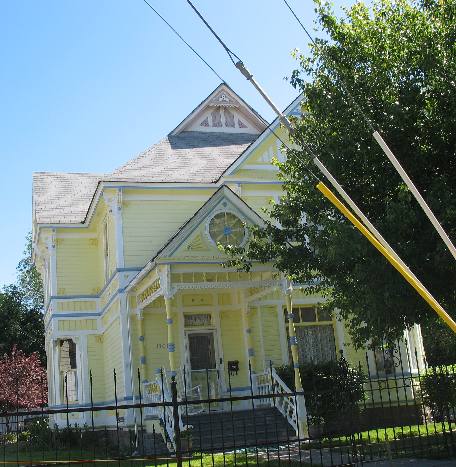
This is the Bowen Home built in 1895 by the publisher and editor
of Baker City's "Bedrock Democrat" newspaper. The house
was a traditional all-white Victorian with a park-like yard that was
much larger than it is now. The Bowens were pioneers in Baker County
arriving in 1862 with their parents.
St. Francis Cathedral Baker City, Oregon
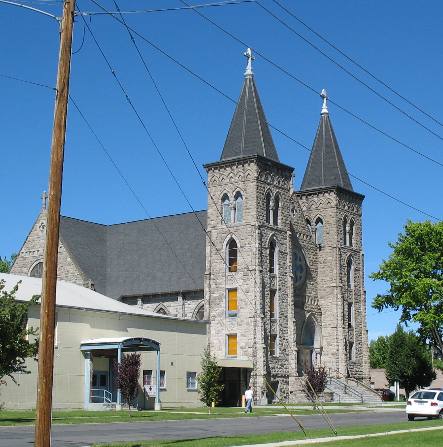
St. Francis Cathedral was constructed in 1908 of volcanic tuff stone
quarried about 12-miles east of Baker City. Many other prominent buildings
erected in the city during the 1900s were constructed of this same
volcanic tuff stone. The Catholic Diocese of Baker, established by
the Pope in 1903, included all of Oregon east of the Cascade Mountains.
Mike & Joyce Hendrix
Mike
& Joyce Hendrix who we are
We hope you liked this page. If you do you might be interested in
some of our other Travel Adventures:
Mike & Joyce Hendrix's home
page
Travel Adventures
by Year ** Travel
Adventures by State ** Plants
** Marine-Boats
** Geology ** Exciting
Drives ** Cute Signs
** RV
Subjects ** Miscellaneous
Subjects
We would love to hear from you......just put "info" in
the place of "FAKE" in this address: FAKE@travellogs.us
Until next time remember how good life is.
