Lewiston Hill & Spiral HighwayJune 26, 2007. We are staying at: Hells Canyon Resort in Clarkston, Washington. Hells Canyon Resort is a top notch RV-Resort at $30 per-night with cable and wifi FHU totally paved interior roads and pads. This is the RV-Park we would recommend when staying in the Lewiston, Idaho/Clarkston, Washington area. Cell phones work, TV recepiton works, it is clean and safe and very convenient to shopping and sightseeing. Places Visited:
Lewiston Hill & Spiral Highway
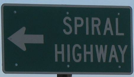
Spiral Highway
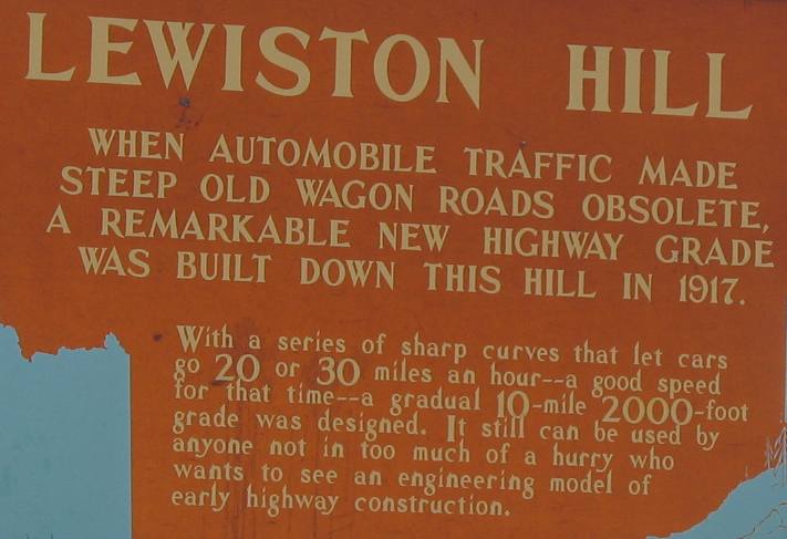
The road that was built down Lewiston Hill in 1917 is the Spiral Highway. Over 10 miles it rises 2000 feet in elevation. It also dropps 2000 feet in those same 10 miles.
Today another grade traverses Lewiston Hill without the switchbacks and is much less than 10 miles, that highway is the grade on US 95 as it heads north out of Lewiston.
Lewiston, Idaho from mid-way up the Spiral Highway on Lewiston Hill
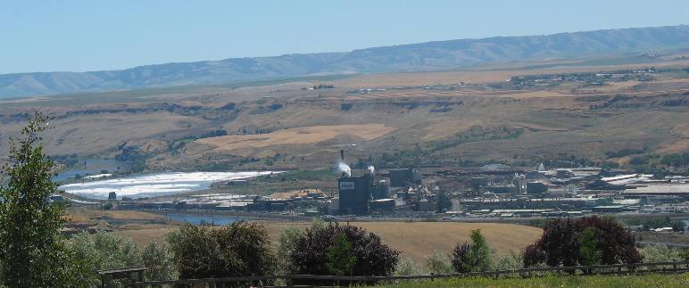
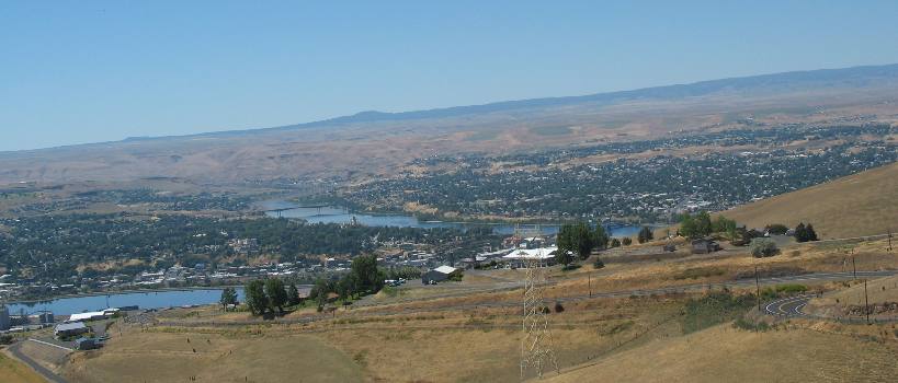
We are heading up the old spiral highway. The view as we work our way up the highway is totally awesome. This picture is looking to the southeast. That huge plant in the picture is the Potlatch, pulp/paper/lumber mill and press board manufacturing facility. That is the Clearwater River running by the Potlatch plant.
Clearwater River as viewed from the Spiral Highway on Lewiston Hill
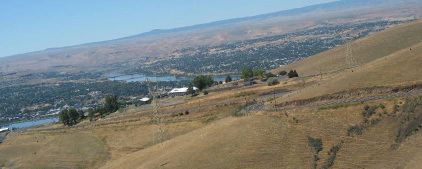
This picture is looking a little west of south but mostly south. The Snake River is flowing south to north with Lewiston, Idaho on the left side of the Snake and Clarkston, Washington on the right side. What you can not see is the Clearwater River that runs from left to right at the bottom of this hill. The reason you do not see the Snake River is because the hill is so steep that the river is hidden. Notice the spiral highway as it spirals down the grade.
Clearwater River on the left and Snake River on the right as seen from Spiral Highway & Lewiston Hill
In this picture you can see a small portion of the Clearwater River on the left side of this picture. The Clearwater River is flowing west while the Snake River is flowing north. At the confluence of the two rivers they the new Snake flows west to meet with the Columbia River not far away in Washington.
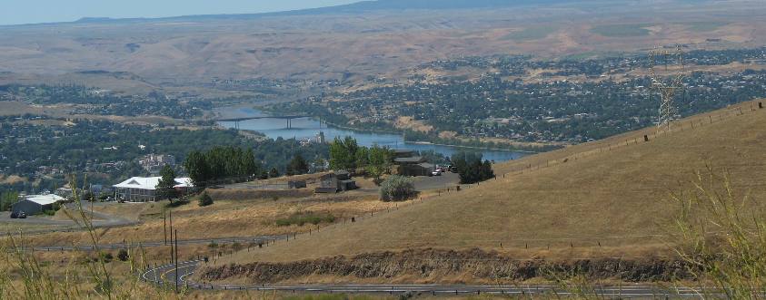
Lewiston, Idaho and Clarkston, Washington as viewed from the Spiral Highway & Lewiston Hill
This picture has it all, Lewiston, Idaho on the left, with the Snake River separating it from the State of Washington and city of Clarkston on the right side of the Snake.
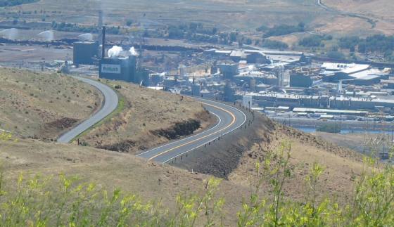
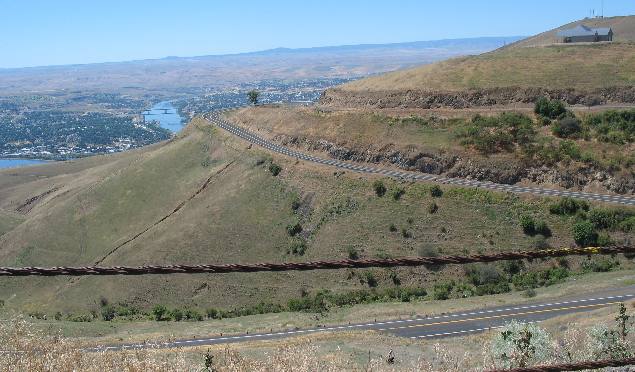
Spiral Highway as it climbs Lewiston Hill
This is a good view of several layers of the spiral highway as it climbs Lewiston Hill. The manufacturing plant in the background is across the Clearwater River in Lewiston. It is the very large Potlach facility that is a combination pulp mill, lumber mill, press board manufacturing facility and I am sure that they sell thousands of bags of bark.
Spirals on the Spiral Highway
This is another picture showing several of the spirals on the spiral highway.
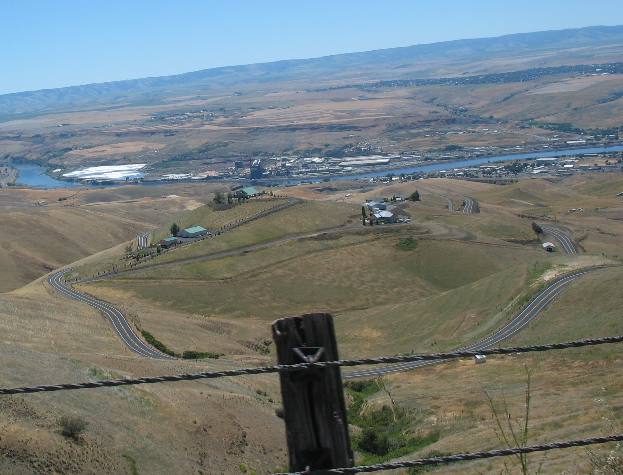
Switchbacks and spirals on the Spiral Highway on Lewiston Hill
The spiral highway as it climbs Lewiston Hill. Let me give you some information regarding what you are viewing in this picture other than the totally awesome Spiral Highway on Lewiston Hill. The Clearwater River is that sliver of blue on the extreme left side. That is the Snake River near the middle of the picture. The Clearwater River is about to join the Snake River. The confluence is cut out of this picture by "Lewiston Hill". The green area to the left side of the Snake River is Lewiston, Idaho while the green patch on the right side of the Snake River is Clarkston, Washington.
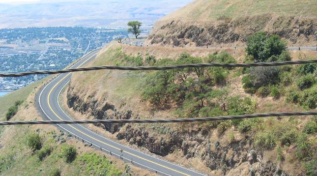
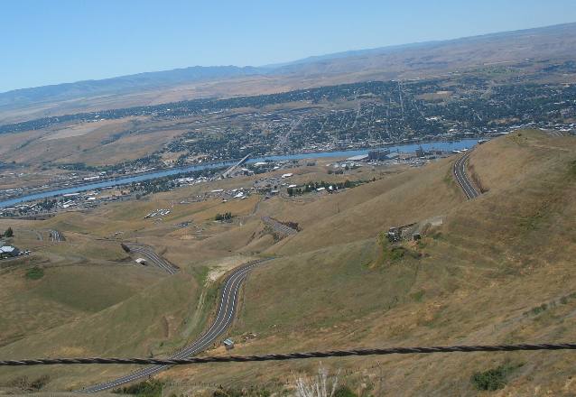
View of Spiral Highway on Lewiston Hill
These pictures are good views of the spiral highway & Lewiston Hill. Lewiston Idaho is on the far side of the Clearwater River.
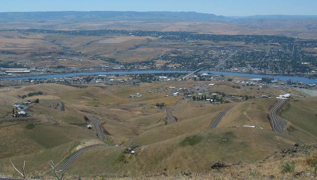
Spiral Highway from Lewiston Hill with Clearwater River & Lewiston, Idaho in background
That is the Clearwater River with Lewiston, Idaho in the background. While it is difficult to tell from this picture Lewiston itself is on a large hill. The streets moving away from the river all seem to have a name with "grade" in them because that is exactly what they are GRADES. On this side of the river you can see the spiral highway as it snakes back and forth across the face of this mountain so that is climbs the 2,000 foot grade in 10-miles.
The Spiral Highway as it "spirals" up Lewiston Hill
This picture probably does the best job of showcasing the spiral highway as it winds it way up Lewiston Hill.
That is the Clearwater River and the city of Lewiston, Idaho.
That is the Clearwater River flowing left to right across the picture with Lewiston in the background.
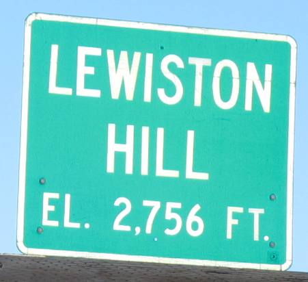
Lewiston Hill
Once at the top of the grade we took a scenic drive through the Palouse Region of Washington and Idaho before returning to Lewiston on US-95. Of course US-95 traverses Lewiston Hill just like the Spiral Highway, only it drops much more precipitously as it eliminates the switchbacks. It is a hoot to drive just in a different manner than the Spiral Highway.
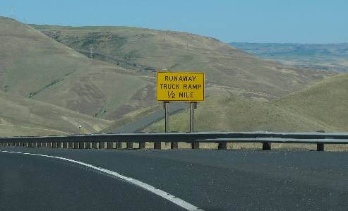
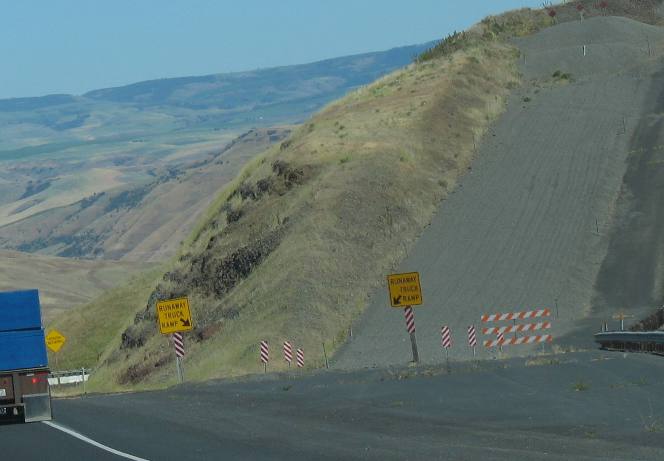
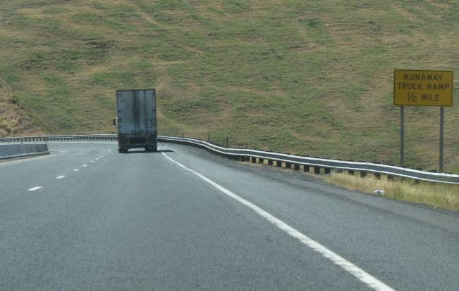
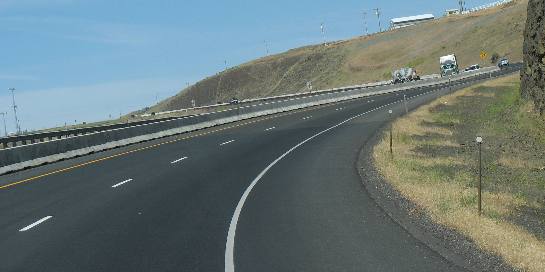
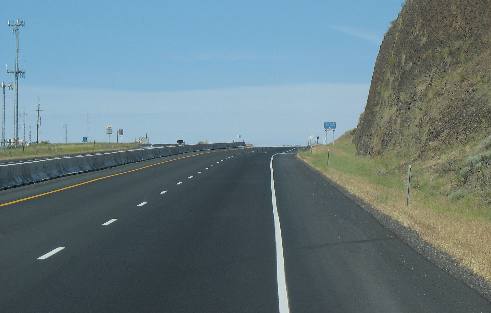
Runaway Truck Ramp on the new grade on Lewiston Hill
Abundant warnings make sure than no one is surprised by the long steep grade.
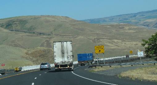
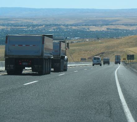
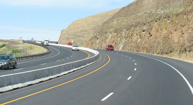
This is a steep grade on US-95 as it traverses Lewiston Hill
Truckers are heeding the warnings.
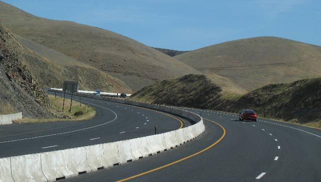
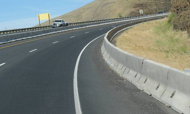
Steep grade on the new Lewiston Hill
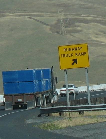
Runaway Truck Ramp on Lewiston Hill
I think I remember three of these runaway truck ramps on Lewiston Hill. This truck was creeping down the grade at 20 mph or less.
Runaway truck Ramp on Lewiston Hill
This is another one of those runaway truck ramps.
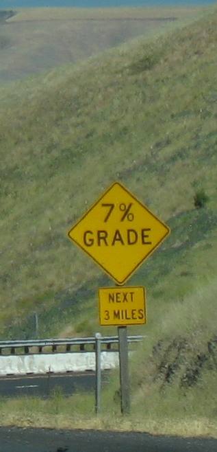
Grade sign on Lewiston Hill
We have already passed several runaway truck ramps on Lewiston Hill before we see this sign.
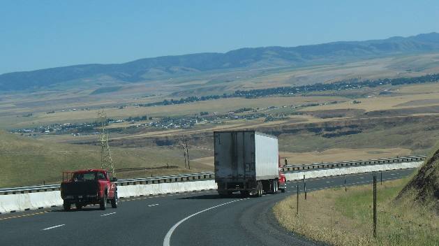
Valley at bottom of Lewiston Hill
Simply horrible grade on Lewiston Hill
And this is some of that 7% grade on the new Lewiston Grade over Lewiston Hill.
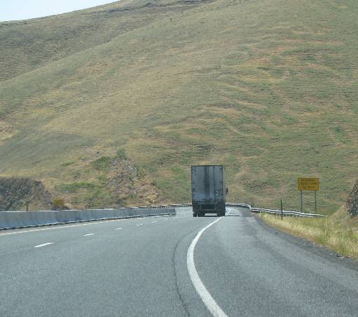
Steep grade & runaway truck ramp on Lewiston Hill
Yet another runaway truck ramp. With this grade I can see why another one would be necessary.
Creeping down Lewiston Hill
Dropping down Lewiston Hill on US 95 is quick.
This WAS the end of "Lewiston Hill" as a travelogue, it was until we headed north up US 95 in the motorhome as we were moving to Coeur d'Alene. While still in Lewiston you start up up Lewiston Hill a steep grade that goes on for around 6-miles. Possibly it is just 5 but who is counting!
Going up Lewiston Hill in our 35' motorhome
We have a gasoline engine, so the first order of business was to choose a gear where the engine was generating around 4,000 rpm and hang in there.
Going up Lewiston Hill in our 35' motorhome
For us the 4,000 rpm results in around 40 mph on this hill with this grade. Automobiles and other unloaded vehicles put the "petal to the metal" and continue doing between 60 and 70 mph up the hill while larger vehicles gear down and find a comfortable speed for their engine to handle then just chug away until reaching the top.
Going up Lewiston Hill in our 35' motorhome
Forty miles-per-hour is almost sitting still compared to automobiles that come whizzing by at 65 to 70 mph.
Going up Lewiston Hill in our 35' motorhome
The grade on Lewiston Hill grinds on and on.
Going up Lewiston Hill in our 35' motorhome
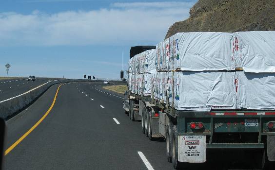
At 40 mph we aren't the slowest vehicle. As you can see we are passing this heavily loaded tractor trailer rig. Notice that I didn't call it an 18-wheeler ------------ because it has MANY more wheels than 18. I think the first part (the normal 18 wheel part) rig has 22 wheels while the two axles on the attached trailer of this rig apear to have two more axles making what appears to add 8 more wheels. Bottom line, --- this "tractor" is pulling a heavy load up this grade at probably 10-mph.
Going up Lewiston Hill in our 35' motorhome
When does this thing end? It just goes on and on.
Going up Lewiston Hill in our 35' motorhome
I will end it with this last memory of the Lewiston Hill on US 95, the "hill" that goes on and on and on, before finally emerging on the Palouse Prairie.
Click here for more Idaho travellogsUntil next time remember how good life is.
More Idaho AdventuresSome of our Miscellaneous Subjects ** More 2007 Travel Adventures
Mike & Joyce Hendrix
Mike & Joyce Hendrix who we are We hope you liked this page. If you do you might be interested in some of our other Travel Adventures: Mike & Joyce Hendrix's home page Travel Adventures by Year ** Travel Adventures by State ** Plants ** Marine-Boats ** Geology ** Exciting Drives ** Cute Signs ** RV Subjects ** Miscellaneous Subjects
We would love to hear from you......just put "info" in the place of "FAKE" in this address: FAKE@travellogs.us Until next time remember how good life is.
|
|
||

|
|||
|
|
|||
|
|
|||
|
|