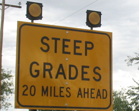
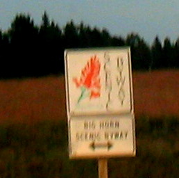
Oh, My God Hill US-14a east of Lovell, Wyoming part-1Warning sign east of Lovell, Wyoming on US-14a as we head toward Oh My God Hill
We are traveling east on US-14a out of Lovell, Wyoming and heading directly into the Big Horn Mountains. This sign is warning us what is ahead and it wasn't lying. We are going to take US-14a up and over Oh My God Hill, past Bald Mountain to Burgess Junction then take US-14 east to Ranchester before turning south on I-19 to get back to our RV at Peter D's RV-Park in Sheridan, Wyoming. Today US-14a is a National Scenic Byway and a good one at that. It was the original Dayton-Kane Highway. Dayton, Wyoming on the eastern side of the Big Horn Mountains and Kane on the Western side. For many years, the northernmost road over Wyoming's Big Horn Mountains was commonly refereed to as the Dayton-Kane Road. It connected those two town on opposite sides of the Big Horns. Today, Kane is just a memory beneath the waters of Big Horn Lake near Lovell. The first access up the east side of the Big Horns were trails used to haul mining equipment from the railhead at Gillette to the Fortunatus gold mine, near Bald Mountain in the 1890's. That route was eventually abandoned because of its steep grades and sharp curves. In 1912, construction began along an improved route on the Dayton side. About the same time, settlers in the Big Horn Basin carved out the beginnings of the first road on the west side to get salt to summer pastures, hence the road was known as the "Salt" road. The original was described as a wagon track of "extreme steepness and sharp turns." In 1922, preliminary plans were made to build 148 miles of road from Sheridan to Greybull via Bald Mountain, then to Lovell and Greybull. Construction began on the east side and progressed westerly from Dayton, and 4.6-miles was completed in November of 1924. A series of construction projects ensued until the road was mostly complete in the mid-1930s with a width from 10 to 24-feet, depending on topography. Much of the road was privately financed. Funding and labor came variously from the timber industry, popular subscription and finally by the Bureau of Public Roads and the Wyoming Highway Department. It was taken into the sate system in 1931 and eventually highway was asphalt paved by about 1939. For the next 25 years, only maintenance and occasional widening were accomplished on the road, until reconstruction began in earnest in 1964. Road cut on US-14a as we head up Oh My God Hill, west of Lovell, Wyoming in the Big Horn Mountains
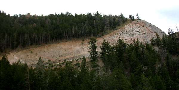
This is just one of the many awesome road cuts on Oh My God Hill as we climb the western face of the Big Horn Mountains on US-14a east of Lovell, Wyoming.
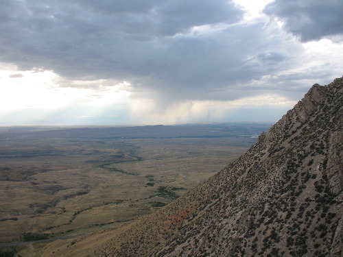
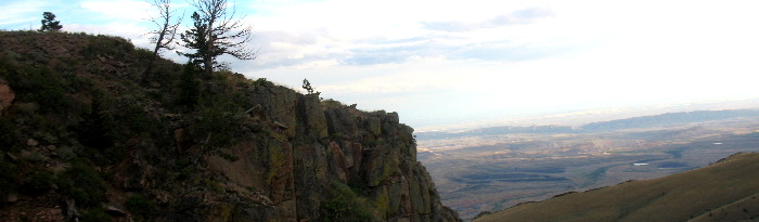
Looking west over the Big Horn Basin from US-14a on Oh My God Hill west of Lovell, Wyoming
As we climbed Oh My God Hill on US-14a out of Lovell, Wyoming we would get these awesome views of the Big Horn Basin. It is late in the afternoon and a storm is dropping rain in the far distance.
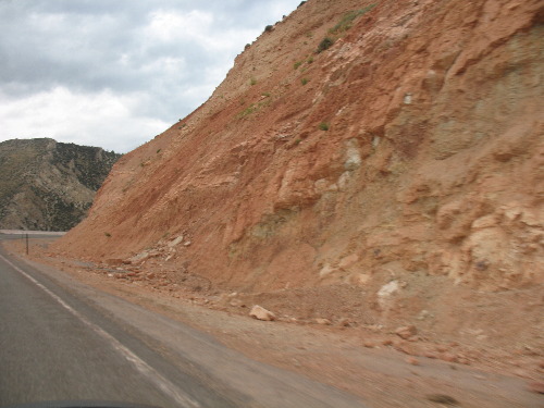
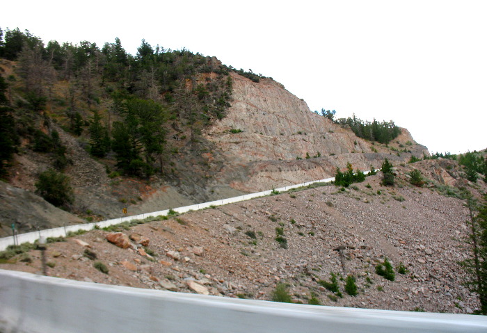
Road cut and the steep grade on US-14a as we head up Oh My God Hill, west of Lovell, Wyoming in the Big Horn Mountains
There is a reason US-14a carries the moniker Oh My God Hill and this is just a sample. Wow!
Road cut and the steep grade on US-14a as we head up Oh My God Hill, west of Lovell, Wyoming in the Big Horn Mountains
This picture encapsulates why this portion of US-14a carries the moniker Oh My God Hill.
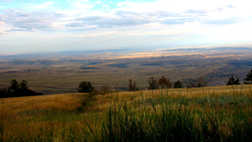
Looking west over the Big Horn Basin from US-14a on Oh My God Hill west of Lovell, Wyoming
Stunning view of the Big Horn Basin from high in the Big Horn Mountains west of Lovell, Wyoming on US-14a.
Looking west over the Big Horn Basin from US-14a on Oh My God Hill west of Lovell, Wyoming
In the summer, domestic sheep and cattle graze the range lands of the Big Horn National Forest. These rangelands are the vast grassy hillsides and sagebrush-covered valleys that dominate the plateau of the Big Horn mountains. The Forest Service manages the location, duration, and numbers of livestock grazing through a grazing permit system. In the summer it is likely you will see sheep at high elevations were the rough, treeless terrain supports the growth of wildflowers and sedges. Cattle graze at lower elevations where the terrain is less rugged and the grasses are more abundant. Sheep need more tending than cattle do on these mountain ranges. A herder, with the aid of sheep dogs, moves the sheep daily over the range to prevent overgrazing. He also guards the sheep from predators, such as coyotes, bears, and mountain lions.
Grouse in the Big Horn Mountains along US-14a east of Lovell, Wyoming
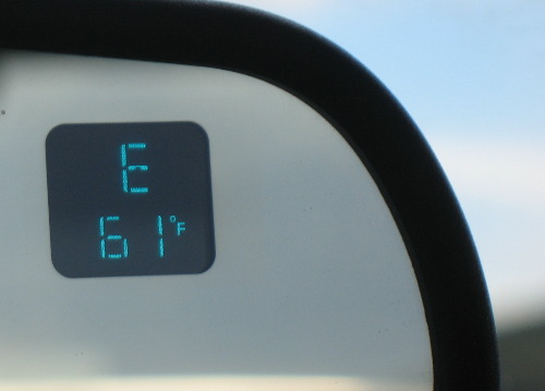
It takes really sharp eyes to spot these things. We only spotted this one but as we sat still in the car over a period of the next 5 to 10-minutes around 6 or more started moving near this one. It was like they appeared out of thin air. This is a grouse, probably a spruce grouse considering where we spotted it, deep in the Big Horn Mountains. If indeed this is NOT a spruce grouse please let us know and we will correct things. Just put "info" in the place of "FAKE" in this address: FAKE@travellogs.us Temperature as we approach Bald Mountain in the Big Horn Mountains on US-14a east of Lovell, WY
Keep in mind that this is mid-August in Wyoming. We had just come from the Big Horn Basin around Lovell where the afternoon temperature was approaching 90-degrees. We just passed a patch of snow along US-14a as we made our way around the crest of the Big Horn Mountains and about to start our descent.
The end or beginning of US-14a at Burgess Junction in the Big Horn Mountains where US-14a meets US-14 turn left or east US-14 goes to Ranchester, Wyoming while right goes through Shell Canyon and down into Shell and Greybull, Wyoming and on through Cody into the east gate of Yellowstone NP
This is such an informative sign we had to include it. Joyce took this at Burgess Junction where US-14a meets US-14. Both US-14 and US-14a are Scenic Drives. Both US-14 and US-14a feature steep grades but of the two US-14 is the easiest on big rigs. Keep in mind there is a reason the descent into Lovell, on US-14a is called Oh My God Hill. We are going to turn left or east on US-14 and drop down to Ranchester, Wyoming on US-14 from here.
Click here for some Colorado travellogsUntil next time remember how good life is. More Wyoming AdventuresSome Idaho Adventures ** More 2014 Travel Adventures
Mike & Joyce Hendrix
Mike & Joyce Hendrix who we are We hope you liked this page. If you do you might be interested in some of our other Travel Adventures: Mike & Joyce Hendrix's home page Travel Adventures by Year ** Travel Adventures by State ** Plants ** Marine-Boats ** Geology ** Exciting Drives ** Cute Signs ** RV Subjects ** Miscellaneous Subjects
We would love to hear from you......just put "info" in the place of "FAKE" in this address: FAKE@travellogs.us Until next time remember how good life is.
|
| ||
|
| |||
|
| |||
|
|