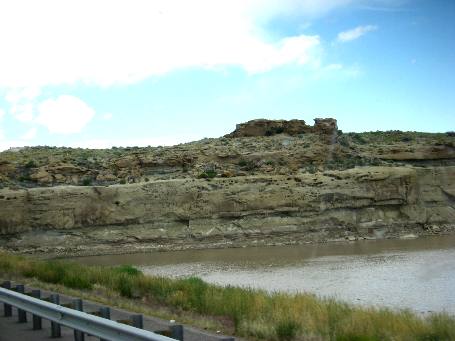
Riverton, Wyoming westbound on US-26Sedimentary Rock formations along US-26 east of Riverton, Wyoming
Sedimentary rock is exposed along the Wind River that parallels US-26 between Shoshoni and Riverton, Wyoming.
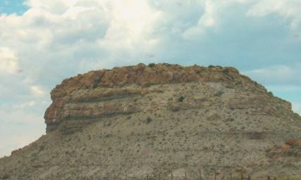
Sedimentary Rock formations along US-26 east of Riverton, Wyoming
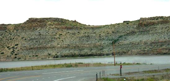
What you see here is sedimentary rock layers exposed on the far side of the Wind River east of Riverton. The Wind River is at flood stage and much wider than normal. Sedimentary Rock formations along US-26 east of Riverton, Wyoming
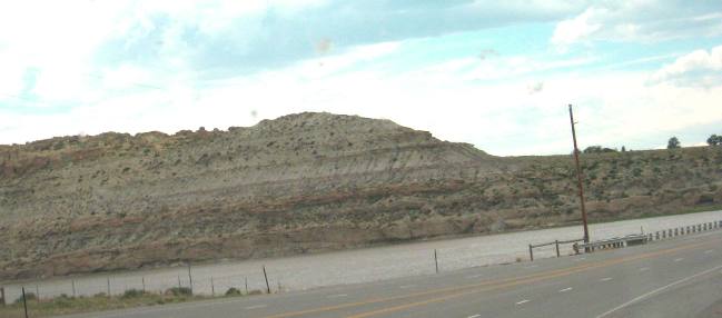
Layer upon layer of sedimentary rock has been exposed in this cut by the Wind River east of Riverton Wyoming. The Wind River was in flood stage when Joyce took this picture around 26-June 2011 and abnormal snow melt has swollen the Wind River.
Sedimentary Rock formations along US-26 east of Riverton, Wyoming
Millions of years of sedimentary rock layers exposed by the Wind River east of Riverton, Wyoming.
Sedimentary Rock formations along US-26 east of Riverton, Wyoming
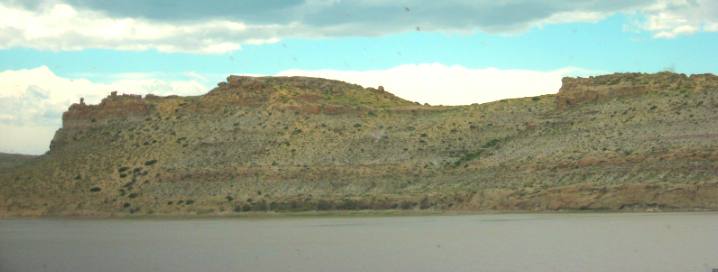
The Wind River at flood stage and a magnificent exposure of sedimentary rock layers east of Riverton, Wyoming along US-26.
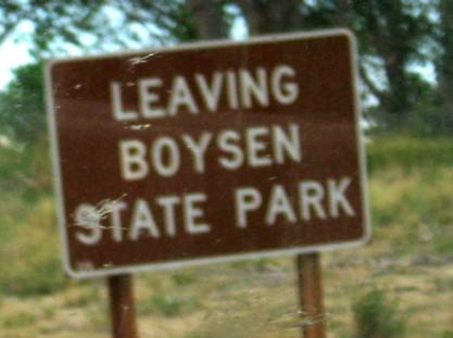
Boysen State Park in Riverton, Wyoming
The main part of Boysen State Park is located east of Riverton near Shoshoni. I am not sure why this Boysen State Park sign was in Riverton. I guess Boysen State Park might encompass both sides of Boysen Reservoir from the dam all the way to Riverton. Boysen Reservoir is a reservoir formed by Boysen Dam, an earth-fill dam on the Wind River in the central part of the US state of Wyoming. It is near the town of Shoshoni in Fremont County. The dam was constructed between 1947 and 1952 at the mouth of Wind River Canyon, just upstream from a previous dam that had been built by Asmus Boysen in 1908 on land he had leased from the Shoshone and Arapaho tribes. The dam and much of the reservoir are physically located on the Wind River Indian Reservation.
Boysen Dam is constructed across the Wind River just before it enters a deep ravine (Wind River Canyon) through the Owl Creek Mountains, which extend upstream for ten miles towards Thermopolis, and reach heights of 2,500 feet above the valley floor. In our opinion the Wind River Canyon on US-20 between Shoshoni & Thermopolis is one of the most exciting and scenic canyon drives in North America. But that is another subject. Now back to Boysen Dam and Reservoir on the Wind River. The gorge (Wind River Canyon) starts gradually just south of Thermopolis, narrow and sheer-sided at first but quickly deepening, as the initial sheer layer becomes high above, below which the sides are steeply sloping, covered with grass and bushes. The rocks are ancient sedimentary layers from the Triassic and Precambrian eras, muted grey-brown in color. There are plenty of pull outs along the road for views of the cliffs and the Wind River, as it flows through a thin corridor of tall cottonwood trees. A railway parallels the highway on the opposite bank of the river, crossing over just before the dam, and then running right along the east shore of the lake. The land surrounding the reservoir, at the foot of the mountains, is typical of much of central Wyoming - low mesas, short cliffs and flat plains, covered by sagebrush and short yellowish grass. A few isolated buttes now form tiny islands in the lake, which has flooded 20 miles of the river, though the south end is very shallow, and the length can vary significantly depending on the water level. US-26 in Riverton, Wyoming
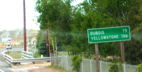
US-26 will take you from Riverton to Dubois, across the Continental Divide at Towogotee Pass then down to Moran Junction in Grand Teton National Park then to the south gate of Yellowstone National Park.
Click here for more Wyoming travellogsUntil next time remember how good life is. More Wyoming AdventuresSome Utah Adventures ** More 2011 Travel Adventures
Mike & Joyce Hendrix
Mike & Joyce Hendrix who we are We hope you liked this page. If you do you might be interested in some of our other Travel Adventures: Mike & Joyce Hendrix's home page Travel Adventures by Year ** Travel Adventures by State ** Plants ** Marine-Boats ** Geology ** Exciting Drives ** Cute Signs ** RV Subjects ** Miscellaneous Subjects
We would love to hear from you......just put "info" in the place of "FAKE" in this address: FAKE@travellogs.us Until next time remember how good life is.
|
| ||
|
| |||
|
| |||
|
|