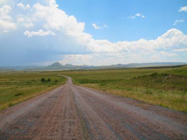
Scenic Drive on SR-34 west of Wheatland, WyomingJuly 17, 2009 Scenic Drive on SR-34 west out of Wheatland, Wyoming to the Laramie Mountains & Laramie Plateau We are staying in the FREE city campground in Wheatland. It has electricity 30 & 50 amp. Water & dump station at a central location. The campground is located at the south end of 8th street. Once in town you will be on 9th street when you get to the red light turn east and go to 8th street then turn south and proceed to the city campground about 6 blocks. You will spot the park, the campground is on the south side in a row of large cottonwood trees. We headed out to drive Wyoming SR 34 from Wheatland to where it connects with US-30 north of Laramie on the Laramie Plateau. To get to SR 34 we have to travel on a local highway for a short distance. Of course around here that means traveling through an agricultural area. Wheat field in Wheatland, Wyoming with Laramie Mountains in background
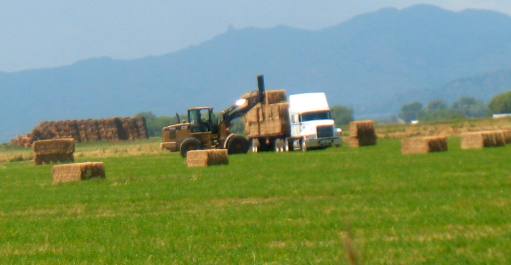
As we headed out on our scenic drive along SR 34/46 from Wheatland we stopped to watch this large machine loading 2,000 pound bails of hay on the waiting 18-wheeler.
Large hay operation along SR-34 outside Wheatland with Laramie mountains in background
This is what you call a serious hay operation, with the Laramie Mountains in the background.
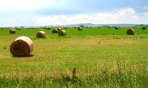
Crops grown along scenic SR-34 west of Wheatland, Wyoming
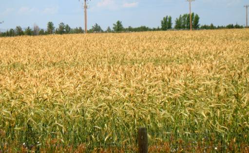
This grain looks different than the wheat we were seeing in Kansas and even here in Wyoming. It is standing about 36" tall and has a much larger seed head. Since we do not know our grains I hesitate to make a guess but since this is a livestock intensive area around here it may be oats, but that is just a guess. Scenic view off SR-34 west of Wheatland, Wyoming
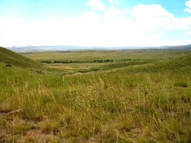
As we head west on SR-34 we leave the irrigated fields behind. We also start gaining elevation. We are looking south from a small rise in this picture.
Laramie Mountains on SR-34 side road west of Wheatland, Wyoming
We turned north on this road from SR-34 for about 5-miles then it turned into dirt/gravel. We decided to turn around and continue our scenic drive following SR 34. It would have been an interesting drive since it was taking us north and into the Laramie Mountains.
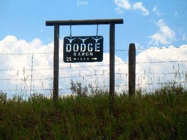
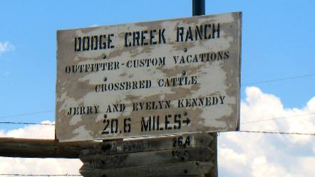
Interesting signs we saw on our scenic drive out SR-34 west of Wheatland, Wyoming
These signs were at the corner where that road headed north from SR 34. Note where these ranches are from this intersection. One is 25-miles the other 20.6 miles. Like the .6 makes any difference. What we also noticed at this intersection but did not get a picture of was 5-mail boxes. The five families living on this road have their mail boxes here. I do not know how far all the ranches are from these mailboxes but these two are 25-miles and 20.6-miles from their mailbox. That is hard for me to comprehend since my mail slot is in my front door. Things are different out here. Much different.
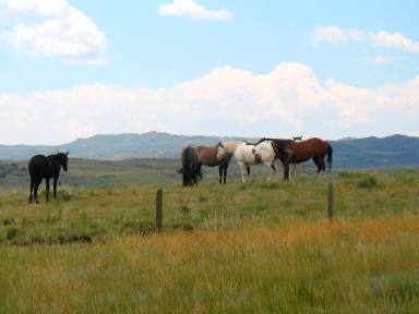
Horses and Laramie Mountains out SR-34 west of Wheatland, Wyoming
These horses indicate that some form of human is probably nearby although we could not see where they might be. They did not appear to be wild or very wild horses. However, there wasn't a ranch house or building within miles of here. I can not even remember a road turning off SR-34 anywhere near here.
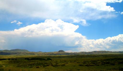
Storm cloud building south of SR-34 west of Wheatland, Wyoming
This storm cloud was building south of us and we guessed it was probably somewhere between us and Cheyenne.
That is all there is. Until next time remember how good life is. Click here for some Wyoming travellogsUntil next time remember how good life is. More Wyoming AdventuresAdventures by State ** More 2009 Travel Adventures
Mike & Joyce Hendrix
Mike & Joyce Hendrix who we are We hope you liked this page. If you do you might be interested in some of our other Travel Adventures: Mike & Joyce Hendrix's home page Travel Adventures by Year ** Travel Adventures by State ** Plants ** Marine-Boats ** Geology ** Exciting Drives ** Cute Signs ** RV Subjects ** Miscellaneous Subjects
We would love to hear from you......just put "info" in the place of "FAKE" in this address: FAKE@travellogs.us Until next time remember how good life is.
|
| ||
|
| |||
|
| |||
|
|