Utah: Provo and scenic drive around southern portion of Utah Lake,
Elberta, Goshen & Santaquin including Utah Lake State Park in
Provo
May 26, 2007.
We are in Lakeside RV-Park on west Center Street in Provo next door
to Utah Lake State Park located on Utah Lake. We forgot all about
Memorial Day until late last week when "the lights came on".
Joyce immediately got on the cell-phone and started trying to find
a place for us to settle in for the long Memorial Day weekend. She
got lucky and found the last vacancy at Lakeside RV-Park. That is
why we are here but we are happy to be here. It is a nice park costing
27.41 per-night for FHU and plenty of shade from mature cottonwood
trees. Down the street is Utah Lake State Park where rates are $18
per-night for water & electric and central dump station. They
were full or we would have probably been there. Either would be just
fine in our opinion although Lakeside RV is much nicer and overflows
with more expensive RV's if you get my drift.
Marina at Utah Lake State Park: Provo, Utah
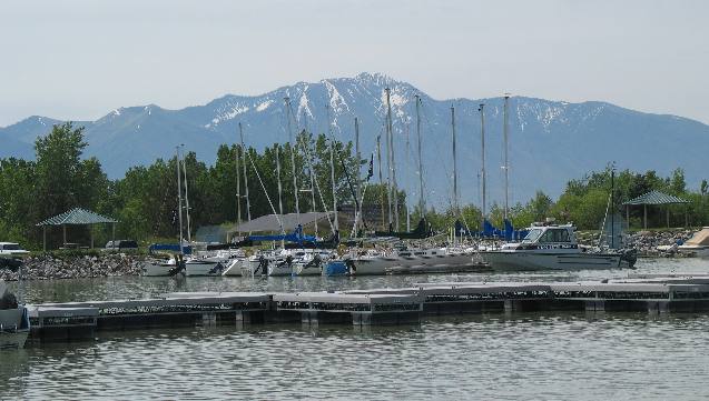
Joyce took this picture from Utah Lake State Park on the western
side of Provo Utah. That is the Wasatch
Mountains. Provo is situated between that mountain and where
we are located on the eastern bank of Lake Utah.
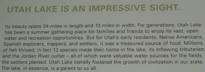
Utah Lake is one of the largest freshwater lakes west of the Mississippi
River.
Utah Lake State Park: Provo, Utah
Quirrh Mountains & Utah Lake State Park: Provo, Utah
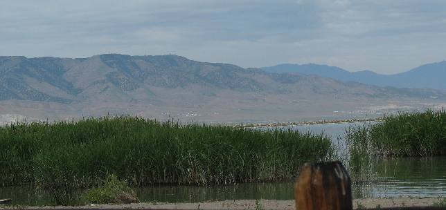
Joyce took this picture looking west from Utah Lake State Park located
on Utah Lake in Provo. As best as I can determine those are the Quirrh
Mountains on the west side of Utah Lake.
Provo Tabernacle
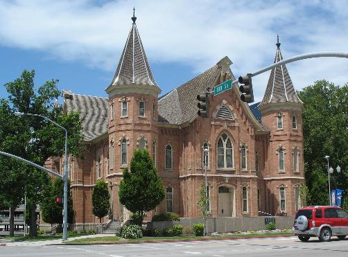
This is the Provo Tabernacle constructed in 1883 by Mormon pioneers.
This beautiful religous edifice is utilized by faithful throughout
the valley.
Grain field in the valley surrounding Utah Lake near Provo, Utah
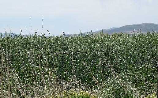
This is one of the unidentified grain fields in the south valley.
I wish I knew more about grain identification but all grains look
so similar to us.
Wasatch
Mountains as seen from the valley on the west side of Utah, Lake
near Provo, Utah
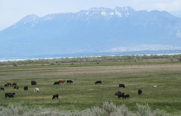
Joyce took this picture looking east from what is known as south
valley about 30-miles south west of Provo. The cattle are grazing
at an elevation of around 4,300 feet while the mountain peak is around
11,926 feet. That mountain is the one we took the Alpine
Loop around yesterday.
Quirrh Mountains & Utah Lake west of: Provo,
Utah
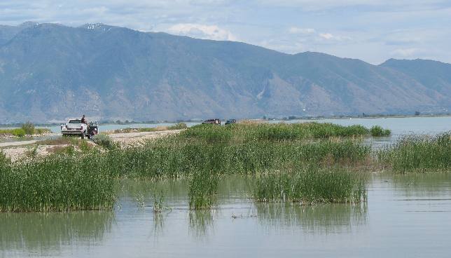
This was taken at a recreation area on Lake Utah with facilities
for fishing, camping, swiming beach, and boat launching.
Catfish from Utah Lake near Provo, Utah
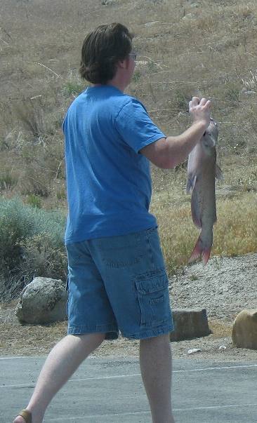
This fellow was heading to the cleaning table with a nice catfish.
.
Quirrh Mountains & Utah Lake west of: Provo,
Utah
These boats were in line to take out after a wonderful day on the
water.
This picture is looking to the northease from somewhere in the south
valley portion of Utah Lake
Bank swallows and nest holes
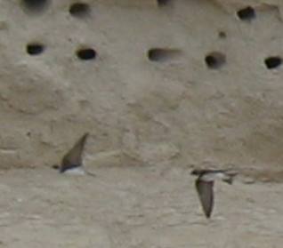
One never knows what they are going to run across when out exploring.
In this instance we came across a bank riddled with small holes. To
our surprise hundreds of bank swallows were occupying the holes.
Bank swallow nest holes
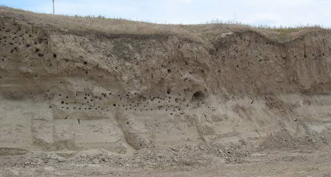
Virtually all of these holes contained nesting bank swallows.
Fruit orchard on bank of Utah, Lake southwest of Provo
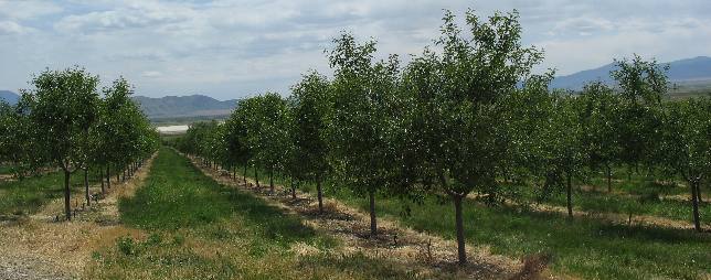
This is a fruit growing area with orchard upon orchard of various
fruit trees.
Fruit orchard on bank of Utah, Lake southwest of
Provo
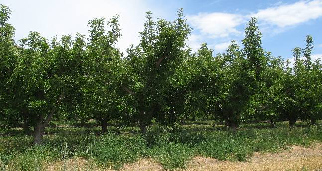
Fruit orchards included cherry, apple, apricot, peach and possibly
others dot the south end of Utah Lake.
Fruit orchard on bank of Utah, Lake southwest of Provo
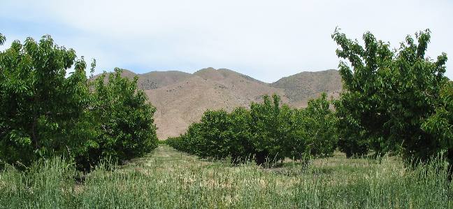
These orchards seem to all be using dripper type watering systems.
Notice how dry and barren the nearby hillsides are that do not have
irrigation.
South Valley farm land and Wasatch Mountains
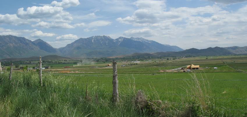
This picture was taken south of Utah Lake in the valley known as
south valley. South Valley is an agricultural area with a combination
of fruit orchards and alfalfa fields.
Dairy operation in South Valley southwest of Provo, Utah
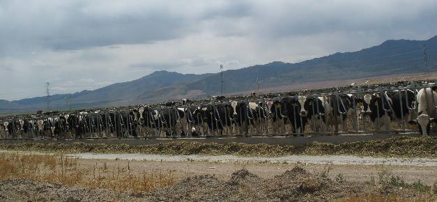
On the southwest side of Utah Lake we came across a large dairy in
the town of Elberta.
Dairy operation in the South Valley town of Elberta,
southwest of Provo, Utah
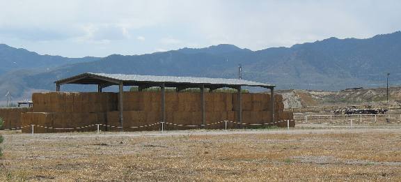
This large dairy seemed to be the only industry in Elberta.
Old Sinclair station in Elberta, Utah
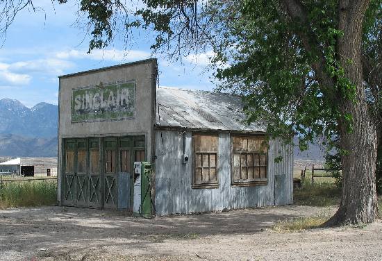
This old Sinclair station in Elberta was meant for a photograph,
don't you agree?
Old mine east of Elbetta, Utah
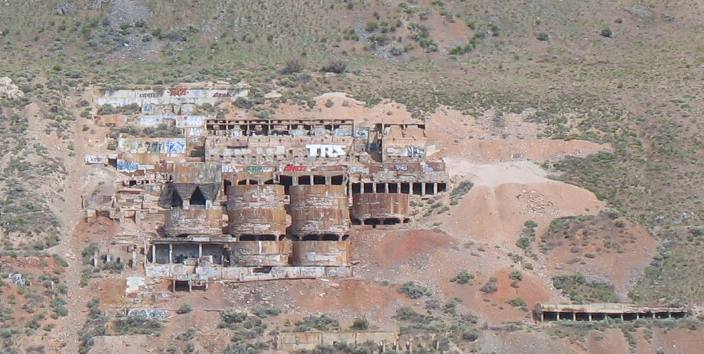
Between Elberta and I-15 while traveling east on U.S. 6 we spotted
this old mine on the side of a large hill. I suspect this that this
was a dolamite or limestone mine. If anyone knows please let me know.
It was located on a large hill southwest of Santaquin and visible
when heading east on U.S. 6.
Huge willow tree
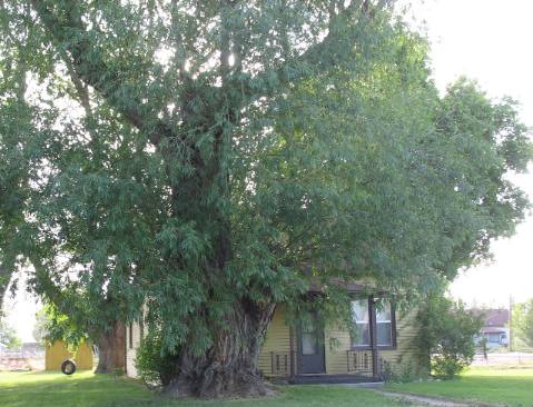
We stopped to take a picture of this large willow tree. Look closely
at the size of this trunk. This tree was located on west Center Street
near Utah Lakes State Park.
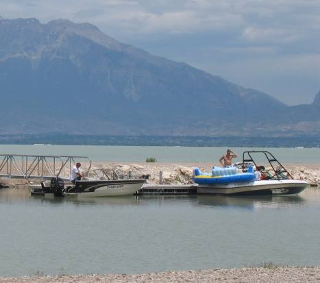
Utah Lake State Park
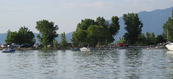
Saturday, of the Memorial Day weekend, was a big boating day on Utah
Lake as can be seen in this picture taken in the boat basin at Utah
Lake State Park.
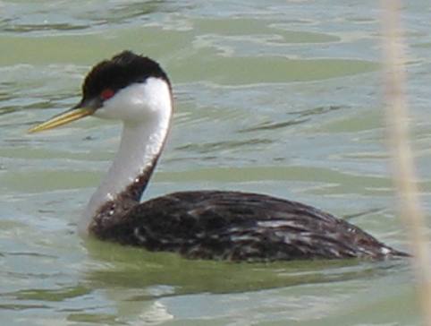
Western grebe
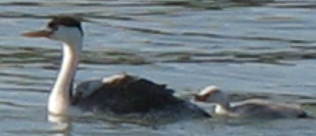
Western grebe on Utah Lake near Provo, Utah.
Yellow-headed blackbird
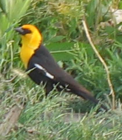
Two species of birds were prevalent on and around Utah Lake and they
were the western grebe and yellow-headed blackbird.
Yellow-headed blackbird
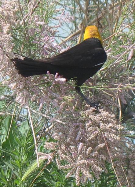
Yellow-headed blackbirds are very colorful. The purple flowers are
tamerisk.
Yellow headed black birds were nesting in reeds near the shore and
feeding in tamarisk trees. Their briliant color added to the subdued
light mauve of the tamarisk trees they were active in.
Western Grebe on Utah Lake
Western grebe were common birds on Utah Lake but we do not see many
of them on our travels.
Until next time remember how good life is.
Mike & Joyce Hendrix
