Sandia Peak Albuquerque, New MexicoMay 11, 2007. We are staying at Hidden Valley Resort, a PPA park $11.88 FHU 30-amps nice level pull-thru sites with gravel interior roads and sites. Level sites in New Mexico are a bonus. VBG For those of you that are not familiar with PPA (Pass Port America) it is an organization you can join for less than $50 per-year. Campgrounds that belong to PPA offer 1/2 price discounts. That kind of savings can quickly add up. While participating PPA parks generally have some restrictions on dates the PPA offer is valid, or possibly days of the week the discount is valid, or perhaps the number of days that the PPA discount will be honored the discount is genuine. Many times PPA campgrounds are new campgrounds that need help in getting established. Other times PPA campgrounds may be on the outskirts of town instead of in the "prime" location thus they need to provide an incentive for campers to stay with them. Whatever the reason PPA campgrounds generally provide a much cheaper option. PPA is the only campground organization that I think is worth the cost. PPA does not have a gimic. What you see is what you get. Once you join they send you a directory listing all participating campgrounds. The PPA directory is the FIRST directory we check when trying to locate a place to spend the night. You can join PPA by calling 228-452-9972. If you decide to join PPA, it would be nice if you gave them my number "R-0156251" as the PPA member that told you about PPA. In return PPA will give me a years membership free. I will thank you in advance for that kindness. Thank you.
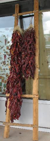
Ristra
This crude ladder is a common room decoration in many New Mexico homes. Ristras are are another ornament or decoration as well. If you are wondering what ristras are I explain them a bit better here.
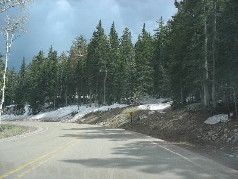
After traveling about 6-miles on SR-14 we turned west on Sandia Crest Road. From the intersection of SR-14 it is a 14-mile climb to Sandia Peak and the overlook.
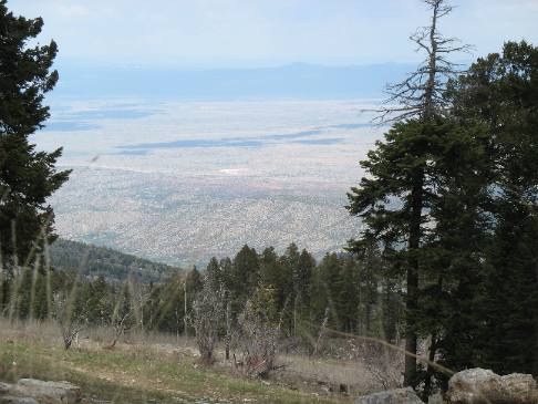
View from road up to Sandia Peak
Somewhere on the way up to Sandia Peak we got this glimpse of the wonderful plain stretching to the north. I think those low hills you see in the distance are the Cerrillos hills where we were the other day when we visited friends in Cerrillos.
Sandia Peak Gift Shop and Restaurant
Sandia Peak Albuquerque, New MexicoMay 11, 2007. We are staying at Hidden Valley Resort, a PPA park $11.88 FHU 30-amps nice level pull-thru sites with gravel interior roads and sites. Level sites in New Mexico are a bonus. VBG For those of you that are not familiar with PPA (Pass Port America) it is an organization you can join for less than $50 per-year. Campgrounds that belong to PPA offer 1/2 price discounts. That kind of savings can quickly add up. While participating PPA parks generally have some restrictions on dates the PPA offer is valid, or possibly days of the week the discount is valid, or perhaps the number of days that the PPA discount will be honored the discount is genuine. Many times PPA campgrounds are new campgrounds that need help in getting established. Other times PPA campgrounds may be on the outskirts of town instead of in the "prime" location thus they need to provide an incentive for campers to stay with them. Whatever the reason PPA campgrounds generally provide a much cheaper option. PPA is the only campground organization that I think is worth the cost. PPA does not have a gimic. What you see is what you get. Once you join they send you a directory listing all participating campgrounds. The PPA directory is the FIRST directory we check when trying to locate a place to spend the night. You can join PPA by calling 228-452-9972. If you decide to join PPA, it would be nice if you gave them my number "R-0156251" as the PPA member that told you about PPA. In return PPA will give me a years membership free. I will thank you in advance for that kindness. Thank you.
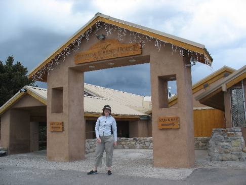
Sandia Crest House on Sandia Peak Albuquerque, New Mexico
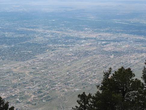
View of Albuquerque from Sandia Peak
At the top we are able to survey Albuquerque from a mile above the city. What an awesome sight to behold. I can't make out much of Albuquerque but I can spot the Rio Grande River flowing from right to left in the top right quadrant of this picture where we are looking to the southwest from Sandia Peak.
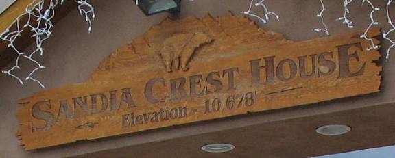
On Sandia Mountain we are nearly two miles above sea level (10,678') and one mile above the city of Albuquerque. They say you can see 100 miles in all directions on a clear day. This isn't a clear day. The rosy colored granite of the face of the cliff visible from Albuquerque turns crimson when the setting sun reflects on it. Early Spanish settlers named the mountain for that watermelon color. Sandia is Spanish for watermelon. The tram that rises from the western valley to another spot on Sandia Peak almost 2-miles south of where we are. We wrote about that tram ride in another travelogue several years ago. This time we have a digital camera with us.
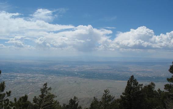
Rio Grande Valley and Mt Taylor as seen from Sandia Peak
This view looking west across the Rio Grande Valley features the Rio Grande River flowing through the center while 11,300' Mt. Taylor, one of New Mexico's highest peaks, is in the distance------remember that Mt. Taylor is 60-miles west of us.
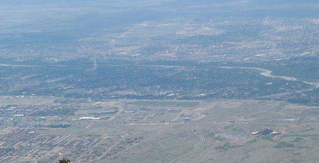
Rio Grande River flowing through Albuquerque
It is easier to see the Rio Grande River in this picture. I assume that is I-25 running from left to right. Remember that this picture is looking west toward Albuquerque from Sandia Peak.
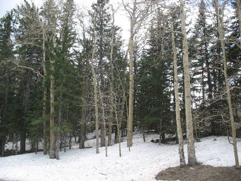
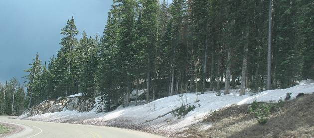
Snow on Sandia Peak
It didn't snow on us while we were on Sandia Peak but this snow reminded us that is was cold at this altitude.
Snow on Sandia Peak
Snow was common above 8,000' elevation.
Snow on Sandia Peak
Yes it is chilly up here.
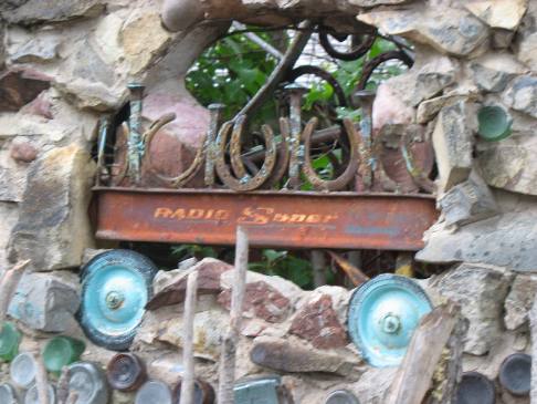
Tinkertown Museum
Near the bottom we stopped at Tinkertown Museum (located on Sandia Crest Road). As we turned into the parking lot at the Tinkertown Museum we made a simultaneous decision that we didn't really want to spend money or time in this place. I think we made that decision upon viewing this eclectic fence. This is only one part of that fence.
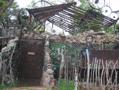
Tinkertown Museum
This is another part of that fence. Those are bottles in concrete that are making up this part of the fence. I am not sure what the other items are. Tinkertown Museum is advertised as New Mexico's premier Folk Art Environment as featured on PBS' Antiques Roadshow. It is the life work of Ross Ward and is open 9-6, April-Nov. 1st. If you visit the place please drop us a note to let us know what we missed.
More New Mexico AdventuresSome Exciting Drives** More 2007 Travel Adventures
Mike & Joyce Hendrix
Mike & Joyce Hendrix who we are We hope you liked this page. If you do you might be interested in some of our other Travel Adventures: Mike & Joyce Hendrix's home page Travel Adventures by Year ** Travel Adventures by State ** Plants ** Marine-Boats ** Geology ** Exciting Drives ** Cute Signs ** RV Subjects ** Miscellaneous Subjects
We would love to hear from you......just put "info" in the place of "FAKE" in this address: FAKE@travellogs.us Until next time remember how good life is.
|
| ||

| |||
|
|
|||
|
| |||
|
|