Toston Dam & White PelicansJuly 30, 2007. We are staying in Lincoln Road RV-Park Helena, MT less than a mile west of I-15 at exit 200. Lincoln Road RV-Park is about 10-miles north of downtown Helena but in a very good position to access everything in the area. $25.04 with Good Sam discount plus-taxes for FHU in nice gravel pull-thru sites with some shade. Free wifi was available but no cable TV. The free wifi was available but you had to take your laptop to the office (it wasn't available from your RV).
Little gates of the Mountains described in Lewis & Clark Journals
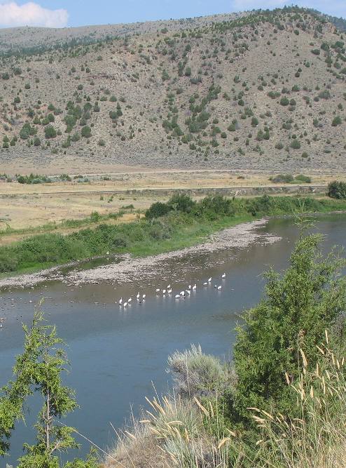
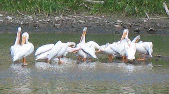
This picture was taken downstream (north) of the Toston Dam 10-miles south of Townsend. Those are white pelicans you see in the river. Pelicans are a lot like dogs and cats, they spend a lot of time motionless. They begrudgingly move when hunger pangs strike.
White Pelicans on the Missouri River
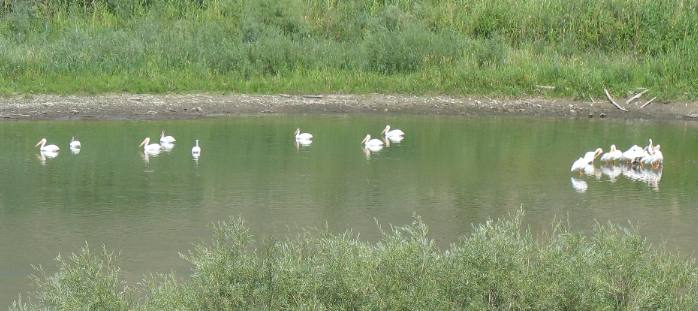
This is another group of white pelicans patiently waiting for the dinner bell.
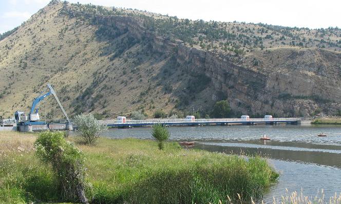
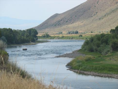
Toston Dam on the Missouri River
The Lewis and Clark Expedition passed this way on their westward trek across the continent. Expedition members camped on the west side of the Missouri River on July 25, 1805 according to journal entries. Where they camped is a short distance upstream from present day Toston Dam. Western Ranchers will be delighted to note that Captain Meriwether Lewis discovered and described stipa Comata, commonly known as needle & thread grass. Captain Clark identified a large spring on a map. Today that large spring is located a half-mile downstream from the dam.
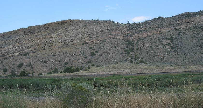
Cliffs described by Indians as "Little Gates to the Mountains" Louis & Clark
The rocky cliffs on either side of the dam were significant landmarks previously described to Lewis & Clark by Indians at Fort Mandan where they wintered over with the Mandans. Fort Mandan is in present day North Dakota. The cliffs were described as "little gates of the mountains". The Indians described these "little gates of the mounains" as the second chain Mountains the river flowed through. We have already visited and written about the more notable "Gates of the Rocky Mountains" that were located about 25-miles north of Helena.
White pelicans below Toston Dam
White pelicans below the Toston Dam on the Missouri River. These are not too far from the "big-spring" that Clark described in his journal.
Little Gates of the Mountains
The cliff on the other side of the Missouri is the beginning of the "Little Gates of the Mountains," that the Mandan Indians had told Lewis and Clark about when the expedition wintered with them during the winter of 1804/1805.
Five days and about 55 miles up the fast-flowing river from the entrance to the "gates of the Rocky mountains," and a day and a half before they reached the headwaters of the Missouri at the Three Forks, Lewis came upon "a bluff point where the river again enters the mountains." In journals this spot was described this way, "I beleive it to be a second grand chain of the rocky Mots." Private Whitehouse, in his journak indicated Sacagawea had something to do with expecting the second set of "gates to the mountains". Here is an excerpt from his journal; "passed some rough rockey hills, which we expect from the account we have from the Indian Woman that is with us, to be the commencement of the Second chain of the Rockey Mountains; but they do not appear, to be so high, as the first chain of Mountains which we have passed, nor so solid a rock at the entrance of them." Keep in mind that the Lewis & Clark party could see snow topped mountains up river. They knew they were near the source of the Missouri River.
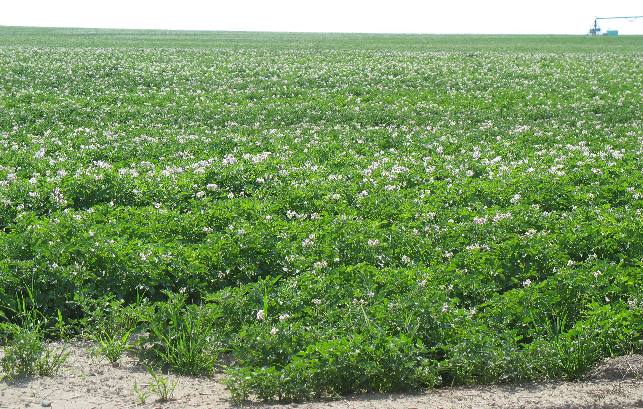
Montana potatoes
Montana potatoes. We expect to see potato fields like this about 150-miles south of here in Idaho.
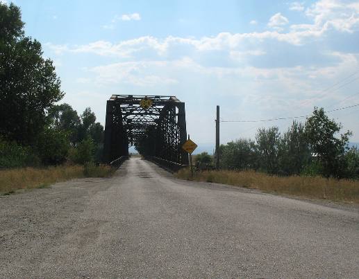
Toston Bridge in Montana
The virtually abandoned town of Toston, Montana located on the Missouri River approximately 10-miles south of Townsend is accessed by this bridge over the Missouri River. Many bridges in Montana are one lane as this one is. Many of these old bridges also have wooden planks for decking, as this one does.
More Montana AdventuresSome Exciting Drives** More 2007 Travel Adventures
Mike & Joyce Hendrix
Mike & Joyce Hendrix who we are We hope you liked this page. If you do you might be interested in some of our other Travel Adventures: Mike & Joyce Hendrix's home page Travel Adventures by Year ** Travel Adventures by State ** Plants ** Marine-Boats ** Geology ** Exciting Drives ** Cute Signs ** RV Subjects ** Miscellaneous Subjects
We would love to hear from you......just put "info" in the place of "FAKE" in this address: FAKE@travellogs.us Until next time remember how good life is.
|
| ||

| |||
|
|
|||
|
| |||
|
|