Places Visited: Montana: Driving from Helena to Lincoln via SR 279 and SR 200 then from Lincoln west on SR 200 to SR 141 where we headed south to the intersection with US 12 where we headed east back into Helena. July 28, 2007. We are staying in Lincoln Road RV-Park Helena, MT less than a mile west of I-15 at exit 200. Lincoln Road RV-Park is about 10-miles north of downtown Helena but in a very good position to access everything in the area. $25.04 with Good Sam discount plus-taxes for FHU in nice gravel pull thru sites with some shade. Free wifi was available but no cable TV.
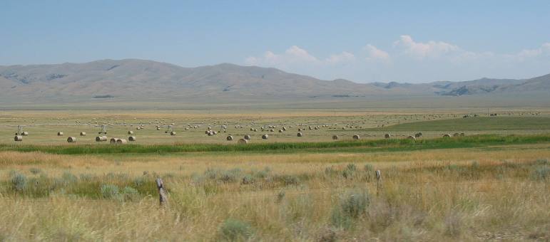
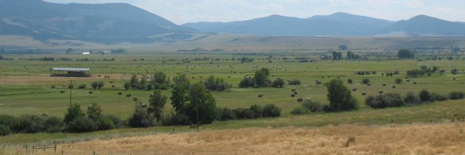
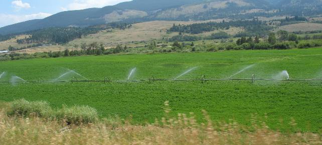
We are headed west today to cross over the Continental Divide near where Lewis and some of his men crossed on their return trip across the continent in 1806. We were heading west on Lincoln Road (SR 279) when Joyce took this picture. Irrigated land is producing hay and I think wheat in this picture. The wheat would be that lighter colored field in the distance.
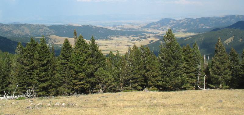
The valley we were following was loaded with pastoral scenes like this one.
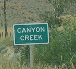
Follow SR 279 west toward the Continental Divide and Lincoln and you will have a good idea where we are. Canyon Creek is east of the Continental Divide.
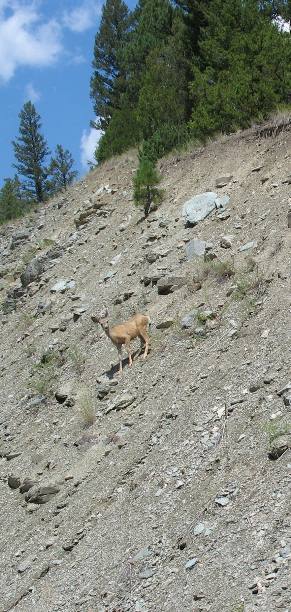
Even in the middle of the day we are able to spot wildlife like this deer making his way down the roadcut.
We are SR 279, also known as Flesher Pass road, as we climb to the Continental Divide at Flesher Pass.
In early July of 1806 guides showed Captain Meriwether Lewis an ancient travel route the called the "river of the road to the buffalo." This road has been used for generations by the Native American Indians to hunt buffalo east of the Continental Divide. Lewis wrote in his journal, the guides " alleged that as the road was a well beaten track we could not now miss our way." The trail ran along the Blackfoot River as it passed by present day Lincoln. Remnants of this ancient "road" can still be seen along the Blackfoot River near Lincoln.
On July, 1806 Lewis and his nine men camped on Beaver Creek near here. Lewis described Lincoln as a "beautiful plain on the border of which we passed the remains of 32 old lodges. By lodges he was referring to old Indian structures. Just a few miles to the northeast Lewis and his party crossed the Continental Divide over what is today's Lewis & Clark Pass (northeast of Lincoln on SR 200). From the pass they could see "fort mountain" -- now called Square Butte, 20-miles to the northeast. Upon crossing the Continental Divide they were once again back in United States Territory. Remember as the Corps of Discovery left St Louis in 1804 the United States had just completed the "Louisiana Purchase" thus everything east of the Continental Divide (at least in this area) became United States Property.
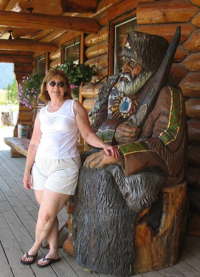
This is Joyce posing for me in front of the Hi-Country Trading Post (one of those "must-do" tourist spots) located 2-miles west of Lincoln on SR-200. Hi-Country is noted for beef and elk jerky. RV'ers are attracted to it because they allow overnighting in their huge parking lot.
Of course if you prefer you can dry-camp in the Lincoln City Park for $10 a night---your choice. We saw several adequate commercial RV-Parks in Lincoln plus the Lincoln City Park had hookup sites as well as the dry camping sites but I do not recall a price for the sites with electricity.
Hi-Country Trading Post is located next to the facility where they produce their line of meat snacks. In addition to their meat products their store has an extensive collection of great "Made in Montana" products like jams and jellies. A real Montana Tourist Trap but worth visiting to say you have "been there done that". The Trading Post is also used to display a variety trophy big game mounts. If you want to order some of their jerky products you might try www.hicountry.com
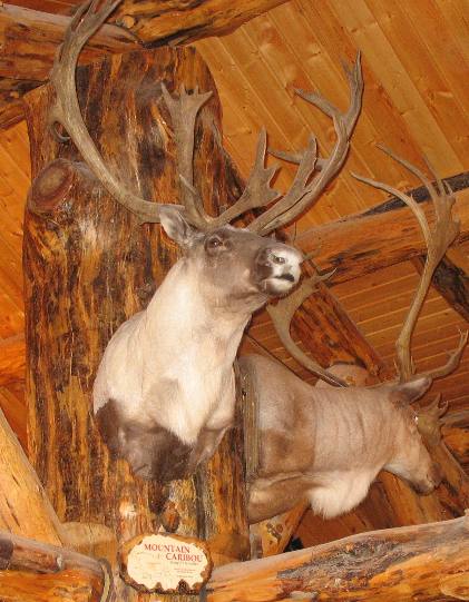
When we were in Canada a few weeks ago we saw a small herd of caribou but were not sure what they were. Several locals told us they were elk but --------- well, I might have a southern accent but I didn't fall off the turnip truck last night. What we saw were caribou. At that time I did not know caribou ranged that far south but here they have Montana caribou mounted and on display. This is the animal we saw and they range down into Montana.
Some of the Lewis and Clark expedition passed near Lincoln in the summer of 1806. The expedition was on their way back east from the Pacific Ocean. On July 3, they divided forces at Traveler's Rest (on the Montana-Idaho border) to explore more territory (than if they stayed together) before reuniting on the Missouri River at the confluence of the Yellowstone River and returning home together. Clark and his group of men headed overland for the Yellowstone River where they constructed canoes to ride home in. Lewis, with another group chose a shortcut to the plains described to him by their Nez Perce guides, who would ride only a little beyond the junction of the Bitterroot and Clark Fork River and predicted trouble with the Blackfeet Indians. From July 3-7, 1806, Lewis with nine men and his dog Seaman, followed a well worn trail known as "River of the Road to the Buffalo." This trail led them up the Blackfoot River and quickly across the Continental Divide to the Missouri River. When crossing the Continental Divide Lewis observed "high broken mountains," destined to become the Bob Marshall Wilderness.
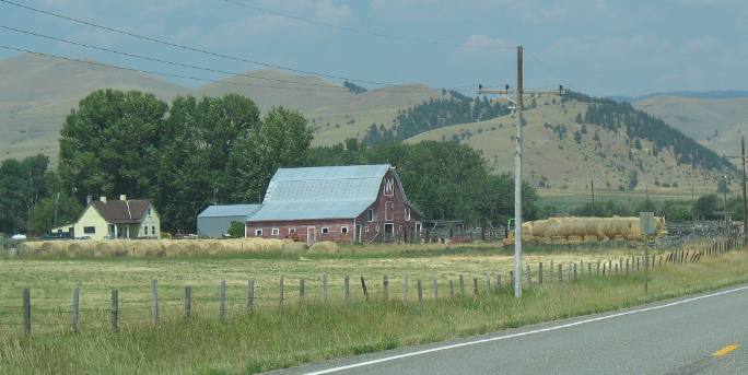
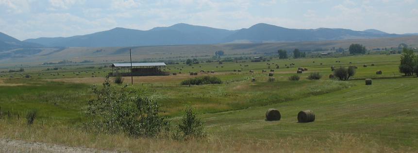
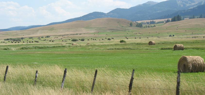
After visiting the town of Lincoln and the Hi-Country Trading Post we continued west on SR 200 for another 20-miles until we finally turned south on SR 141. Once turning south on SR 141 we were following a well watered valley that was producing prodigious amounts of hay. It is a really beautiful valley, pastoral in every aspect.
It seems like everyone has baled hay at the same time and not had time to get it out of the fields yet.
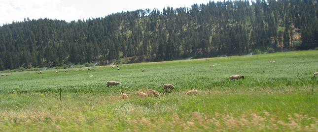
Mike, the virtual friend that lives near here wrote to provide more information about this picture. The rancher that owns this land is taking part in an experimental program to control weeds using sheep. Every summer, they bring about 700 sheep from Choteau and they feed on the weeds on the opposite side of the road from the picture. The sheep *really* blend into the landscape and I know a lot of people drive by them and never see them. I don't know if they were near the road the day you drove by. They actually have a couple shepherds ( along with 2 or 3 *big* dogs) that watch over the sheep - they have a tiny trailer that they tow around to be in the vicinity of the sheep. Thanks to Mike we have this added information.
Ok, here is a field that has not yet been cut.
This is an odd sight, a pasture full of sheep. This field looks ready to be mowed and baled yet it is full of these sheep. We wonder if this isn't an accident. A reader that lives near here "Mike" wrote to tell me that the sheep are the pet project of the ranchers wife. He sold off his cattle a few years ago but she still has about 80 sheep. It actually costs more to get a sheep shorn than you can sell the wool for. The field they were/are grazing on is just about out of grass. He is the about the only rancher in the valley that still bales the small 90lb bales - everyone else uses big rounds or big squares that weigh close to a ton.
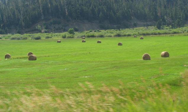
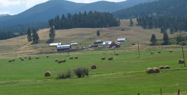
I am not sure they are planning on picking up this hay.
Large bales of hay are everywhere.
If this valley were to be named today I think it would have to receive the moniker of "Hay Valley".
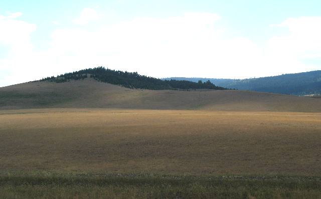
Then for a moment the road veers away from that well watered valley and presents us with this dry rangeland. Actually, this is what Montana looks like where irrigation is not available.
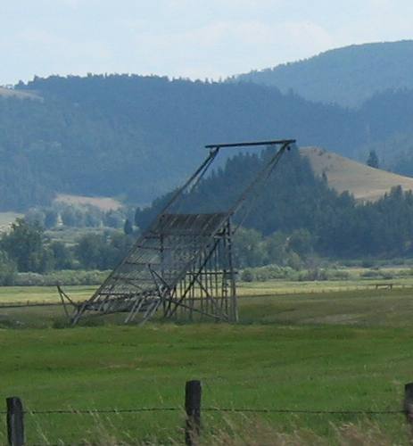
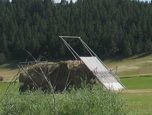
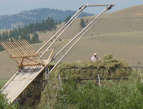
Then as we near the intersection of US 12 we started seeing hay fields again. Except these fields were not bailing their hay in the normal method. Take a look at this contraption. It is a piece of equipment used to create monster piles of hay.
A virtual friend, "Mike" that lives in the area wrote to give me some additional information on this thing. They are Beaver Slides and are driven by a tractor PTO - they used to be horse driven. ( My guess is that the farmer would use the PTO (Power Take Off) to winch the loaded hay to the top of the rig.
The hay forms a crust that makes it pretty weather proof and I am told it will
last Many thanks to "Mike" for providing this information. Anyone that can add to this information is certainly requested to provide it. I will update this travelogue with that additional information. Keep in mind that we are driving south on SR 141 approaching Avon.
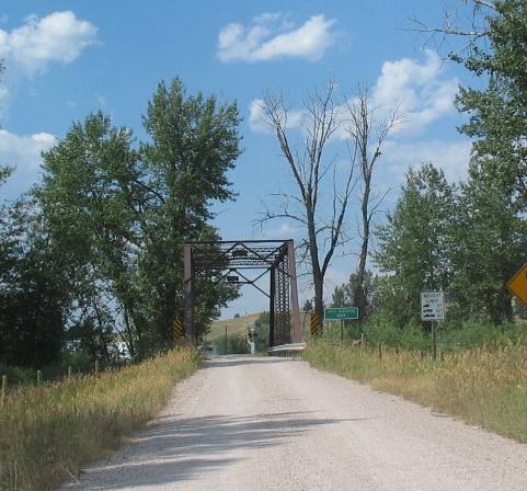
At the intersection of SR 141 and US 12 we spotted this gravel road leading off SR-12 across a creek on that one land bridge that must have been constructed when Moses was a baby.
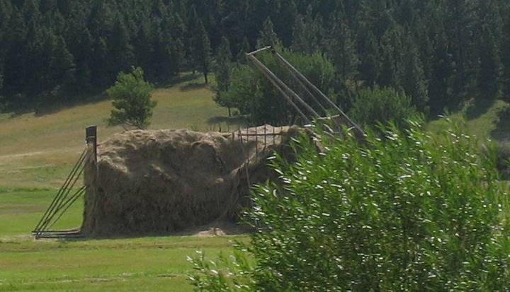
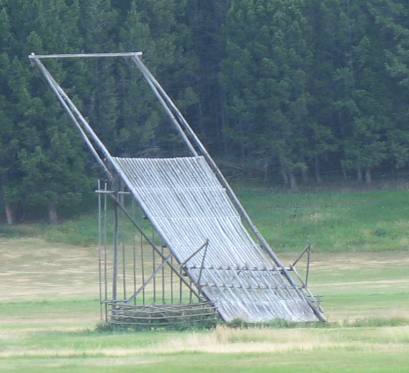
This is another look at that "beaver slide contraption" farmers are using to stack hay in large piles. In this picture you can see a hay pile in progress.
This is another look at one. This time more infrastructure is evident. Some of this infrastructure is moved from hay pile to hay pile.
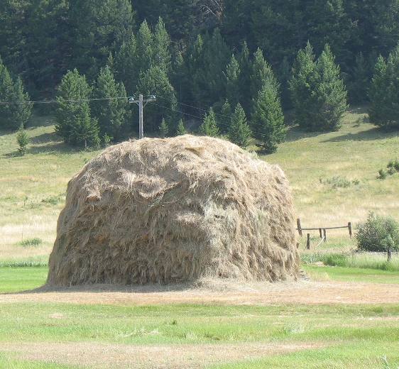
This is a pile of hay that was "constructed" with that "beaver slide contraption". For this pile the "beaver slide apparatus" used to construct this "smaller" mound has been moved. I say "smaller" because most of the mounds are at least twice this size.
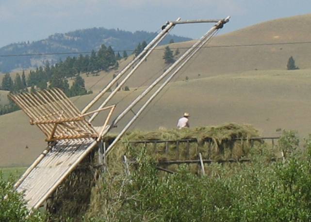
In this picture a farmer is on top of the hay with a pitch fork. Hay is placed on that wooden slide then pulled up the ramp. If you look closely you can see rope leading from that wooden thingee to pulleys located on the ends of the long poles.
We have never seen hay being stored in this manner. This method of storing hay was being used on 8 to 10 farms/ranches all located near the intersection of SR 141 and US 12.
This is another picture of one of those "beaver slide contraptions" that is not in use. Beaver slides seem to vary in size. This is a smaller one.
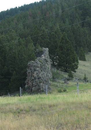
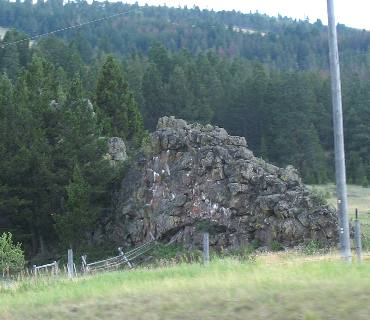
Not long after turning east on US 12 we passed this strange rock "fin". This rock is obviously harder than the surrounding rock as it has not eroded away like the softer rock has. I wonder if this was an intrusion into the limestone by molten rock from deep in the earth.
This is another picture of that strange formation. Something tells me that it must be an intrusion of igneous rock into a crack in the overlying sedimentary layers.
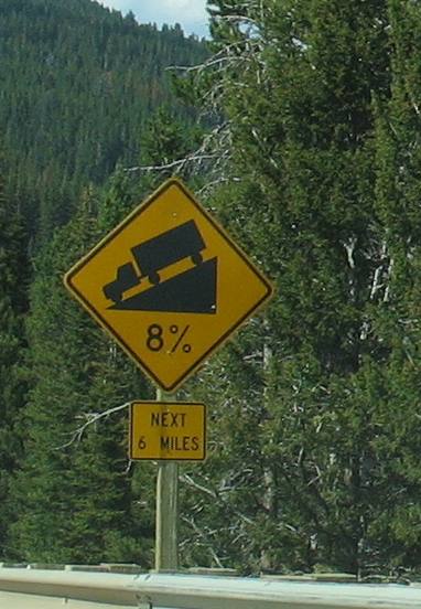
This picture was taken on MacDonald Pass looking east toward Helena. We are also standing on the Continental Divide, elevation 6,325'. MacDonald Pass and two other Continental Divide crossings link Helena with points west. These passes, all with roads leading into Helena are the reason Helena survived as a town, after the gold played out. Mullan and Priest Passes, to the north of this route, had roads as early as the 1850s. In 1870, a toll road was constructed over this portion of the Continental Divide. During the 1880s a half dozen six-horse stages a day passed this way to and from Helena and western Montana. The MacDonald Pass is also noted for being where Cromwell Dixon earned a $10,000 prize when he became the first aviator in America to fly over the Continental Divide. The year was 1911 and he flew out of Helena over the Continental Divide then returned to Helena. From here west to the Idaho line, US 12 and I-90 follow the old Mullan Road that I told you about in travelogue #125 Fort Benton. This important 624 mile road connected Fort Benton on the Missouri River with Fort Walla Walla in Washington. It was the "connecting link" between water transportation available on both sides of the Rocky Mountains. Originally a centuries old Indian trail, Mullen mapped the road over the pass in the 1850s. In 1860, it was incorporated into the military road that would bear his name. Mullen, aside from his engineering ability, was a man of considerable insight as evidenced by the following excerpt from his final report. He prophesied "... the locomotive engine will make passage of the ... wild interior at rates of speed which will startle human credulity." Indeed, two decades later, in 1883, the Northern Pacific Railway constructed its main line over Mullan Pass. Mullen himself might have been astonished had he seen the "freight train" that crossed this divide in 1865! Seven camels, each laden with 600 pounds of flour, made the trek from Helena to the Deer Lodge area mines. Not even Mullen could have imagined that. Camels were one of the less successful experiments in American transportation history. The dromedary carried tremendous loads, was sure footed, had great stamina, but the horses, mules and oxen of the teamsters and mule packers stampeded at sight and smell of them. Camels were gone from Montana by 1867.
This is what you can expect between MacDonald Pass and Helena. Go back and take another look at that picture that looks east toward Helena in the valley. The grade does not look that bad but I suspect things are a bit distorted by the smoke. Whatever, it is a fairly steep grade for six miles and from there it continues dropping but at a more moderate 6% or 5% grade. Out west these grades seem to go on forever. At least the engine seems to think they go on forever.
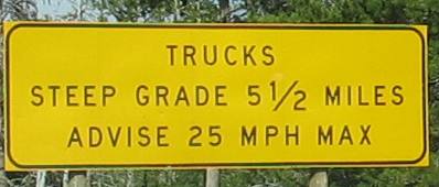
This is good advice. Heavy loads don't want their speed to get out of control and losing control of downhill speed is an easy thing to do on grades like this.
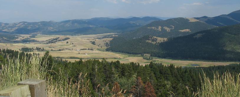
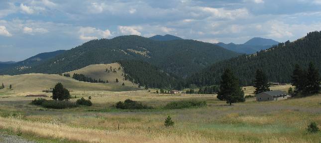
As we fall off the Continental Divide a beautiful valley emerges.
This is a few miles west of Helena on US-12.
Until next time remember how good life is. Mike & Joyce Hendrix
|
| ||

| |||