White Bird Idaho
June 22, 2007. We are staying at Angel's Nook RV-Park in White Bird, Idaho. $12.80 FHU no TV signal, no cell phone service, no wifi. Actually, there is no TV service or cell phone service in town. This is a small private RV-Park definitely mom & pop but close to town in the back yard of one of the oldest homes in town an an easy walk to everything in White Bird. It is a Passport America Park and we would stay here again.
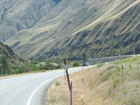
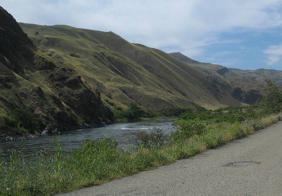
US-95 between Riggins and White Bird in Western Idaho as it follows the Salmon River
This is the scenery as we leave Riggins in Western Idaho. We are traveling north on US-95 following the Salmon River.
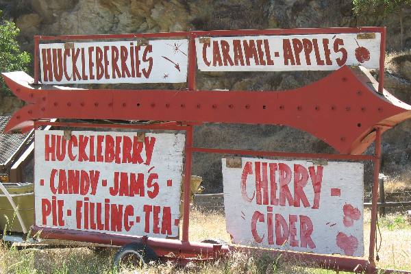
Fiddle Creek Fruit Stand on US-95 north of Riggins, Idaho
Less than a mile north of town we stop at Fiddle Creek Roadside Fruit Stand and load up with raspberries, blackberries, cantaloupe, onion, peaches, nectarines, huckleberry pie filling and several more goodies that escape my memory.
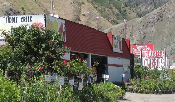
Fiddle Creek Fruit Stand on US-95 north of Riggins, Idaho
This is another picture of Fiddle Creek Fruitstand on US-95 north of Riggins.
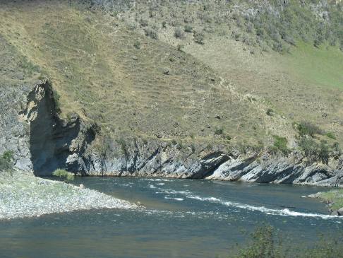
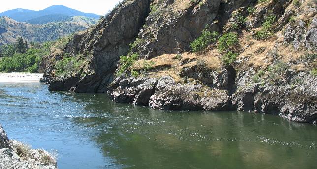
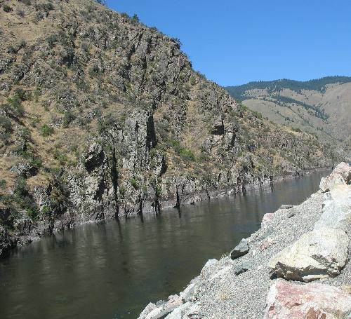
Salmon River flowing through extremely hard basalt north of Riggins, Idaho
The Salmon River is carving this canyon through extremely hard basalt. This basalt is from an ancient lava flow.
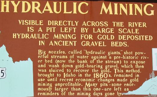
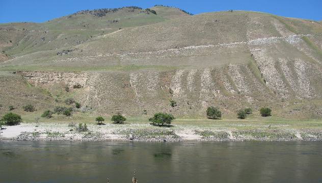
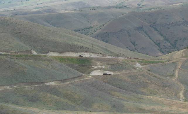
We stopped to view the scar left by a hydraulic mining operation in the 1860's
Scar left by a hydraulic mining operation in the 1860's
This is where miners were using powerful streams of water to wash away the bank in search of gold bearing sand.
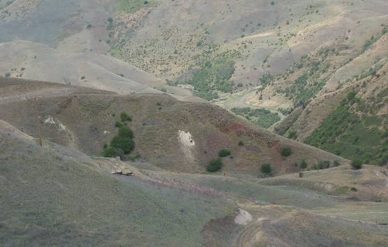
Scar left by a hydraulic mining operation in the 1860's
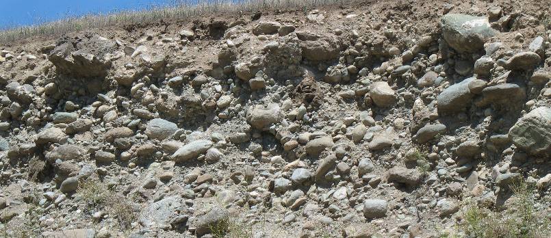
In case you do not understand what hydraulic mining is all about think of it as placer mining on steroids. Placer mining is where miners searched for gold in stream beds. Geologist recognize this geologic formation as conglomerate created with rounded river rocks. Thus this was an ancient river bed. Gold collects in stream beds when quartz rocks containing gold fall into creek beds where the water power has tumbled and ground the rocks down releasing small flakes of gold trapped in the quartz. The gold flakes being heavier than the gravel falls to the bottom. The miners search for those flakes of gold in the sediments at the bottom of these creeks. During the gold rush days they looked for quartz rock containing gold in conglomerate formations such as this one. Then knowing that this was once an ancient river bed they looked for gold in this ancient river bed just as they would a current river bed.
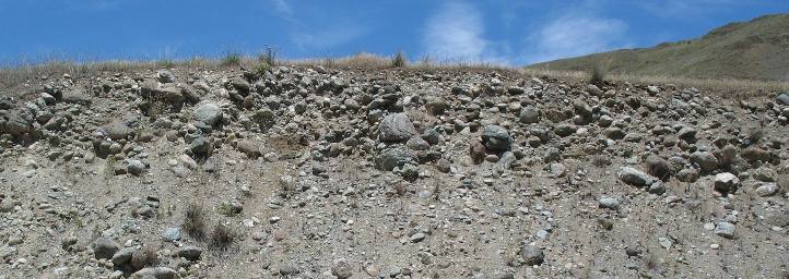
Closeup of the conglomerate in the hydraulic mining scar along the Salmon River north of Riggins, Idaho
Those who have a rudimentary understanding of geology can look at this and tell it is conglomerate in an ancient river bed. They can tell that because all the rocks are rounded (river rocks). Thus knowing that this is an ancient river bed, there would be a good chance gold could be in the sediments of the old river bed especially if they can spot gold bearing quartz rocks in the river rock.
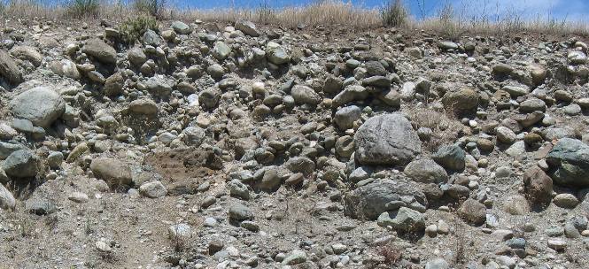
Closeup of the conglomerate in the hydraulic mining scar along the Salmon River north of Riggins, Idaho
The chances were especially good if miners detected quartz rock containing gold in the exposed gravel. Now you know what "Hydraulic" mining was all about.
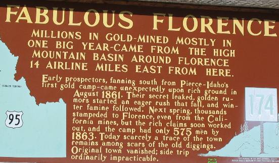
Fabulous Florence, Idaho the old gold mining "ghost town"
While Florence is a ghost town now it was a rip roaring place at one time. According to one resident P.W. Gillete's diary dated June 15, 1862: "Here the congressman, legislator, judge, divine, doctor, lawyer, merchant, farmer, laborer and sailor mingle in the same crowd, wear like slouch hats, blue shirts and ragged or patched breeches. Nearly all of this vast horde of gamblers, roughs and desperadoes are from California. There is no law here, or none that sees, abates, retards or punishes crime. Scarcely a day passes that someone is not killed or wounded. There has been strong talk of establishing a vigilance committee, but as yet nothing has been done. The decent people of Florence endure these outrages with remarkable fortitude." This Florence he is writing about was a bustling mining town in the 1860s, located about 50-miles south of Grangeville. Florence experienced a gold rush which caused its population to boom from 50 to 9,000 people in one year. Gold was discovered in the Florence Basin in August of 1861. By winter, more than 3,000 prospectors flocked to the area. In that year more than one million dollars worth of gold had been produced from placer mining alone. And that was in 1860 dollars! By June 1862, the population peaked to 9,000, producing $7 million worth of gold that year. By 1863, the rush was over. Mining activities continued for the next 20 years with a mixed population of Chinese and white. Following a moderately inactive period at Florence in the 1880s, modern technology for quartz mining revived the area in 1895. People once again converged on Florence and population rose to about 1,000 in 1897. Disorder between owners of the Old Florence townsite and new gold-seekers press the founding of New Florence, 1/4 mile south. The old townsite was torn down for salvage wood and was mined for scraps of gold which may have fallen through the floorboards of a number of structures. By 1897 only a few buildings were standing in Old Florence. By 190, the mining boom had diminished and only occasional stamp mills persisted in their operation. Some minor booms did occur between 1900 and 1940, but none was comparable to those of the 1860s and 1890s. It is estimated that between 1860 and 1866 close to $15million worth of gold dust was taken out of Florence. Gold dust refers to gold that is extracted by placer mining, and placer mining is where miners sift soil generally in river and creek beds looking for flakes of gold. That is distinguished from hard rock mining also called quartz mining which locates gold in quartz rocks then has to crush the quartz rock to release the "flakes" of gold. Quartz rock was crushed in stamp mills. Once the flakes of gold are released from the quartz" then miners could use washboards and like contraptions to wash away the rock and retrieve the gold flakes. Idaho became a "Territory" in March of 1863. Not a state but a "Territory". Statehood will come later. Staple foods of the 1860s were sourdough bread or flapjacks, beans, bacon, tea and whiskey. Chinese played a significant role in Florence between 1864 and 1890. In 1870, 50% of the population of the area was Chinese. The richest single claim in Florence appears to have been that of Jacob Weiser (for whom the Weiser River was named) and his partners. The gold was reportedly two inches thick on the bedrock. The claim yielded some $20,000 in just eight days of cleanup. One pan from the claim yielded $151.50 and two men with a rocker acquired $1.800 in just three hours -- that would be roughly $2,800, and $333,500, respectively, at current gold prices. Weiser sold his interest in the claim for $10,000 and left Florence with a mule-load of gold dust worth about $30,000 which would be worth more than $500,000 at current prices.
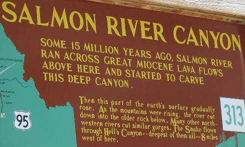
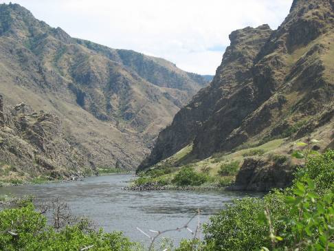
Salmon River Canyon between Riggins and White Bird in western Idaho
Salmon River flowing through extremely hard basalt north of Riggins, Idaho
This is where the Salmon River has carved a canyon through this extremely hard lava flow material. This picture was taken north of Riggins in western Idaho along US-95.
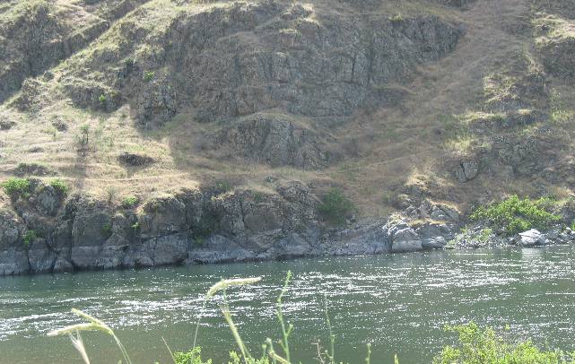
Salmon River flowing through ancient lava flow north of Riggins in western Idaho
Another picture of the Salmon River flowing through that ancient lava flow. The ancient lava flow is extremely hard basalt. Note the steep sides that have not eroded over thousands of years.
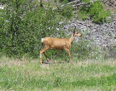
Mule deer near downtown White Bird in western Idaho
We are seeing more and more deer. We did not see any deer when crossing the southern part of Idaho along the Snake River. Along the Oregon border in central Idaho we are seeing plenty of deer.
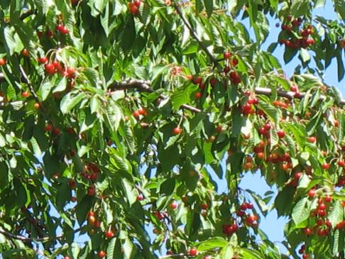
Pie cherries on tree near White Bird, Idaho
We dropped the motorhome at Angel's Lair RV-Park in White Bird then headed out on an adventure filled drive to Hells Canyon in the Saturn. On the way we passed numerous cherry trees like this one. The ranger at Pittsburgh Landing told us they were pie cherries.
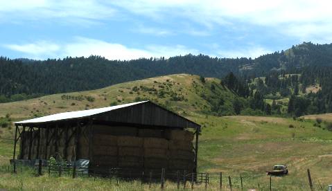
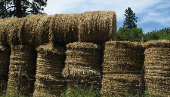
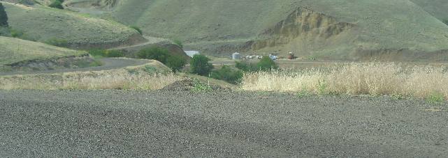
Western Idaho agriculture is evident in this store of hay
The drive from White Bird to Pittsburgh is on a 17-mile long NFS road most of which is good gravel. Ranches and farms were scattered out along the first half of the drive. They are all putting up hay for the winter.
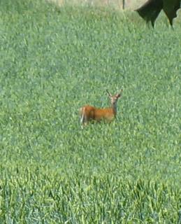
Deer seem to make their home in the grain fields of western Idaho
We stopped to watch several deer feeding in the middle of this grain field. They both watched us for a few moments then went back to eating. This is pretty representative of western Idaho agriculture. We saw this field outside White Bird, Idaho.
Western Idaho agriculture consists of intensive hay operations in areas like White Bird
Farmers in this area are growing grass hay instead of alfalfa.
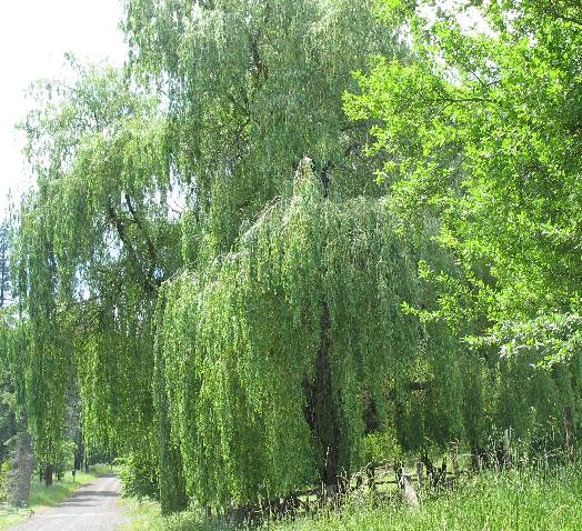
Huge willow tree along Deer Creek Road to Pittsburgh Landing on the Snake River in western Idaho
This beautiful willow tree was located at the corner of a property where livestock took advantage of the shade.
We saw this beautiful willow tree at a ranch off Deer Creek Road the Forest Service Road that connects White Bird with Pittsburgh Landing on the Snake River in Hells Canyon NRA.
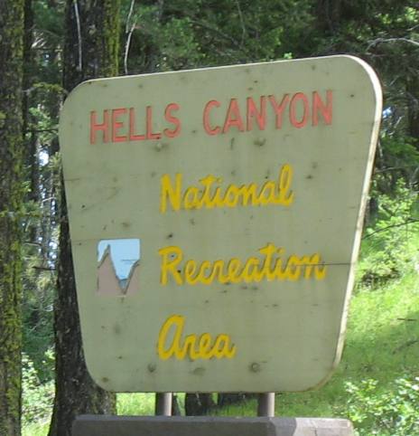
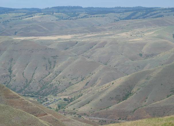
Hells Canyon NRA National Recreation Area as seen from the Forest Service Road leading to Pittsburgh Landing in Hells Canyon out of White Bird, Idaho
I have not mentioned it but the 17-mile drive involves a steep grade of 10-miles climbing to the top of a mountain range then a 7-mile drop on an even steeper grade to Pittsburgh Landing on the Snake River a few miles south of Hells Canyon. This sign is located somewhere near the "saddle" (that is what the locals call the "shallow" place in the mountain where the road crosses. Anyway, this was a totally awesome ride up to the "saddle". But as we will find out in just a few seconds, we ain't seen nothing yet.
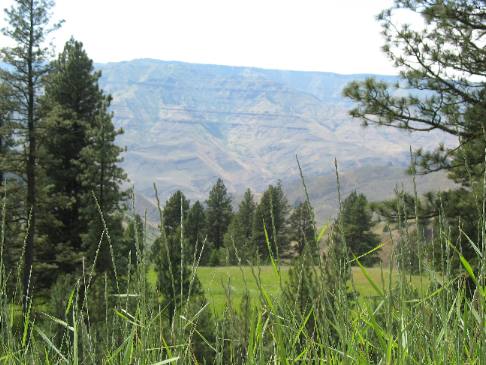
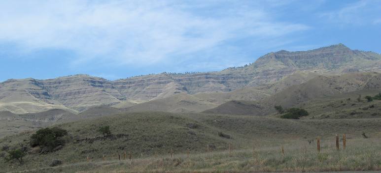
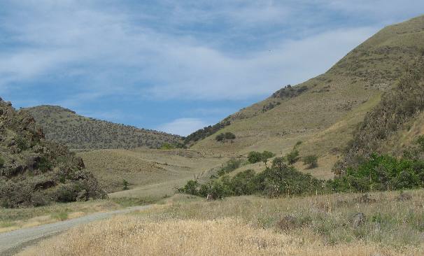
Top of divide seperating the Snake River and Salmon River near White Bird, Idaho
The scenery at the top is beautiful. When I say at the top I am referring to the "top" of the mountains that seperate the Salmon River from the Snake River west of White Bird.
Only a handful of hardy geologists have studied the rugged terrain of Hells Canyon. At Pittsburgh Landing, they have identified ancient volcanic rock and sediments dating back 160 to 180 million years--some with clues to the ocean origin of these formations. Layers of columnar basalt tell geologist that this area, like much of the Northwest, was inundated repeatedly by massive lava flows 15 to 17 million years ago. Along the Snake River, geologists find evidence of another catastrophic geologic event. About 15,000 years ago, the Bonneville Flood roared through Hells Canyon. Erosion, uplifting and other geological forces continue to shape the face of Hells Canyon today. Falling into Hells Canyon at Pittsburgh Landing west of White Bird, Idaho
The drop in elevation from where we are to where you begin to see the road at the bottom was something on the order of a 10% grade coupled with multiple switchbacks. Even that relatively straight section was on a grade greater than 6%. From here to the Snake River and Pittsburgh Landing was one super joy ride.
Descending into Hells Canyon in Hells Canyon NRA on National Forest Road 493 southwest of White Bird, Idaho
We are dropping like a rock. Notice how far down that switchback is on the left side of this picture.
We are falling off the divide between the the Snake River and Salmon River in Western Idaho southwest of White Bird.
Forest Service Road 493 heading into Hells Canyon southwest of , White BirdIdaho
Even when the road straightens out the grade remains totally unbelievable.
We are falling off the spectacular divide between the the Snake River and Salmon River southwest of White Bird in western Idaho.
Dropping into Hells Canyon southwest of White Bird Idaho on Forest Service Road 493
The road in this picture is for all practical purposes fairly straight, but it is dropping at a 6% to 8% grade. Second gear will not hold our speed down on the Saturn. Forest Service Road 493 is accessed from Deer Creek Road in White Bird. It takes you through the Hells Canyon NRA to Pittsburgh Landing on the Snake River in Hells Canyon.
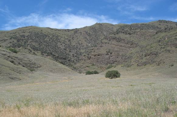
Geology in Hells Canyon NRA east of Pittsburgh Landing on the Snake River
These two trees looked like live oak trees from back in the south. It is odd for us to see these two large trees with no other trees in sight. Note that as we fall into Hells Canyon near Pittsburgh Landing on the Snake River we are going through a fairly arid area.
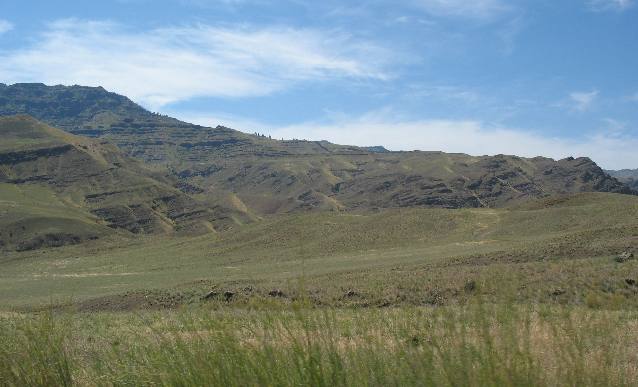
Arid area of Hells Canyon NRA near Pittsburgh Landing on the Snake River southwest of White Bird, Idaho
Much of the terrain is very dry and treeless after falling off the divide between the Salmon River and Snake River here in western Idaho.
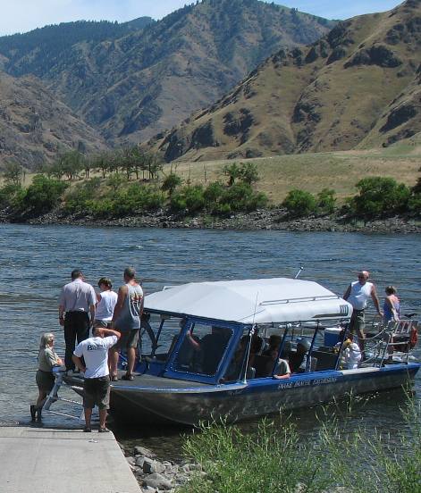
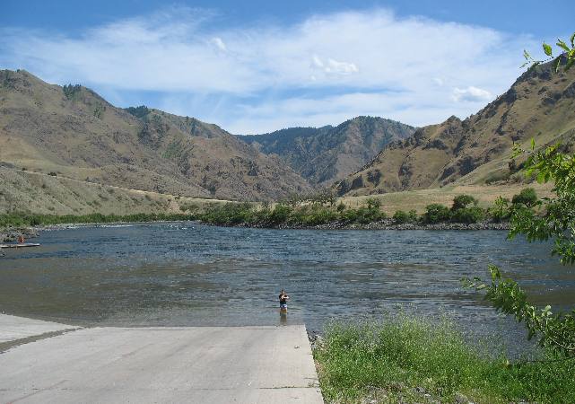
Pittsburgh Landing on the Snake River in Hells Canyon looking across the Snake River into Oregon
Finally we reach the Snake River and Pittsburgh Landing. We watched as this jet boat, out of Lewiston, stopped to let passengers use the rest room. After the passengers boarded they pushed off and headed downstream at 30 to 40 mph. They are still 50-miles or more miles from Lewiston. Pittsburgh Landing is located on the Snake River in Hells Canyon southwest of White Bird, Idaho.
Pittsburgh Landing on the Snake River in Hells Canyon looking across the Snake River into Oregon
The jet boat is gone and only one little girl remains playing in the water at the end of the boat ramp.
That is Oregon on the far side of the Snake River.
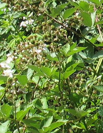
Blackberry bushes at Pittsburgh Landing in Hells Canyon NRA southwest of White Bird, Idaho
We are totally amazed at the blackberry bushes in this area. The bushes are huge in comparison to blackberry bushes in the southeast. These bushes are 6 to 8 feet tall and loaded from top to bottom with big berries plus they are still blooming. It won't be long until there will be more blackberries available than can be picked. Our daughter-in-law would go wild. She really loves blackberries.
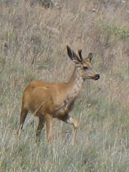
Mule deer at Pittsburgh Landing in Hells Canyon NRA southwest of White Bird, Idaho
We seem to be seeing deer around every turn.
This young buck did not seem to be phased by all the activity at Pittsburgh Landing in Hells Canyon NRA.
Oregon as seen from Pittsburgh Landing on the Snake River in Hells Canyon NRA southwest of White Bird, Idaho
Looking across the Snake River to the far bank in Oregon.
Looking south into Hells Canyon on the Snake River from Pittsburgh Landing south west of White Bird, Idaho
From Pittsburgh Landing looking south into Hells Canyon.
Of course that is the Snake River with western Idaho on the left side and eastern Oregon on the right side.
Snake River flowing through extremely hard basalt deep in Hells Canyon NRA southwest of White Bird
The mighty Snake River has cut this section of Hells Canyon through extremely hard lava flow as can be seen on this Oregon bank.
Snake River from the Campground at Pittsburgh Landing in Hells Canyon NRA
This is what the Oregon side looks like as it rises out of the canyon.
Looking east from Pittsburgh Landing on the Snake River toward the divide separating the Snake River from the Salmon River in western Idaho
In this picture we are looking back to the east on the Idaho side of Hells Canyon.
That area is roadless. Our road is going to go through a "saddle" located to the right of where this picture ends.
Looking east from Forest Service Road 493 deep in Hells Canyon NRA near Pittsburgh Landing on the Snake River
This is another picture looking east from Pittsburgh Landing.
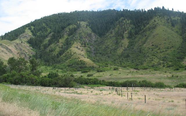
Looking north from Forest Service Road 493 deep in Hells Canyon NRA southwest of White Bird, Idaho
This picture was taken early on as we drove out of Pittsburgh Landing on Forest Service Road 493. At this point we are only a few miles east of Pittsburgh Landing on the Snake River.
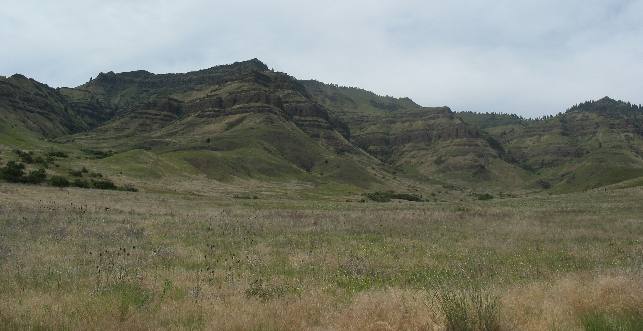
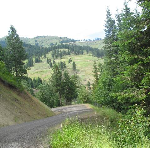
Hells Canyon NRA as seen from Forest Service Road 493 southwest of White Bird, Idaho
After climbing for 15-minutes or so and looking to the south trees began to appear and the grass started getting enough moisture to turn green. Note how in this picture you can see where the brown grass ends and the green grass begins.
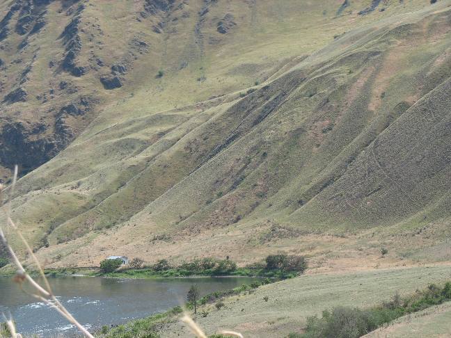
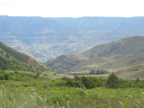
Looking down into Hells Canyon from Forest Service Road 493 in Hells Canyon NRA southwest of White Bird, Idaho
On this switchback Joyce pointed the camera back where we came from. Pittsburgh Landing and the Snake River is somewhere way down there. The elevation rising on the other side of Hells Canyon is in Oregon. Keep in mind that the Snake River is running from left to right in this picture.
Looking down into Hells Canyon from Forest Service Road 493 in Hells Canyon NRA southwest of White Bird, Idaho
From even higher, an on another switchback this is what that same valley looks like.
Keep in mind that is Oregon you see on the far side of Hells Canyon in the distance.
Looking down into Hells Canyon from Forest Service Road 493 in Hells Canyon NRA southwest of White Bird, Idaho
Pay close attention to this picture because it contains several of the switchbacks we have just negotiated. Believe me this is one of the most exciting drives available to regular automobiles in the United States.
Forest Service Road 493 through Hells Canyon NRA leads to Pittsburgh Landing on the Snake River.
Approaching the summit of the divide between the Snake River and Salmon River in western Idaho near White Bird
At the summit we are in the forest and for a brief moment we are not going up or down. But it is only a fleeting moment --------- then we start dropping toward US 95, the Salmon River and White Bird.
Falling off the divide between the Snake River and Salmon River on Forest Service Road 493
While not as steep as the other side this side is still in excess of 6% which makes for an exciting ride.
On this side of the divide we are falling into White Bird on the Salmon River.
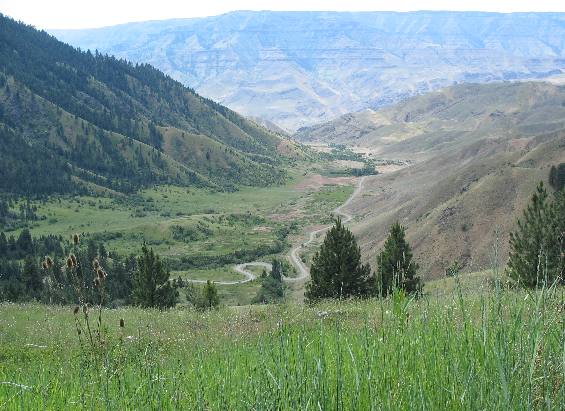
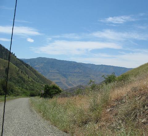
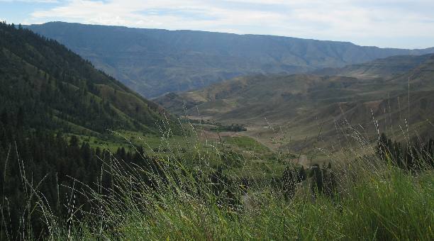
Our first peak at US-95 leading to White Bird
At long last we get a glimpse of US 95 way, way down there. We still have a long way to drop before we get to that highway, and as you can see it is going to be an exciting drop. While I do not see the Salmon River in this picture it is down there because US-95 follows the Salmon River all the way from Riggins to White Bird. As you can see the Salmon River runs through an extremly narrow valley in this area.
Returning to White Bird from Pittsburgh Landing on the Snake River in Hells Canyon NRA southwest of White Bird, Idaho
As we fall off the mountain the terrain becomes dryer and dryer. Notice the road as it drops along the far side of this picture.
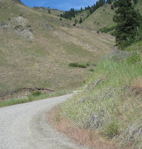
Falling toward the Salmon River and White Bird on Forest Service Road 493
Forest Service Road 493 continues to drop, as we head toward the Salmon River and US 95 south of White Bird in western Idaho.
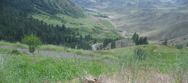
US-95 on the Salmon River in western Idaho near White Bird
Then we round another corner and get another glimpse of US 95. For a moment our goal is in sight, but as you can see we still have a long way to go. It is a totally incredible drop off this mountain to the Salmon River Valley below.
US-95 on the Salmon River in western Idaho near White Bird
This is another glimpse of US 95 and our destination.
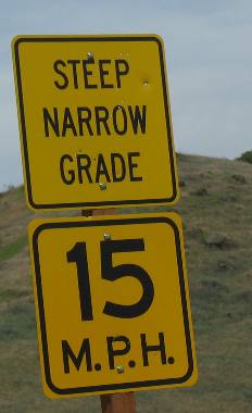
Steep Narrow Grade sign on Forest Service Road 493 southwest of White Bird, Idaho
Then we see this sign. What a joke! Not that the road ahead of us is not steep and narrow but NOTHING like the road we have just driven over. This sign is on a state or county road. Obviously the Forest Service does not put up signs like this. I guess the Forest Service either doesn't have the funding to put up signs like this or they just assume everyone knows their roads are steep and narrow. This sign is probably on the part of the road called Deer Creek Road and may be state or county maintained.
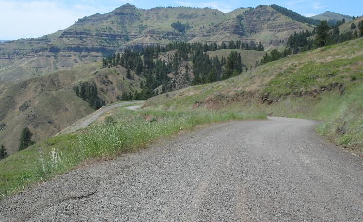
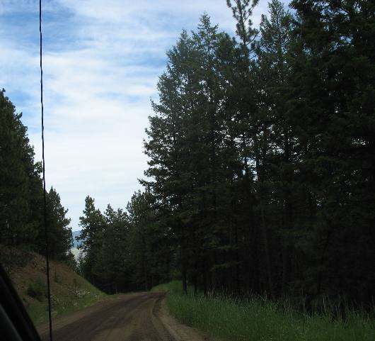
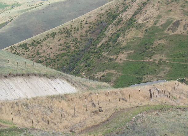
Spectacular road into White Bird from Hells Canyon NRA and Pittsburgh Landing on the Snake River
Here we go down that steep, narrow road. At least this section has some guard rails. The Forest Service does not believe in guard rails. We must be on Deer Creek Road out of White Bird.
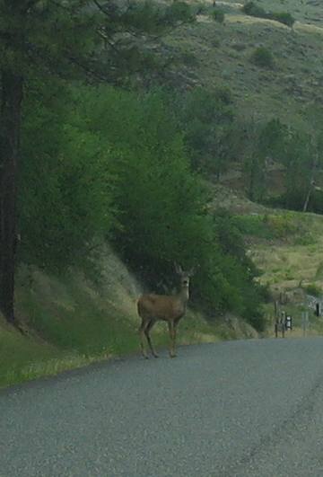
Mule deer along the Salmon River in White Bird, Idaho
As we get down to the Salmon River in White Bird this deer is there to welcome us home.
We are staying in White Bird tonight. Click here for more Idaho travellogsUntil next time remember how good life is.
More Idaho AdventuresSome of our Miscellaneous Subjects ** More 2007 Travel Adventures
Mike & Joyce Hendrix
Mike & Joyce Hendrix who we are We hope you liked this page. If you do you might be interested in some of our other Travel Adventures: Mike & Joyce Hendrix's home page Travel Adventures by Year ** Travel Adventures by State ** Plants ** Marine-Boats ** Geology ** Exciting Drives ** Cute Signs ** RV Subjects ** Miscellaneous Subjects
We would love to hear from you......just put "info" in the place of "FAKE" in this address: FAKE@travellogs.us Until next time remember how good life is.
|
|
||

|
|||
|
|
|||
|
|
|||
|
|