Forest Service road to Hells Canyon OverlookJune 20, 2007. We are staying at Canyon Pines RV Resort in Riggins, Idaho. $28.08 FHU-cable and free wifi, nice size sites on the Little Salmon River (208-628-4006) From Riggins there are two scenic drives, both on Forest Service roads, that take you to overlooks of Hells Canyon. We chose one and headed out toward Hells Canyon. Oh what a ride! If you are interested in taking this scenic drive go less than 1-mile north of Riggins on US-95. Turn west on Race Creek Road (NF 241). Continue on this road following signs to "Iron Phone Junction". The road is a fairly good (but exciting) gravel road. At Iron Phone Junction there are a number of signs --- follow the one that points to Saw Pit and Low Saddle viewpoints ----- it should be NF 2060. From the viewpoints you have to retrace your path to Iron Phone Junction. At Iron Phone Junction we took the north loop back to US 95 instead of returning the way we came in. We followed Cow Creek Road back to US 95 in Lucile some 10-miles north of Riggins. If you decide to take this scenic drive I would recommend returning on Cow Creek Road, it is an exciting descent with spectacular views.
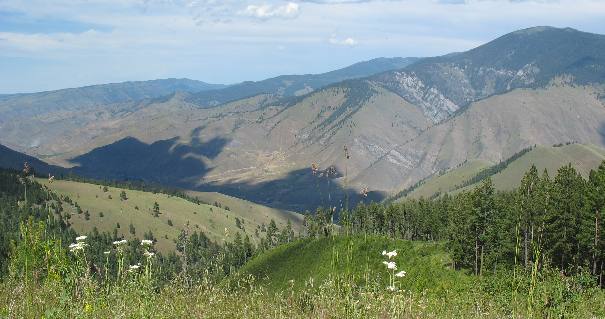
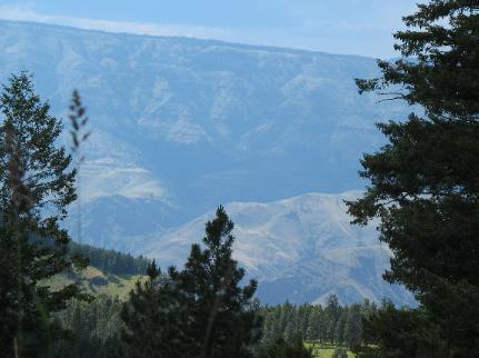
Mountains between us and the Hells Canyon Overlook
Between Riggins and Hells Canyon lie several real mountains that have to be crossed. Riggins, is at 1,801 foot elevation. These mountains are over 5,000'. Understand that getting to that overlook is going to require a major climb on gravel Forest Service Roads.
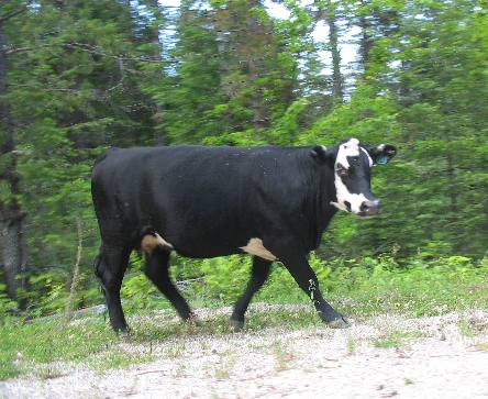
Forest Service road to Hells Canyon Overlook: Riggins, IdahoNote that the National Forest is a free range area
The National Forest is a free range area and cows, like this one, share the Forest Service road to Hells Canyon Overlook with us.
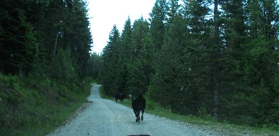
On the Forest Service road to Hells Canyon Overlook we see free range cattle on the road
These cows are making a hasty retreat on that Forest Service road to Hells Canyon Overlook. They are grazing in the National Forest during the summer but will return to their home pastures when temperatures start to drop in the Fall.
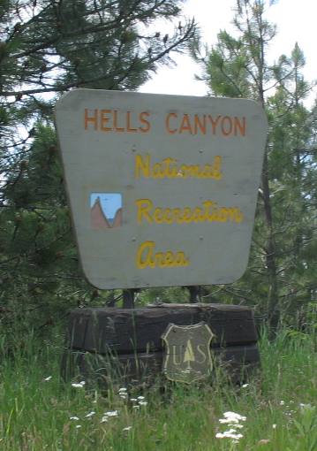
Hells Canyon National Recreation Area sign on the Forest Service road to Hells Canyon Overlook: Riggins, Idaho
About 12-miles into this drive we ran across this sign, where the Forest Service road to Hells Canyon Overlook gets significantly narrower and closer to the edge. Joyce is starting to express concern. She has been good up until this time. Even the famous Moki Dugway in Utah didn't rattle her. This road did, but we kept going. If I recall this sign is at or near Iron Phone Junction and where NF Road 2060 takes you to Saw Pit and Low Saddle viewpoints.
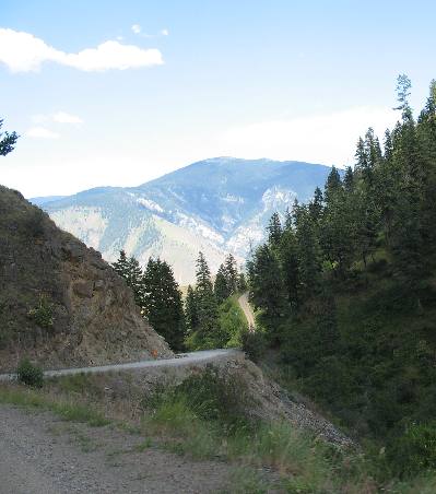
Hells Canyon in the distance in this view from the Forest Service road to Hells Canyon Overlook
From here we are able to get glimpses of Hells Canyon. Hells Canyon is in that chasm between where you see the plateau on the Oregon side of the Snake River some 25 or more miles in the distance. Look closely through the haze and you see the plateau on the far side of he canyon as it falls this way creating the Oregon side of Hells Canyon. It is harder to see the terrain on this side of the river as it falls toward the river because it is so steep.
We turned around without getting any closer to the overlook. It just wasn't worth it. Possibly in a jeep, but the Saturn is not designed for gravel roads in this condition.
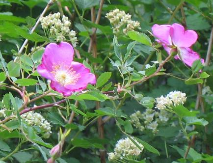
Wild roses along the Forest Service road to Hells Canyon Overlook
We are at an elevation of over 4,000 feet and possibly over 5,000 feet. Wild roses are growing along the gravel Forest Service road to Hells Canyon Overlook. Joyce is happy that we have turned around but knows we have to descend that steep climb we just negotiated. These roses weren't taking her mind off the steep descent we were about to experience.
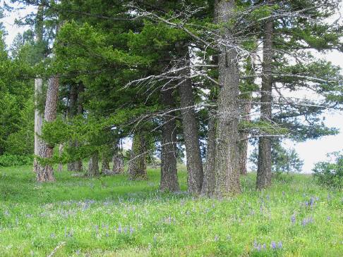
View from summit on that Forest Service road to Hells Canyon Overlook: Riggins, Idaho
At this altitude there is enough moisture to support evergreen trees and a good stand of grass.
Lower elevations exist in near desert conditions.
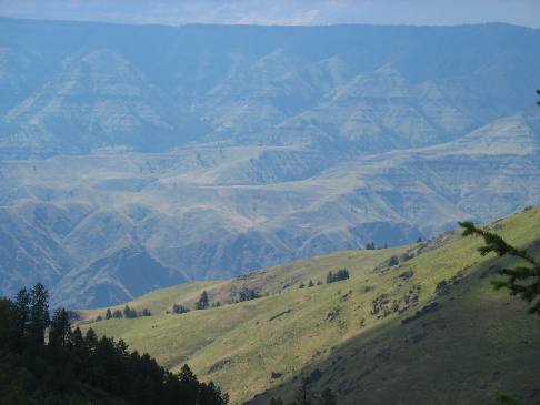
Hells Canyon in the distance as viewed from that Forest Service road to Hells Canyon Overlook
Desert conditions return not far below us. This picture is looking west across Hells Canyon. Where you see the the canyon walls rising to the high plateau is in Oregon. On this side where the canyon is falling into the Snake River we are in Idaho. In this picture the Oregon side of the canyon is in one color while this side (Idaho-side) is a completely different shade. Additionally, if you want to understand distances we are over 10-miles from anything you see on the Oregon side of the canyon.
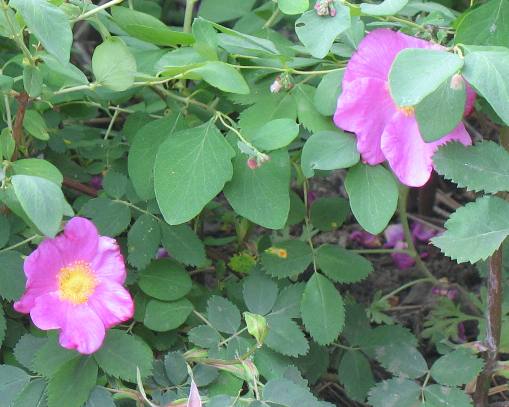
Wild Roses along the Forest Service road to Hells Canyon Overlook: Riggins, Idaho
We are still at a high enough altitude where wild roses get enough water to put on a dazzling show.
Drive down from Hells Canyon Overlook on that Forest Service road to Hells Canyon Overlook
We are falling like a rock on that Forest Service road to Hells Canyon Overlook. Joyce loves to be on the outside of these drop-offs ------ NOT!
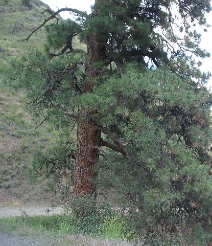
Huge Ponderosa Pine along the Forest Service road to Hells Canyon Overlook
This is one huge ponderosa pine. I wonder how it has escaped the loggers saw. Some things are just miracles.
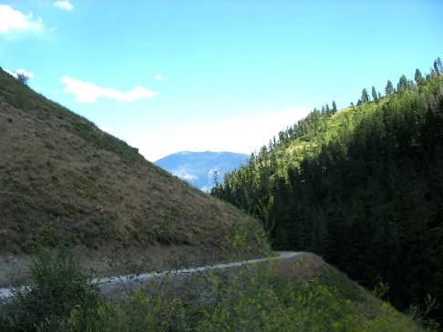
Spectacular scenery on return to Riggins down that Forest Service road to Hells Canyon Overlook
We continue to drop like a rock on the gravel Forest Service road to Hells Canyon Overlook, but the views are spectacular.
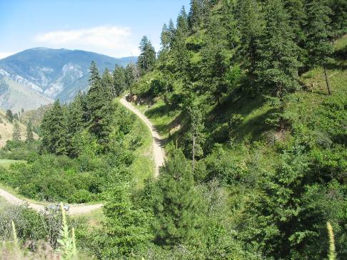
Relentlessly dropping in altitude on the Forest Service road to Hells Canyon Overlook
Down and around, constantly down and around and we are still high enough to be in the forest. We are going to drop at least another 2,000 feet before we reach the Salmon River near Riggins, Idaho on that Forest Service road to Hells Canyon Overlook.
Salmon River north of Riggins
Finally, back to civilization and US-95 along the Salmon River north of Riggins.
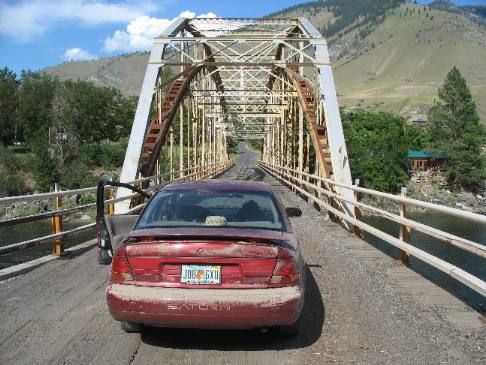
Bridge over Salmon River north of Riggins ending our drive on that Forest Service road to Hells Canyon Overlook
I stopped to take this picture of the bridge over the Salmon River and the pile of dust on the Saturn after this 35-mile drive over dirt/gravel road.
Click here for more Idaho travellogsUntil next time remember how good life is.
More Idaho AdventuresSome of our Miscellaneous Subjects ** More 2007 Travel Adventures
Mike & Joyce Hendrix
Mike & Joyce Hendrix who we are We hope you liked this page. If you do you might be interested in some of our other Travel Adventures: Mike & Joyce Hendrix's home page Travel Adventures by Year ** Travel Adventures by State ** Plants ** Marine-Boats ** Geology ** Exciting Drives ** Cute Signs ** RV Subjects ** Miscellaneous Subjects
We would love to hear from you......just put "info" in the place of "FAKE" in this address: FAKE@travellogs.us Until next time remember how good life is.
|
|
||

|
|||
|
|
|||
|
|
|||
|
|