Salmon River, & the Sunbeam Consolidated Gold Mine out of Stanley, IdahoFollowing the Salmon River from Stanley to Sunbeam Consolidate Gold Mine Dam site. June 14, 2007. Our motorhome is in Garrity RV-Park in Nampa 10-miles west of Boise. It was $21 per-night for FHU & Cable while every place else in the area seemed to start at $26 and rapidly go up. Garrity was just fine. It was clean, well managed, the sites were close but we were not there and didn't go outside except when heading to and from the automobile. There was a good number of permanent or long term in the campground but they were being managed properly thus were no problem. We would stay at Garrity again but those that like to spend the day and evening under the awning sipping cool ones might rather be in one of the other area parks. N43° 35.245' W116° 31.592' Salmon River flowing through Stanley, Idaho
While the motorhome is in Nampa we have decided to spend the night in a motel in Stanley. It was just too far to drive back to Nampa and accomplish all the things we wanted to see and do. After making arrangements to spend the night in Stanley we headed off down the Salmon River to explore that scenic drive. Whatever, we do we have to return to our motel room in Stanley tonight.
Salmon River near Stanley, Idaho
We turned north in Stanley on SR-75 following the Salmon River.
Note that we are in Stanley and this picture does not have a snow capped mountain in it. A picture from Stanley without a snow capped mountain is difficult, but possible.
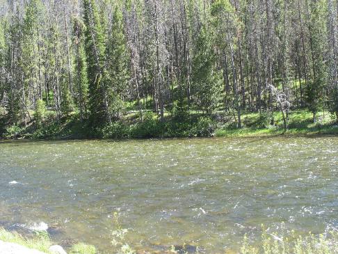
Salmon River near Stanley, Idaho
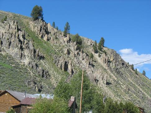
Joyce took this picture to show how the Salmon River has cut through this mountain. We are south of Stanley along the Salmon River.
Igneous intrusions creating dikes visible on one side of Salmon River
The other side of the Salmon River and that same mountain looks like this. The igneous intrusions or dikes were not visible on the other side of the river.
We are located in what is known as Lower Stanley where these igneous intrusions are prominent on the hill.
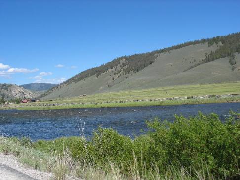
Snowmelt from the Sawtooth Mountains makes the Salmon River
Snowmelt from the Sawtooth Mountains created the Salmon River less than 25-miles south of here. It is hard for us to fathom this much flow coming from snowmelt in a mere 25-miles.
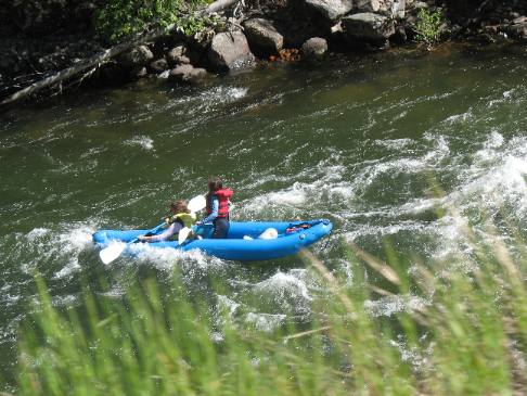
Rafting the Salmon River
It was late in the day and not many people were on the river. Fortunately we came across a few people enjoying the river in in these inflatable craft. Gold was mined in this area for a number of years. Mining in Central Idaho began with the discovery of gold in the Stanley Basin in 1863 followed by finds at nearby Robinson Bar in 1868 and the Loon Creek gold rush in 1869. In 1870 the first prospectors began working claims at the junction of Jordon Creek and the Yankee Fork River. The gold rush on the Yankee Fork was on and the area went through several boom periods until ending permanently in 1910. During this period hundreds of people lived in the towns of Bonanza and Custer and large mills like the General Custer, Charles Dickens, Lucky Boy and Sunbeam were built to process this rich ore. Gold dredging was active on the Yankee Fork from 1940 to 1952 when an estimated 1.8 million was mined from the area.
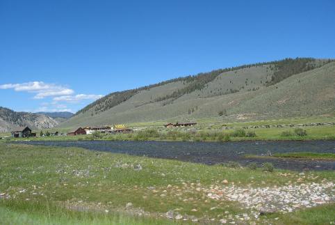
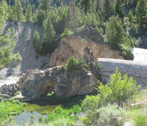
Site of Sunbeam Mines Dam on Salmon River
We stopped on the Salmon River at the site of the small town of Sunbeam where in 1910 things were looking good. Sunbeam was here because of the Sunbeam Consolidated Gold Mine located on the Yankee Fork 16-miles north of here. During 1909 and 1910 the young town of Sunbeam flourished as crews operated the large mine and built the "Sunshine Dam" here, on the Salmon River, to provide power to the mine and it's machinery. The construction of the dam and the power plant captured the imagination of the country when Challis's newspaper, The Silver Messenger, printed postcards showing the power dam and it's lake. The power plant ran only one year before the mine closed and transformed the town of Sunbeam into a ghost town in 1911. In the early days prospectors panned for gold in the Yankee Fork Salmon River area from the late 1860's to 1879. Then in 1880, the Yankee Fork Consolidated Gravel Mining Company built a ditch to deliver water for their new hydraulic gold mining operations.
Site of Sunbeam Consolidated Gold Mines hydroelectric plant on Salmon River
In 1909, the Sunbeam Consolidated Gold Mines Company chose this same area for a hydroelectric plant to provide power for their mine and mill 13-miles away on Jordan Creek. This location was chosen because the flow rate of the Salmon River was adequate to drive the turbines. It was also hoped that the upriver hot springs would keep the water warm enough for winter power plant operation. The strategy was sound but the company went bankrupt in 1911.
The old dam is the white structure in the left center of this picture.
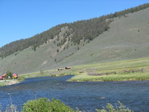
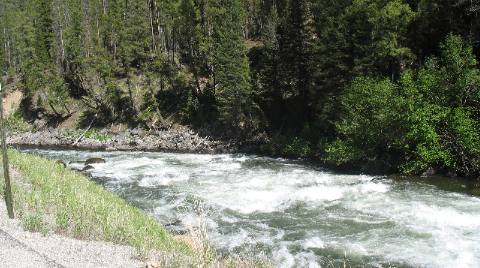
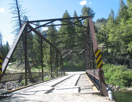
Old bridge across the Salmon River
Somewhere along the way we found this old bridge crossing the Salmon River to a small Forest Service Campground on the other side.
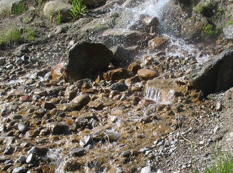
We stopped at an old bathhouse on the river and found that it had a lot of history. While the very nice stonework bathhouse is what remains from the 1937 building constructed by the Civilian Conservation Corps (CCC). It was originally used as a bathhouse and now is a historic site with no hot water running to it. For some reason we didn't get a suitable picture of the bathhouse but we did manage to find the source of the rotten egg smell (the hot springs) that furnished water to the no longer functioning bathhouse.
Hot springs on the Salmon River
It seems that Alexander Ross and his Hudsons Bay Company fur trappers were the first white men to visit these hot springs. His diary describes camping "at the boiling fountain" when they came here on October 1, 1824.
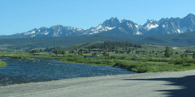
Salmon River, Salmon River Valley, Stanley and the Sawtooth Mountains
Then as we approach Lower Stanley the Sawtooth Mountain Range comes into view across the Salmon River Valley.
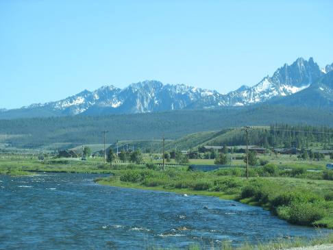
Sawtooth Range, Salmon River and Lower Stanley
This picture has it all, the Sawtooth Range, Salmon River and Lower Stanley.
Click here for more Idaho travellogsUntil next time remember how good life is.
More Idaho AdventuresSome of our Miscellaneous Subjects ** More 2007 Travel Adventures
Mike & Joyce Hendrix
Mike & Joyce Hendrix who we are We hope you liked this page. If you do you might be interested in some of our other Travel Adventures: Mike & Joyce Hendrix's home page Travel Adventures by Year ** Travel Adventures by State ** Plants ** Marine-Boats ** Geology ** Exciting Drives ** Cute Signs ** RV Subjects ** Miscellaneous Subjects
We would love to hear from you......just put "info" in the place of "FAKE" in this address: FAKE@travellogs.us Until next time remember how good life is.
|
|
||

|
|||
|
|
|||
|
|
|||
|
|