Hagerman Valley, Thousand Springs, Melon Rocks June 5, 2007. We are staying at High Adventure River Tours RV-Park/Store & Dutch Oven Cafe located on the southeast corner of exit 147 near Hagerman, Idaho. It is a nice RV-Park with shade and long pull-through sites. PPA with tax ran $16 for FHU. For those of you that are not familiar with PPA (Pass Port America) it is an organization you can join for less than $50 per-year. Campgrounds that belong to PPA offer 1/2 price discounts. That kind of savings can quickly add up. While participating PPA parks generally have some restrictions on dates the PPA offer is valid, or possibly days of the week the discount is valid, or perhaps the number of days that the PPA discount will be honored the discount is genuine. Many times PPA campgrounds are new campgrounds that need help in getting established. Other times PPA campgrounds may be on the outskirts of town instead of in the "prime" location thus they need to provide an incentive for campers to stay with them. Whatever the reason PPA campgrounds generally provide a much cheaper option. PPA is the only campground organization that I think is worth the cost. PPA does not have a gimic. What you see is what you get. Once you join they send you a directory listing all participating campgrounds. The PPA directory is the FIRST directory we check when trying to locate a place to spend the night. You can join PPA by calling 228-452-9972. If you decide to join PPA, it would be nice if you gave them my number "R-0156251" as the PPA member that told you about PPA. In return PPA will give me a years membership free. I will thank you in advance for that kindness. Thank you.
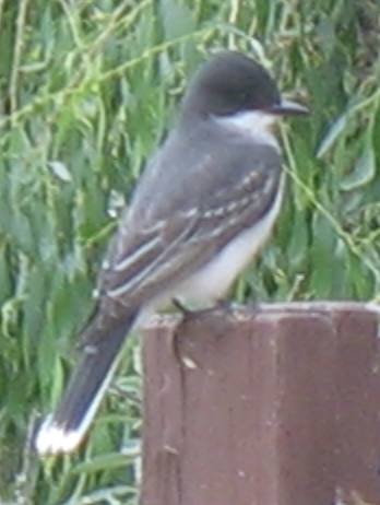
Eastern kingbird
When in the "Magic Valley" around Hagerman we are seeing a wide variety of flora and fauna. Joyce got this photo of an eastern kingbird -- the second pair we have seen recently. There are obviously more of them in the west than we realized.
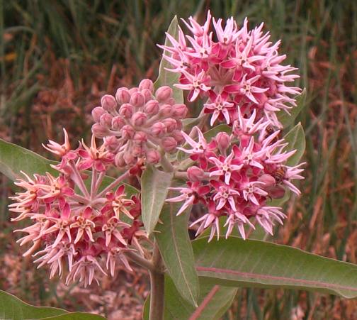
Showy milkweed in Hagerman Valley
We seem to be spotting these showy milkweed in many different places around the Hagerman Valley.
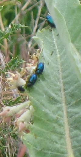
Showy milkweed beetles on milkweed in Hagerman Valley
While waiting for Joyce to take that picture of the showy milkweed bloom I was scanning nearby plants for monarch butterfly caterpillars since milkweed is a host plant for monarch caterpillars. Instead of caterpillars I spotted these bright, incandescent blue beetles feeding on milkweed leaves.
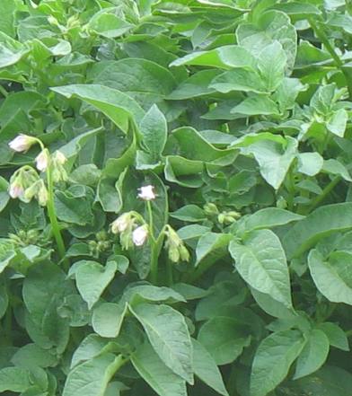
Idaho Patotos Hagerman Valley
Lush potato fields are strewn throughout the Hagerman Valley aka., Magic Valley.
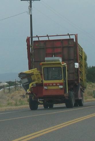
Hay hauler around Hagerman Valley
Special trucks that ride around in hay fields picking up bales of hay can be seen on area highways as they move between hay fields and local dairies that require huge quantities of hay.
Hagerman Fossil Bed National Monument
Across the river from Hagerman is the Hagerman Fossil Bed National Monument. We visited the National Monument but Oregon Trail views is all that we saw.
From this view point we can see two trails that wander from left to right across this valley. The kiosk calls one the Emigrant Trail and the other one the Oregon Trail. Emigrant Trail and Oregon Trail are generally use interchangeable. I have to wonder if the National Park hasn't just named one Emigrant and the other Oregon to distinguish, for themselves, which trail they are referring to.
Anyway, while this is the Hagerman Fossil Bed National Monument you do not see fossils when you visit this place. All you see is remnants of the old Oregon Trail.
Hagerman Fossil Beds National Monument
From the road that runs through Hagerman Fossil Beds National Monument you can see and walk on several sections of Emigrant Trail and Oregon Trail. The kiosk in the National Monument refer to one path as the Oregon Trail and the other one as the Emigrant Trail. I have absolutely no clue as to what the difference might be.
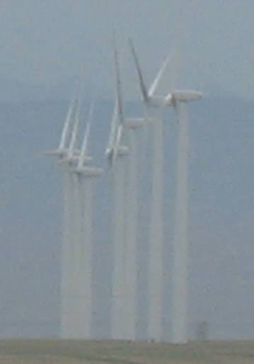
Idaho wind generators on a hill overlooking Hagerman Valley
Joyce took this picture of the seven wind generators located on a high mesa south of the Snake River about 10-miles west of Hagerman & the Hagerman Valley. I think you can reach these wind turbines by following the gravel road that runs through Hagerman Fossil Bed National Monument.
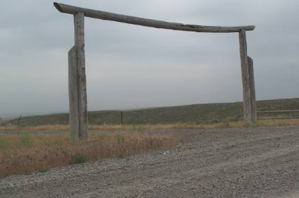
Idaho ranch gate near Hagerman Valley
Earlier this summer when we were in Texas we began noticing unique gates and fences. Joyce spotted this Idaho gate and we had to add it to our "gate" collection.
Varmit Guns on Sale at store in Hagerman Valley
Sometimes signs just ring a bell. This Varmint sign was one. Where else can you see a "Varmint Guns on sale" sign? I hope you enjoy it as much as we did.
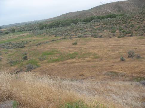
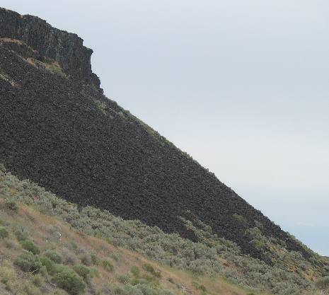
Talus slope as seen from the Hagerman Valley
Joyce took this picture taken from the Hagerman Valley showcases a beautiful talus slope.
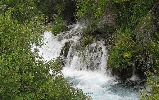
One of the THOUSAND SPRINGS in the Hagerman Valley
Clean, cold water gushing from the thousand springs provides ideal conditions for fish hatcheries and commercial fish farms.
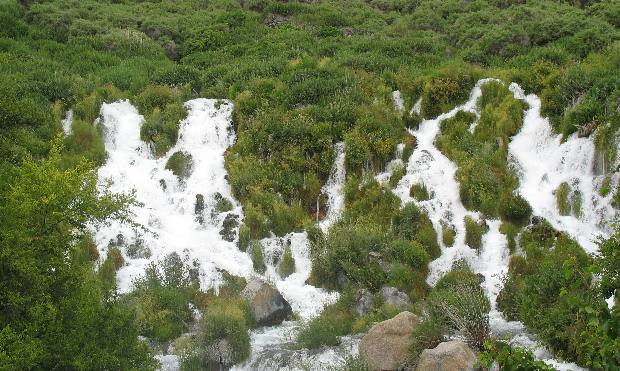
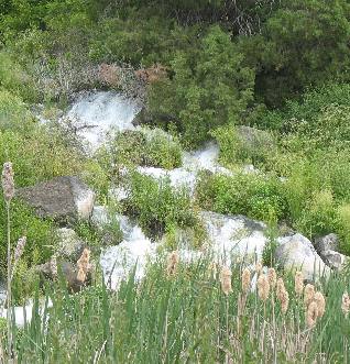
More of the THOUSAND SPRINGS of Hagerman Valley
More of the THOUSAND SPRINGS in the Hagerman Valley
Some of the Thousand Springs of Hagerman Valley
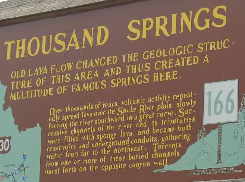
Do you remember the Snake River Aquifer we discussed in travelogue #62 that flowed through "pillow basalt", well you are about to see water springing out of lava rock in an area along the Snake River called 1,000 Springs. Melting snow and rain water feed this aquifer from a large basin 35,000 square miles in size. Following permeable layers of basalt, water flows in a southwestern direction until it reaches the Snake River Canyon, where it emerges as springs. The Thousand Springs area near Hagerman, Idaho contains 11 of the 65 largest cold springs found in the United States.
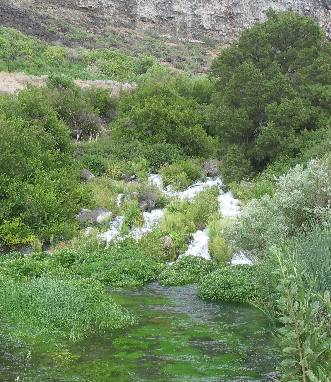
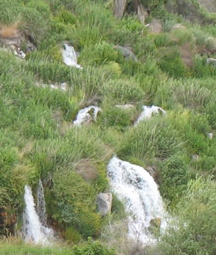
More of the Thousand Springs in the Hagerman Valley
These are some of the Thousand Springs that emerge from a layer of pillow basalt midway up the canyon wall here in the Hagerman Valley.
Note the talus slope located above the springs.
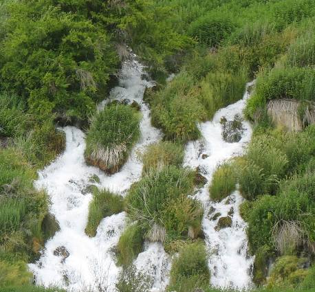
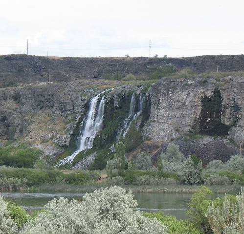
Some of the Thousand Springs in the Hagerman Valley
We are totally amazed at the pressure water is flowing out of the spring on the right. Folks there is an amazing volume of water welling out of these springs. Part of the Thousand Springs of the Hagerman Valley flowing into the Snake River
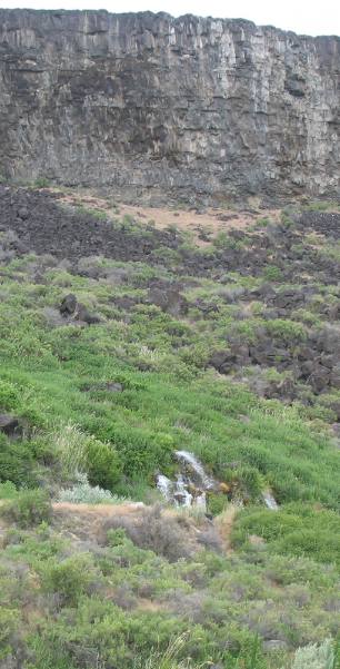
As you drive along the basalt canyon wall in the Hagerman Valley it is easy to spot many of the Thousand Springs emerging from the layer of pillow basalt. Many springs flow into either fish hatcheries or into trout ponds that raise trout for the commercial market. Note the talus slope above the springs.
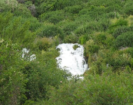
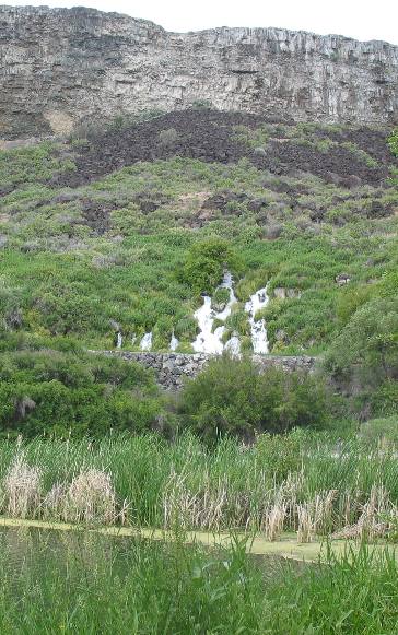
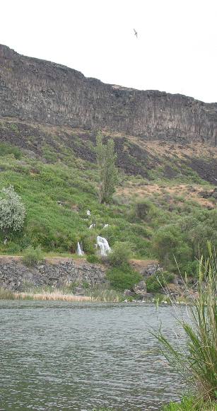
Thousand springs waterfall in the Hagerman Valley
This spring in the Hagerman Valley created an immediate waterfall.
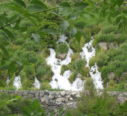
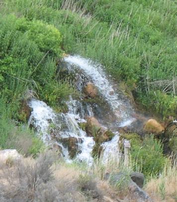
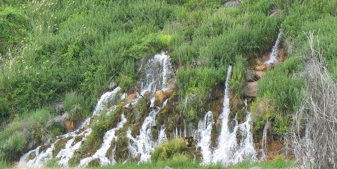
More of the Thousand Springs in the Hagerman Valley
Part of the Thousand Springs system of springs.
I don't know if there are a thousand different springs but there certainly could be. They are everywhere we look.
How many of the Thousand Springs are gushing out of this part of the Hagerman Valley hillside?
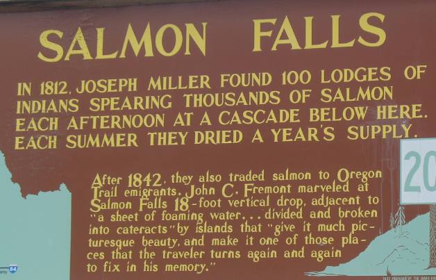
Salmon Falls on the Snake River in Idaho's Hagerman Valley
Salmon Falls on the Snake River is located 5 or so miles east of Hagerman in the midst of the 1,000 Springs area. This state kiosk pretty much says it all. We did not get a good picture of the falls. However, I noticed with interest the 1812 date Joseph Miller was by here. It is interesting because Lewis & Clark didn't make their epic journey until 1804-1805 and yet this Joseph Miller was by here in 1812? Who was Joseph Miller and what was he doing here in 1812? Was he a Mountain Man out trapping beaver in this area? It is also interesting to note that after 1842 the Indians would sell/trade dried salmon to emigrants on the Oregon Trail. I bet by the time emigrants got here fish would taste real good.
Thousand Springs of Hagerman Valley
Information kiosk explaining the Thousand Springs of Hagerman Valley.
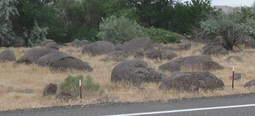
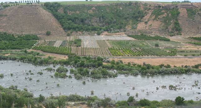
Melon Rocks remnants of Lake Bonneville flood
Massive Lake Bonneville covered present-day western Idaho until about 15,000 years ago, when a natural dam ruptured. The resulting enormous flood lasted about 8-weeks, widened and deepened the Snake River Canyon, and carved new alcoves, side canyons, and valleys. One of the remnants of the Bonneville flood are numerous water-rounded boulders know around here as "melon gravel" or melon rocks.
Melon Rocks scattered through the Hagerman Valley
Melon Rocks, are scattered throughout Hagerman Valley where they were deposited as water from the Lake Bonneville flood that roared through here began to slow down.
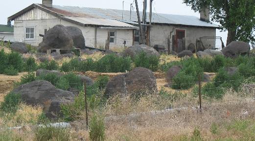
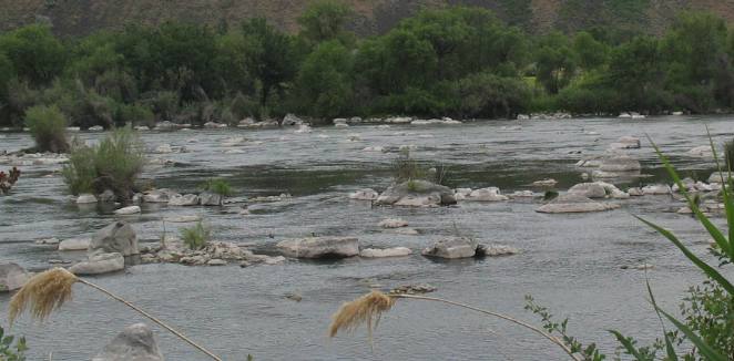
Snake River littered with Melon Rocks in Hagerman Valley
This section of the Snake River flowing through the Hagerman Valley, is littered with melon Rocks.
Melon Rocks in the Snake River as it passes through Hagerman Valley
Looking down on the Snake River from the bluff above the river you can see those melon rocks deposited here during the great Bonneville Flood.
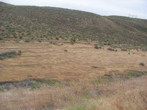
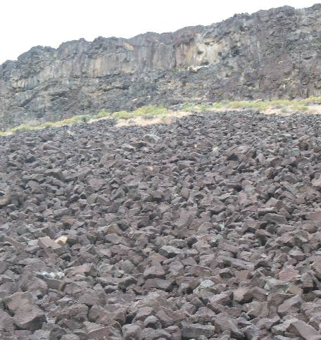
Talus slope of basalt in the Hagerman Valley, Snake River Canyon wall
Talus slope of basalt that came from the basalt Canyon wall in the Hagerman Valley of Idaho. The Snake River has cut this canyon wall over eons of wear.
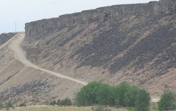
Talus slope on the Snake River Canyon wall in the Hagerman Valley
Steep grade cutting through that talus slope on the way to the top of the Snake River Canyon near Hagerman, Idaho.
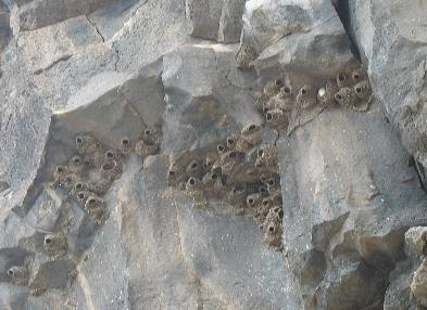
Cliff swallows using the Snake River Canyon cliff wall in the Hagerman Valley, as a nesting site
On the cliff wall, as we were climbing that steep grade, we spotted hundreds of cliff swallows that were using the cliff wall as a nesting site for their colony.
Click here for more Idaho travellogsUntil next time remember how good life is.
More Idaho AdventuresSome of our Miscellaneous Subjects ** More 2007 Travel Adventures
Mike & Joyce Hendrix
Mike & Joyce Hendrix who we are We hope you liked this page. If you do you might be interested in some of our other Travel Adventures: Mike & Joyce Hendrix's home page Travel Adventures by Year ** Travel Adventures by State ** Plants ** Marine-Boats ** Geology ** Exciting Drives ** Cute Signs ** RV Subjects ** Miscellaneous Subjects
We would love to hear from you......just put "info" in the place of "FAKE" in this address: FAKE@travellogs.us Until next time remember how good life is.
|
|
||

|
|||
|
|
|||
|
|
|||
|
|