Shoshone Falls, I. B. Perrine Bridge
over Snake River Canyon in Idaho
June 4, 2007.
We moved the motorhome about 70-miles west to Hagerman
at exit 147 on I-84. We are staying at High
Adventure River Tours RV-Park/Store & Dutch Oven Cafe
located on the southeast corner of exit 147. It is a nice RV-Park
with shade and long pullthrough sites. .
Before arriving in Hagerman
we stopped in Twin Falls taking exit 173 then turning south on US
93 for 3-miles to the Snake River.
I. B. Perrine Bridge over the Snake River Canyon
at Twin Falls
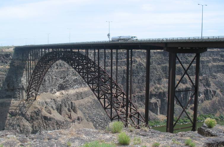
The I.
B. Perrine Bridge over the Snake River Canyon is a masterful
piece of engineering spanning the Snake River Canyon for 1,500 feet
with the roadway approximately 480 feet above the Snake River &
Canyon.
A visitor center is located on the south west corner of the bridge
complete with a large parking lot with plenty of parking for RV's.
From the visitor center parking lot at the I.
B. Perrine Bridge you can walk to viewing points on both sides
and under this impressive bridge and the Snake River Canyon. You can
also drop your motorhome at the visitor center and take your tow car
to visit Shoshone Falls not far from here.
Note the solid lava
walls of the Snake River Canyon.
Snake River Canyon from I. B. Perrine Bridge overlook in Twin Falls
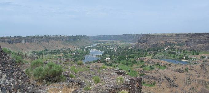
From the view point at the I. B. Perrine Bridge looking west; this
is what the valley and Snake River Canyon look like.
Geology in the canyon walls covers many millions of years. One thing
is for certain in this area-----everything is covered with a thick
layer of lava
rock.
Snake River Canyon from I. B. Perrine Bridge overlook
in Twin Falls
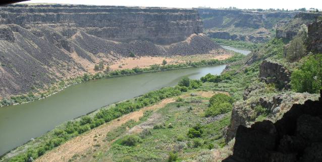
Looking east up the Snake River Canyon from the I.B.
Perrine Bridge overlook you get this view a few miles downstream
from Shoshone Falls.
The solid lava
walls of the Snake River Canyon are over 400 feet deep in this picture.
Looking east up the Snake River Canyon from the I. B. Perrine Bridge
overlook in Twin Falls
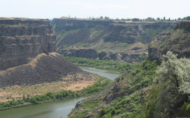
Another view looking east up the Snake River Canyon from the I. B.
Perrine Bridge overlook a few miles downstream from Shoshone Falls.
The Snake
River is flowing through solid lava
rock through this area.
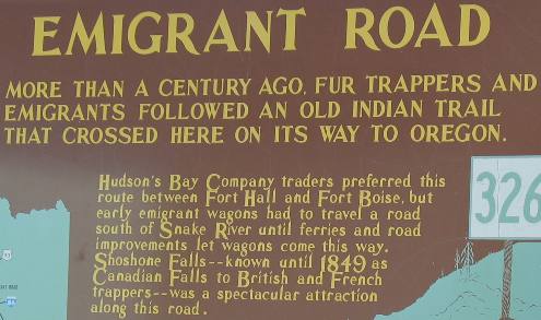
Just north of the I.
B. Perrine Bridge over the Snake River Canyon, US 93 passed
by this Idaho Historic kiosk.
Early travelers on horseback or foot could move from one side of the
Snake
River to the other side with much more ease that wagon trains.
Personally, either side would be miserable to travel on, I don't care
if I were on a horse, walking or in a wagon. It would be a miserable
journey.
While stopped at the Information Center in Twin Falls it is easy
to drop the motorhome in their large parking area for RV's and take
your tow car to Shoshone
Falls around 4-miles upstream.
Southern Idaho landscape near
the Snake
River & Snake River Canyon
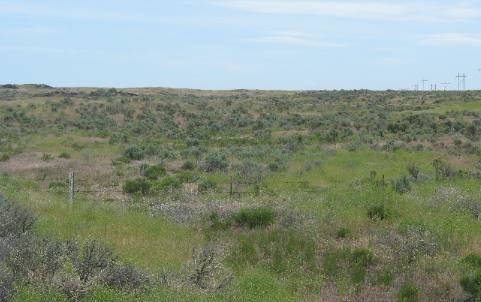
This is the terrain travelers on the Oregon
trail walked on day after day as they made their way
west.
Shoshone Falls on the Snake
River in southern Idaho
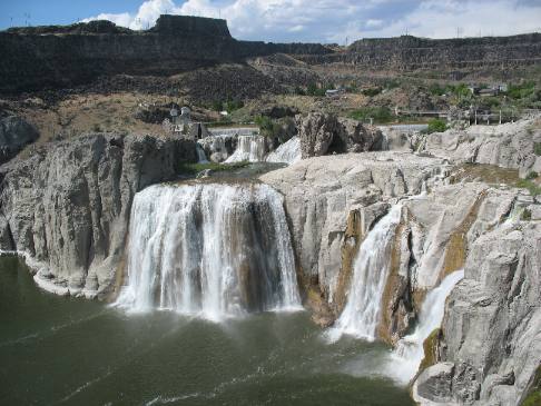
This is Shoshone
Falls, on the Snake
River about 10-miles east of Twin Falls. As you can see very
little water is flowing over the falls. The once mighty Snake
River has been harassed by numerous dams upstream. The only
reason any water is flowing over these falls is because of laws that
require a certain volume of water to be released from the dams.
Do you remember when Evel
Knievel attempted to jump the Snake River Canyon aboard his
rocket powered sky-cycle? At a point where the canyon is nearly 500
feet deep and some 1,700 feet wide at the point where Evel lifted
off the ramp. A malfunction caused his parachute to deploy at the
same time he lifted off. The "sky-cycle" shot across the
canyon with the chute wide open behind. The wind was coming from the
north grabbed the chute and brought Evel and the sky-cycle back toward
the launch pad, but dropped them into the canyon, settling on the
south bank of the river. Evel suffered no major injuries, and he and
the sky-cycle were lifted by helicopter out of the canyon. The attempt
was seen live on ABC Wide World of Sports and to this day is one of
the most watched events in television history.
The event took place somewhere along the high point down there. You
can find this location by visiting Shoshone Falls in Southern Idaho.
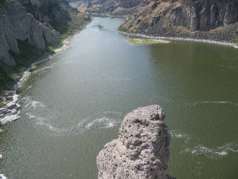
Snake River Canyon below Shoshone Falls where Evel Knievel attempted
his rocket powered sky-cycle jump
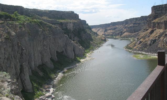
These views are looking downstream below the falls as the Snake River
continues its journey toward Twin Falls.
That is solid lava
that comprises the wall of the Snake River Canyon.
Snake River Canyon below Shoshone Falls
Snake River Canyon below Shoshone
Falls in southern Idaho.
Kiosk for Shoshone Falls
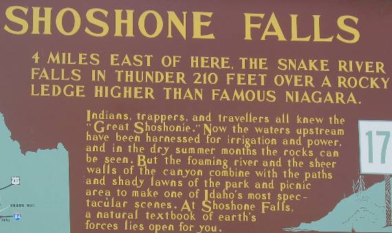
This kiosk for Shoshone
Falls was in the Visitor Center parking lot back in Twin Falls.
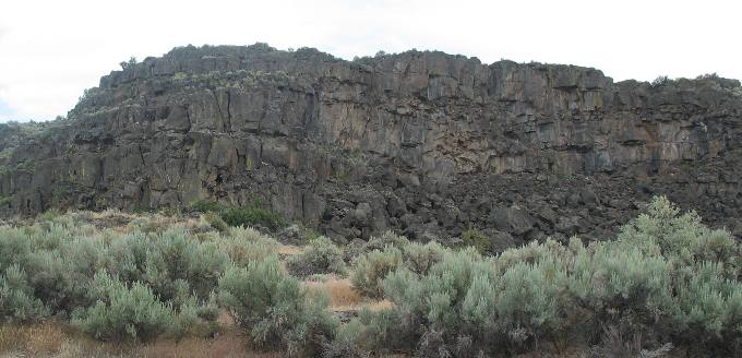
While visiting Shoshone Falls I took this picture of a large
lava cliff created long ago by waters from the Snake
River. I wonder if this canyon was cut when waters from Ancient
Lake Bonneville broke through and scoured the landscape along the
Snake
River as it made its way to the ocean via the Snake
River and Columbia River.