Places Visited: Idaho: Big Springs, Island Park, Mesa Falls and the Henrys Fork of the Snake River, all located 30 to 50 miles south of West Yellowstone, Montana. Aug 2, 2007. We are staying in Grizzly RV-Park in West Yellowstone, Montana just out the west gate of Yellowstone National Park. We stayed in a different site every night because we did not have reservations and at this time of year they are FULL. The only way we got to stay there for 4-nights was to move into cancellation sites. The rates range from around $37 to $47 depending on a variety of things but generally back in sites were cheaper than pull-thru sites. Then they charge $4 for wifi. I suppose the pull-thru sites are a bit larger so the BIG rigs would probably be forced into one of them. Grizzly is a nice park, the nicest campground in the area. Bottom line is if you are planning to visit WEST YELLOWSTONE during July thru Aug-15 you need a reservation as every campground in the area is FULL. After August 15 you can have your choice of campgrounds with no reservations.
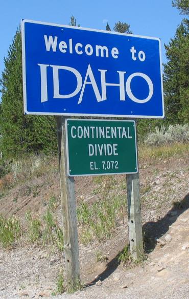
We are staying in a campground in West Yellowstone, Montana that is generally used by RV'ers visiting Yellowstone National Park. However, when in West Yellowstone, Montana there are a number of other things to see and do that, in our opinion, are on par with many of the sights in Yellowstone. One is a visit to the Earthquake Information Center about 20-miles northwest of West Yellowstone. Another would be a scenic drive north to Bozeman along the Gallatin River. That is one beautiful mountain river drive that is worth doing. And finally a scenic drive down into Idaho where there is a wide variety of things to see. We have made it a ritual to drop down into Idaho every time we visit West Yellowstone. Take this quick journey with us and you will see what is so special about this part of Idaho. About 11-miles out of West Yellowstone on US 20 you transition from Montana into Idaho when you cross over the Continental Divide at an elevation of 7,072 feet. From West Yellowstone you do not have much of a climb to get over the Continental Divide since West Yellowstone is around 6,600' elevation.
From the Continental Divide it is just a few miles down the mountain to the valley and the unique town of Island Park.
I say unique because the City of Island Park has the world's longest main street at 33-miles long. Island Park, indeed the entire valley, is situated in a caldera of an extinct volcano with the rim still visible to the west. The region has become an all-season recreational destination. Summer offers anglers world-class streams and lakes as well as hundreds of miles of trails for 4-wheeling. During the fall sportsman find exceptional waterfowl and big game hunting. In winter snowmobilers enjoy thousands of acres of untracked powder and more than 500-miles of groomed trails. The other unique, and to me even more stark reality, is that it is almost impossible to tell there is a "city" along those 33-miles. Along that 33-miles there isn't a grouping of commercial buildings that could be classified as a "city" without stretching the imagination. Over most of the 33-miles of Main Street (US 20) buildings of any kind are about 5-miles apart. I suppose that is why Main Street is 33-miles long ----- it took 33-miles to put together enough buildings to form a "city". What you will see is a beautiful valley.
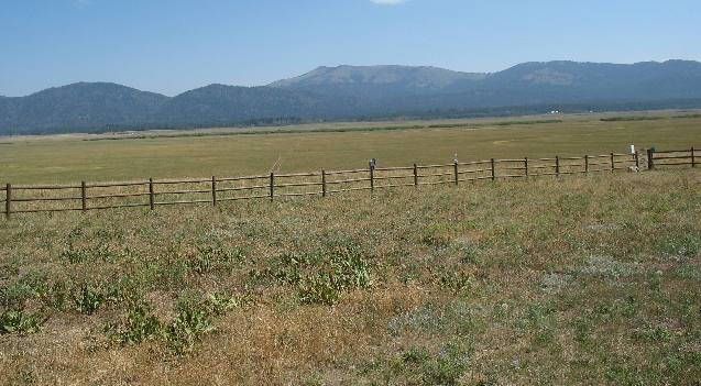
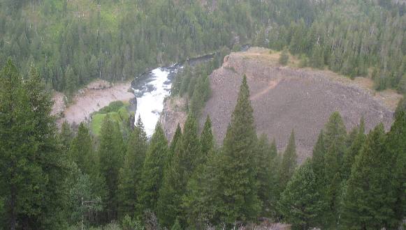
Part of the valley is owned by the Nature Conservancy. That is the truly beautiful section to us. We always stop by the Nature Conservancy Information Center (watch for signs) along US 20 to not only look for wildlife from the deck of the Information Center but to walk through the information center and view the mounts and other information available. This time we didn't see antelope, as we normally do, but we did see two pair of sandhill crane with chicks. Sandhill crane use the field you see in this picture as a nesting area. The Nature Conservancy purchased these ranch lands from area ranchers years ago during some bad times for the ranching industry. At the time there was much bad blood between area ranchers and the Nature Conservancy. However, that has all changed and now area ranchers love the Nature Conservancy. The land is still used for grazing cattle but grazing is strictly controlled. Fences were constructed along the river to keep cattle out of the riparian area where cattle do so much damage. Critical wildlife habitat along the river is preserved. By keeping river access "cattle free" the trout fishery has exploded. Area ranchers move their cattle from pasture to pasture long before overgrazing causes damage to the grass.
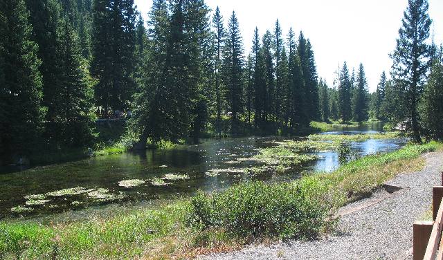
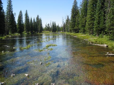
Our next stop was "Big Springs" a wonderful spot that if properly advertised would be a big attraction. At this time it is mostly a gathering spot for locals but that is changing.
Locating Big Springs is a difficult thing to do, it really is. Most maps do not show Big Springs and the locals do not have signs directing you there. It is just something you have to know! We have heard about Big Springs for years but had never located it. This year we decided to be more persistent. Here is what I can tell you. Locate Macks Inn along US-20 (in Island Park). From Macks Inn turn east on Big Springs Loop Road. Stay on that road and do not hesitate to ask locals (anyone you see) where to find Big Springs. The Springs are actually on Big Springs Loop Road about 4-miles east of US 20. Idaho isn't big on signs so pay attention.
Big Springs is located where the 1.3 million-year-old Henry's Fork Caldera (a huge volcanic crater) is covered by the western edge of the more recent Buffalo Lake lava flow, which erupted from vents on the Yellowstone Plateau to the east. Geologist believe that the main source of the springs is rain and snow that falls on the Yellowstone plateau. This water percolates through the highly fractured lava until it meets the less permeable glacial and lake sediments beneath the lava. This causes the water to spread laterally, emerging at the base of the Plateau as Big Springs, the largest of many springs that emerge along the western edge of the Yellowstone Plateau. Thermal waters from deeper sources may contribute to the springs' flow and account for its year-round temperature of 52° F. This temperature is slightly above the mean annual air temperature of the area.
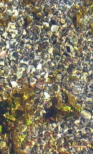
Water in the spring is crystal clear as you would expect. Beautiful rocks glisten from the bottom of the spring.
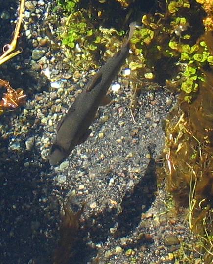
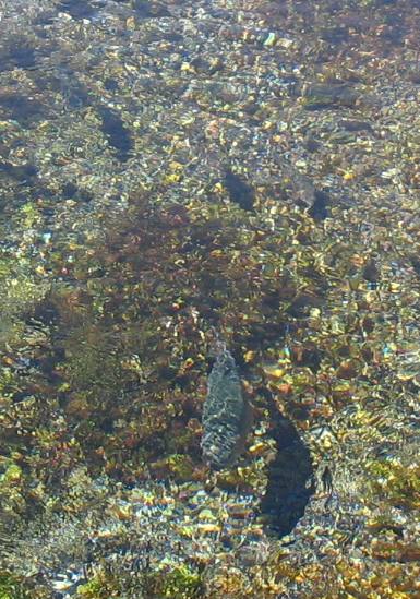
Large trout are easily seen because no fishing is allowed. Visitors like to feed bread to these large trout. If you plan to visit Big Springs remember to bring some bread to feed the fish.
Joyce took this picture from the bridge that crosses over the Big Spring Run.
Big trout, like this one, attract your attention like a pretty woman entering the room. Try to pry your eyes off the big trout and find the other nice trout in this picture hint there are several more.
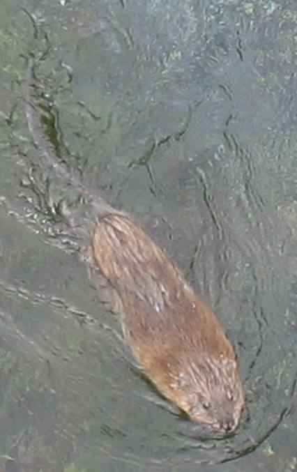
About 10-days after our first visit to Big Spring we returned with our Son and Grandson. They got a kick out of feeding the fish and gulls. Then out from under the bridge pops this muskrat. The cute critter was paddling for all he was worth to stay in the strong current to get his share of the bread.
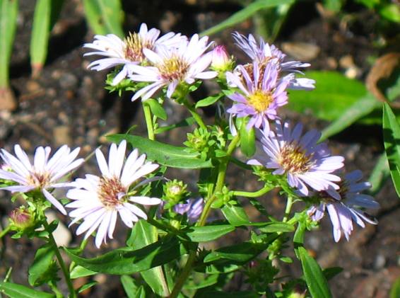
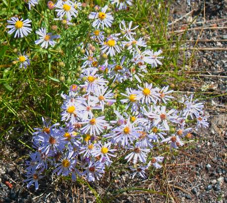
These are showy fleabane. Our friend Suzie Kisner introduced us to this plant last summer when we visited them in the Tetons.
Another picture of fleabane daisy blooms.
Big Springs is located 30-miles north of Mesa Falls to give you an idea of both locations.
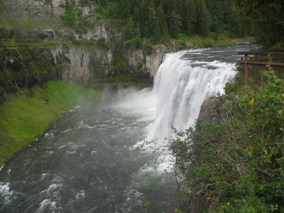
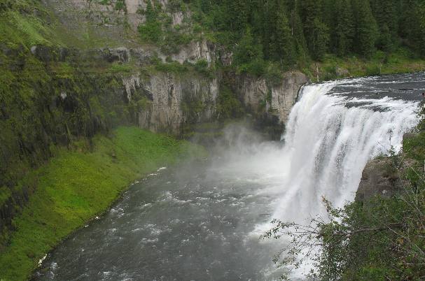
Upper Mesa Falls cascades 114 feet over compressed volcanic ash that dates back 1.1 million years. More recent volcanic eruptions moved the river to its present location where, for the past half-million years the river has carved the canyon.
Upper Mesa Falls, the falls you are looking at here, is the largest undisturbed waterfall in the entire Columbia River system. If you aren't impressed you should be. VBG The lower canyon walls on the far side is tuff (volcanic ash fused together by heat). If this picture reached to the top you could see that this tuff was covered by lava flow (basalt). Basalt is the harder of the two.
Upper Mesa Falls is on Henrys Fork of the Snake River. It is 114 feet high and 200 feet wide. The volume of water flowing over the falls varies between 600 and 1,500 cubic feet per-second. This equates to 387 million to 967 million-gallons per-day.
Henry's Fork of the Snake River was named for Andrew Henry, who led a trapping expedition through the area in 1810 (note that date --- it is only 4-years after Lewis & Clark completed their journey across the continent in 1806). The primary source of the Henrys Fork is Big Springs, one of the largest freshwater springs in North America. The springs and upper river remain ice-free year round.
Andrew Henry played a significant role in opening the West. Born and raised in Pennsylvania, Henry moved to Missouri in 1799. In 1808, a group of influential friends persuaded Henry to invest his money, talents and time in the St. Louis Missouri Fur Company. From 1809 to 1811, Henry, with his company, trapped beaver in Wyoming and Idaho. A natural leader, Henry led a group of trappers into the Snake River Valley in the spring of 1810, camping along the Henrys Fork and wintering near present-day Anthony, Idaho. In 1811, Henry returned to St. Louis, sharing knowledge gained through his explorations with those eager to experience the untamed west.
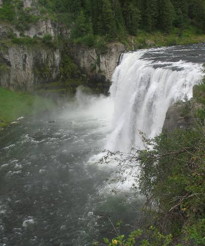
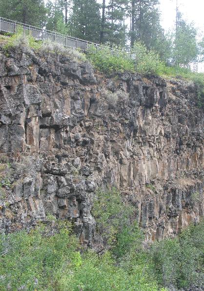
This is the volcanic rock wall of the canyon carved by the Henrys Fork of the Snake River. It is basalt and is hardened lava flow. The lava flow visible on this side of the river looks to me to be 60 to 80 feet thick.
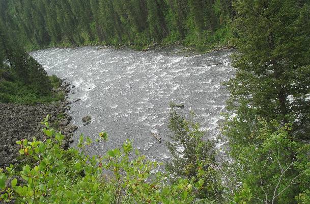
This is the river flowing below Upper Mesa Falls on its way to Lower Mesa Falls a mile or less down river.
Two separate volcanic events combined to create Upper Mesa Falls. A volcanic eruption, 1.3 million years ago, covered the area with a thick layer of volcanic ash. Over time the ash compressed into tuff, forming the rock seen across the canyon. Over hundreds of thousands of years, the river eroded a wide canyon through the tuff. Eventually, basalt lava flows filled the canyon and today provide the resistant rock layer over which the river flows. As the falling water erodes the softer tuff below the basalt, large portions of basalt tumble into the river and Upper Mesa Falls slowly recedes upstream.
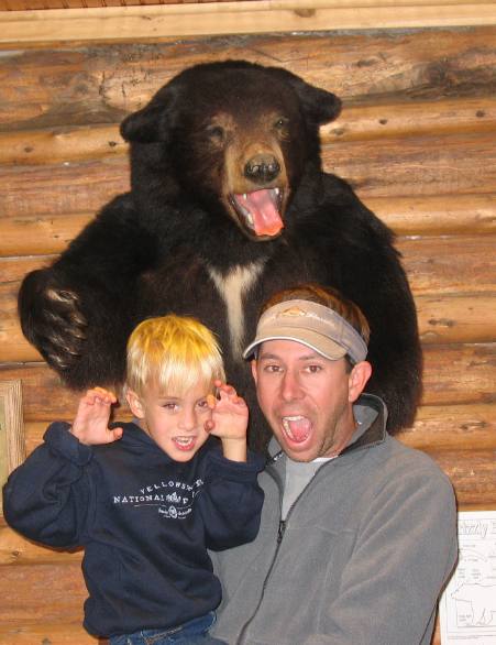
We visited Mesa Falls Park about 10-days later, with our Son and Grandson. Here they are clowning around with one of the stuffed bears on display at the information center.
Lower Mesa Falls is visible from Grandview Overlook located several miles south of Upper Mesa Falls on SR 47. The Grandview Overlook was built by the Civilian Conservation Corps during the 1930's. From this overlook you can see the Henrys Fork of the Snake River squeeze between basalt columns and plunges 65 feet creating Lower Mesa Falls.
I am sorry about the quality of this picture. A severe thunder storm accompanied by high winds, hail, rain and lightening stopped us from getting anything better. When this picture was taken we were in gusty winds with rain and small hail. We took this picture and ran for the Saturn. In the next few days we saw the damage caused by this line of thunder storms. Downed trees knocked out power to Fishing Bridge Campground in Yellowstone National Park for over 5-hours. Downed trees were visible throughout Yellowstone National Park for days. Crews were busy removing the downed trees from highways and parking lots all over the park. If you are looking for Mesa Falls (Upper and Lower) they will be difficult to locate on a map. Locate the small towns of Anthony and Island Park, Idaho. Mesa Falls (both of them) are located between Anthony and Island Park on SR 47. Upper Mesa Falls is part of the National Park system--- it may be operated by the Forest Service.
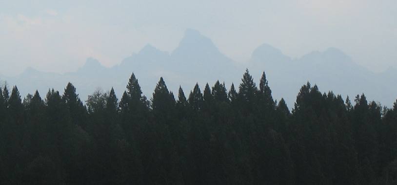
Along SR 47 south of Mesa Falls there is a nice pull out where you can see "Grand Teton" the tallest peak in the Teton Mountain Range. On a clear day Grand Teton would be clearly visible but not only is the area cloaked in smoke from several forest fires that thunderstorm is adding to the visibility problem. It is interesting to learn how the Three Tetons were named. These giant peaks were a famous early western landmark known to fur hunters and Mountain Men. As early as 1819, French-speaking trappers were calling them the Trois Tetons (the three breasts). More prosaic English-speaking Mountain Men named them the Pilot Knobs, but the more romantic French name stuck. Now you know --------- the rest of the story as Paul Harvey would say. Keep in mind that this is the side from which they were seen by the men who named them (from the west looking east).
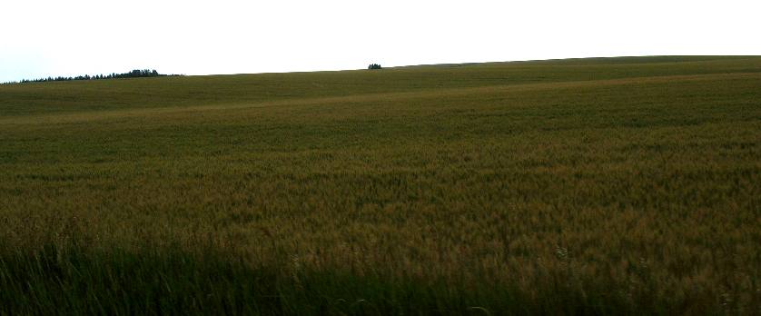
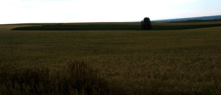
SR 47 between Ashton and Island Park is an Idaho Scenic Byway and a good one. One thing that we always like when we are on SR-47 is the way we transition from thickly forested mountain scenery to open prairie with wheat fields stretching to the horizon.
This is Idaho wheat at its finest. The coloring in these pictures is distorted because of the overcast day. Ordinarily these wheat fields are a beautiful golden color.
Until next time remember how good life is. Mike & Joyce Hendrix
|
| ||

| |||