Canadian Rockies, PH93 & Kootenay
National Park
July 7, 2007.
We are staying in the Tunnel
Mountain National Park Campground in Banff, Alberta. Tunnel Mountain Campground
offers full hookups, no hookups, and electricity only. We are in one of the $29.70
electricity only sites. I do not know what FHU or no hookups cost but they are
all in the same area. All sites are paved.

We
left Radium Hot Springs
this morning heading to Banff on PH 93 through Kootenay
National Park. Immediately upon leaving Radium
Hot Springs we entered the National Park then went through the "springs".
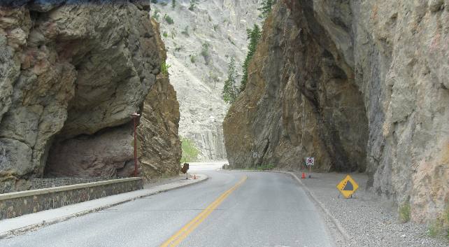
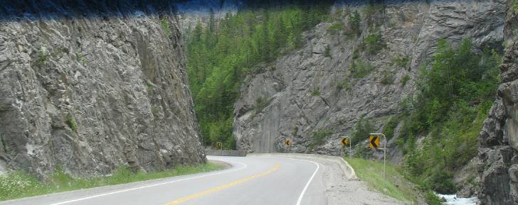
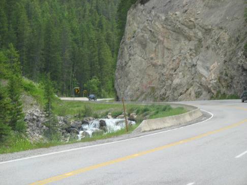
From the "hot springs" the road passes through one of the most awesome
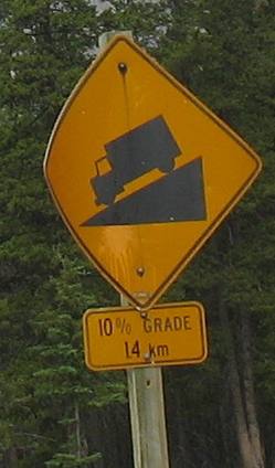
roadcuts anywhere. One has to wonder why a road cut and not a tunnel. About the
same time there is a sign warning about an 11% grade with no indication how long
the grade is going to be. An 11% grade will get your attention especially if it
is going to be 11% for very long. But for now it is back to negotiating these
mind boggling road cuts.
These
folks didn't remove any more rock than absolutely necessary. It does seem to me
that they could have removed more around this curve. I know I cheated on the yellow
line since my outside mirror didn't hit that rock.
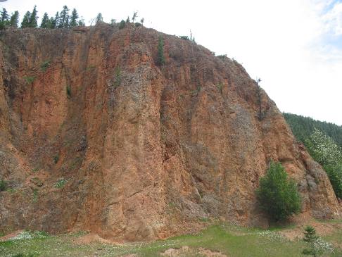
Just
past the road cut area is this reddish color hill of earth that I do not recognize.
What is it doing here? Has it got something to do with the thermal activity less
than a mile away? I don't guess I will ever know unless someone is kind enough
to provide me with some information. Any takers?
It probably has something
to do with iron since it is very near, if not part of, Iron Gates Canyon------
do you suppose this is part of the "iron gate" and the red color has
to do with iron content?
When
this road was built a decision had to be made. In the 1920s, the first road through
the Canadian Rockies,
the Banff-Windermere Highway was constructed. By 1964, this section of the road
was outdated. In order to save the Iron Gates Canyon from the destructive impact
of the new road, a tunnel was built.
You might not have noticed even with
the information about the tunnel above but if you look in the top left hand corner
of this picture you will see the tunnel that was constructed to save Iron Gates
Canyon.
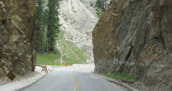
The
early part of this drive,--- the part within 10 or so miles of Radium
Hot Springs is comprised of these roadcuts. Soon we will pop out into
a series of magnificent valleys.
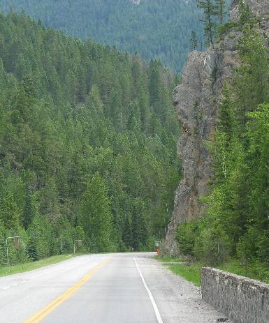
Slowly
we are making our way out of the roadcuts and past that 11% grade. Thankfully,
that grade was a short one, steep but short.
Now you can see some "flat" space
along with the steep roadcuts.
The
Canadian Rocky Mountains
in this area are comprised of limestone and shales deposited on an ancient sea
bottom millions of years ago.
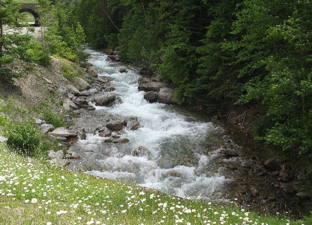
We are following a creek at this point but
will soon meet the Kootenay
River and will follow it to the Continental Divide not far from Banff.
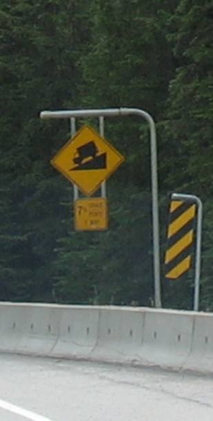
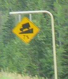
Seven
percent grades like this were common throughout the journey on PH
93 from Radium
Hot Springs to Banff.
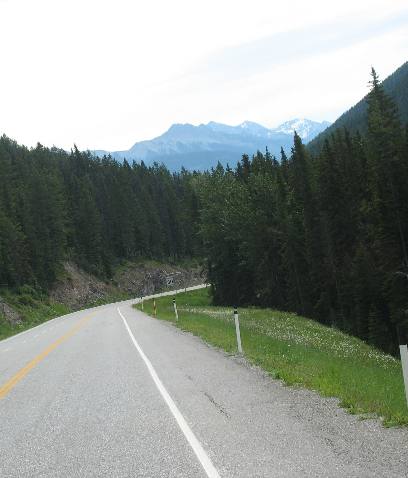
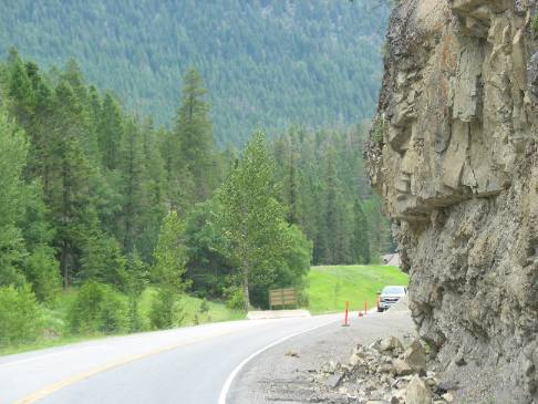
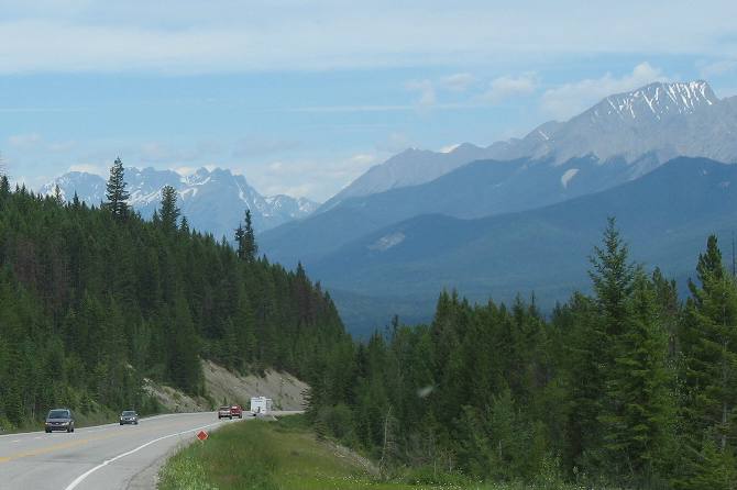
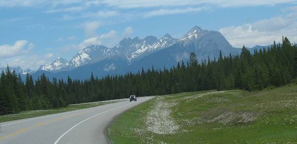
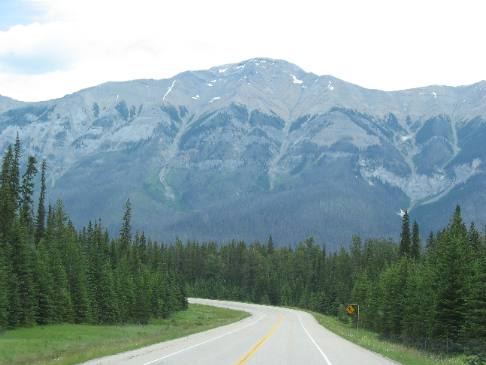
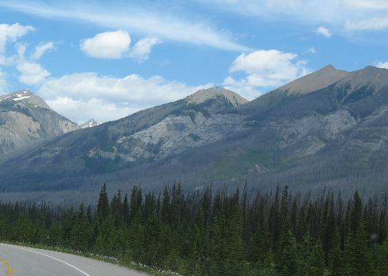
At
times we get a peak at the mountains we are threading our way through.
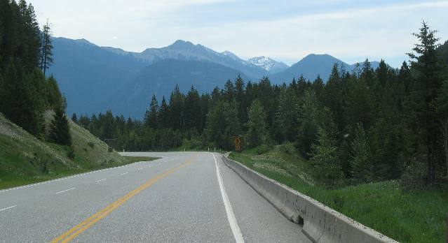
PH
93 in this section is a nice modern highway complete with guard rail.
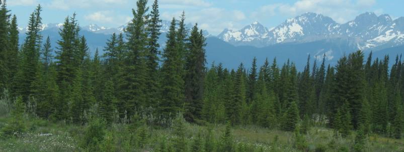
Notice the snow covered mountains we are passing.
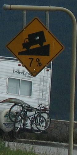
Just
another 7% grade.
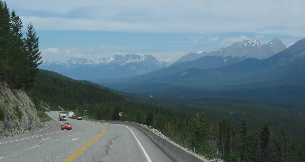
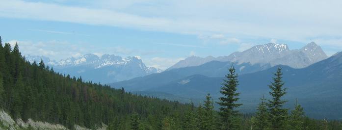
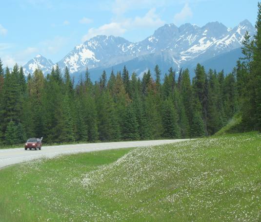
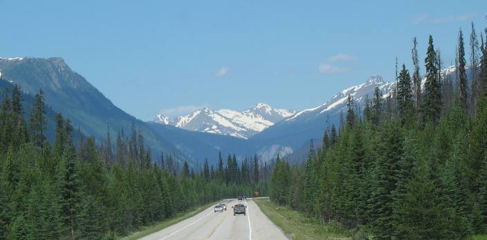
We
must have followed this valley for 30 to 40 miles with spectacular views of snow
capped mountains every way we looked on PH93
in Kootenay Natonal Park.
Joyce
is doing a good job taking these pictures out the front window of our motorhome.
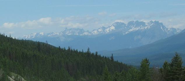
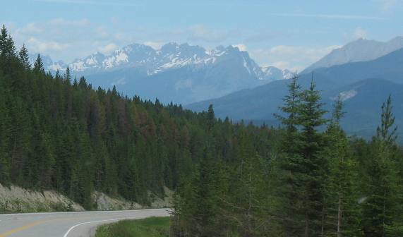
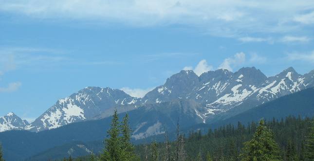
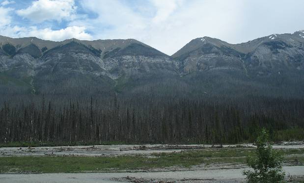
Some
of the mountains are more spectacular than others.
Shadows
on the mountains along with the deep green of the conifer forest make every turn
exciting.
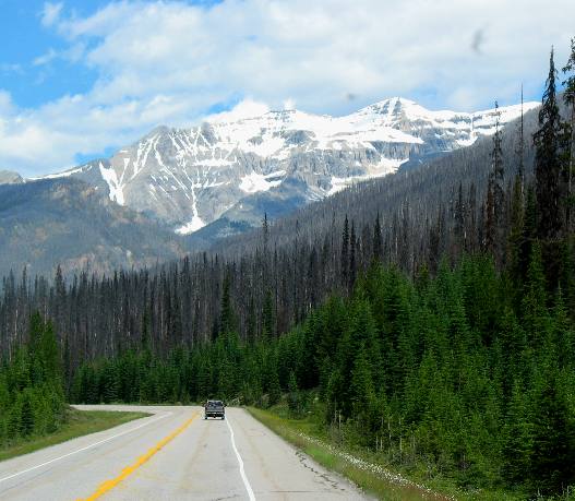
From
here it looks like the mountains have no forest on them.
Some
of that snow is actually deep glaciers that will not melt over the summer.
Scenes
like this will take your breath away.
Now
we are following the Kootenay
River to its headwaters high on the Continental Divide.
We
are going to have to find a pass through those mountains that form the backbone
of the Canadian
Rocky Mountains.
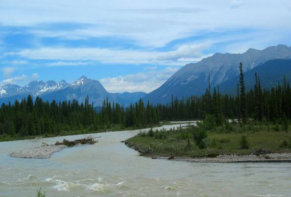
The
milky color of the Kootenay
River is from tiny bits of rock called glacial flour. This is pure glacier
run off and the water is saturated with small particles of rock that have been
ground to pieces by the glaciers.
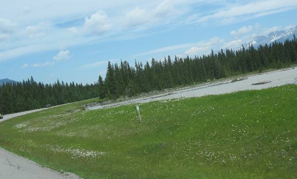
In
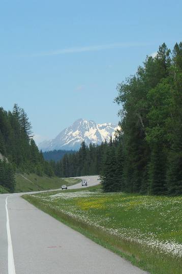
addition to the deep green of the conifer forest small white flowers are lining
the highway.
We
keep getting higher and higher as we continue to follow the Kootenay
River. Note that we are getting much closer to the snow.
The
white flowers are so thick along here that they appear to be snow.
The
valley is beginning to narrow and we are getting closer to the mountain.
By
this time I think we are starting to cross the mountain instead of just following
the valley.
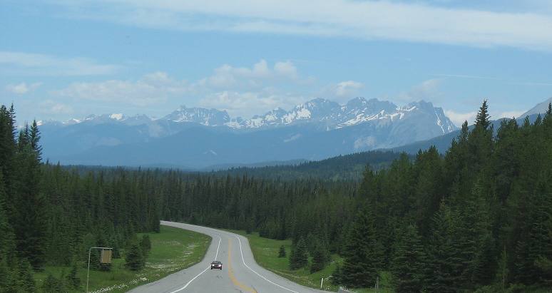
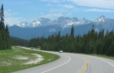
Isn't
this a magnificient view of the Canadian
Rockies from PH93
in Kootenay National Park.
It
isn't all up hill but most of it sure is. After all we have to climb to the Continental
Divide on PH 93 in
the Canadian Rockies.
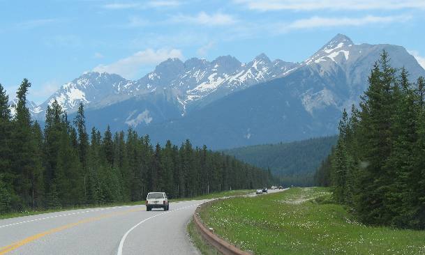
We
seem to be missing the uphill grade signs. Anyway, PH
93 through Kootenay
National Park in the Canadian
Rockies is a fun drive in our motorhome.
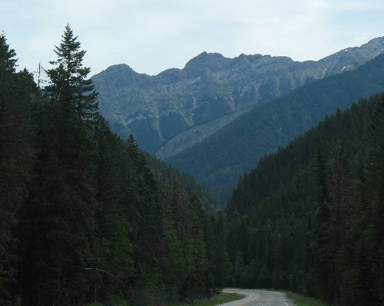
Those
are avalanche chutes and we are getting closer to them.
Snow avalanches
and rock slides cut swaths through green vegetation.
Many large rocks, some
weighing several tons, roll and bounce all the way to the bottom.
You
can clearly see where avalanches and rock slides have created these distinctive
trails through the vegetation.
Remember
that this is limestone and shales that have been thrusted up when two of the earths
plates collided.
In
this picture you can easily see the layers of sedimentary rock rising from the
Kootenay River.
Now
the glaciers are not much higher than we are. Note the avalanche chutes.
We
are nearing the pass over the Continental Divide.

This
is the last picture from British
Columbia. Shortly we cross over the Continental Divide and enter Alberta,
where we will drop down into Banff.
Until next time remember
how good life is.
We
hope you liked this page. If you do you might be interested in some of our other
Travel Adventures:
We
would love to hear from you......just put "info" in the place of "FAKE"
in this address: FAKE@travellogs.us
Until next time remember how good life
is.