Places Visited: Wyoming: Yellowstone National Park July 30 through August 5, 2006: Colter Bay Village Campground in Teton National Park near Moran, Wyoming: N43° 54.659' W110° 38.526' $15.00 NO hookups with paved interior roads and gravel spots. Nice, clean park and you really do not need hookups in the summer. We moved the motorhome from Jackson Hole to Colter Bay Village in the northern part of Teton National Park. That entire drive was through Teton National Park Valley, with the mighty Tetons providing a backdrop on our western flank. A more scenic drive is hard to find. One morning while staying in Colter Bay we decided that we should drive to Yellowstone just because it was so close, so that is what we did.
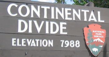
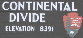
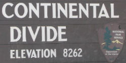
When entering Yellowstone National Park from the south you cross over the Continental Divide three times before arriving in the Old-Faithful area.
On one of the Continental Divide crossing there was a small lake less than an acre in size that someone had dammed up (just a small stone dam) on both sides so that some of the lake drained to the Atlantic and out of the other side some drained to the Atlantic. To make that happen both dams have to be the same exact elevation. I was intrigued by the thought process someone had to make this unique event happen. That would make a good quiz show question. Is there a body of water that drains into both the Atlantic and Pacific? Where is it located? Yes, in Yellowstone National park on the road (US-20) between Old Faithful & Grant Village.
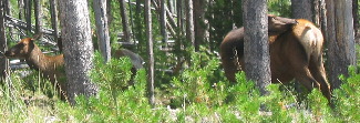
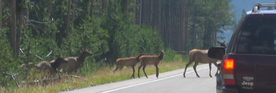
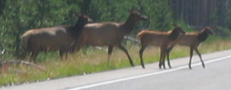
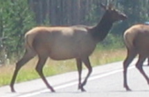
On this trip into Yellowstone only a few Elk were visible.
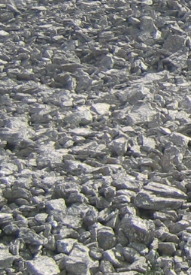
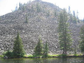
Centuries of weathering in sun and snow cause cliffs to break up, and great piles of rocks accumulate beneath them. These steep boulder slopes are called "Talus" Some slowly creep downhill, by their sheer mass forming rock glaciers. These huge rock piles provide ideal homes for small animals.
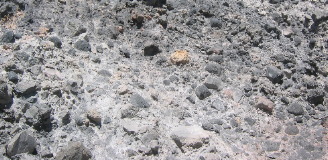
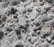
I was fascinated by this section of conglomerate exposed in a roadcut along the Firehole River. It looked to me like the river rocks had been "cemented" together by either flowing lava or ash.
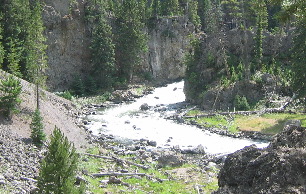
The cliff being cut by the Firehole River is of a flood of lava in cross-section. It may be difficult to imagine the forested Yellowstone Plateau covered with bubbling, hissing lava, but the rocks contain the evidence. Up close, you can see that the dark rhyolite cliff is pocked with volcanic gas bubbles. Waterfalls are further clues. Where the river reaches the edge of a hard lava flow, it erodes softer rock downstream, quarrying a steeper and steeper fall. Once you know what to look for, Yellowstone's scenery begins to simmer in volcanic drama ----- fire turned to stone, if you will.
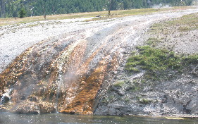
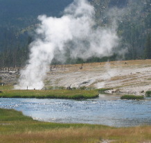
Joyce took this picture from the road between the Firehole River and Old Faithful as the road passes the Lower, Midway and Upper geyser basins, which include geysers, hot springs, mud pots and steam vents. Super hot water gushing from these "vents" is flowing to Iron Spring Creek that flows into the Firehole River a few miles away.
These elk caused an "elk-jam" for a few minutes. It was welcome since we did not see many elk today.
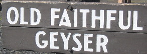
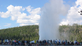
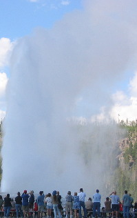
After the elk-jam we stopped for a short while at Old Faithful. It seemed like an obligatory stop. We also visited the Inn. It was a warm day and they didn't have the huge fireplace in operation. What a disappointment.
We stayed and watched Old Faithful perform then we headed back to our campground in the Tetons.
As always a large group of people gather to watch Old Faithful. I think it is impossible to visit Yellowstone without stopping by to view Old Faithful.
Until next time remember how good life is. Mike & Joyce Hendrix
|
| ||

| |||