|
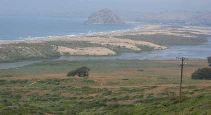
Places Visited: Saturday, May 28: Cypress Bay RV Park Morro Bay, California: $31 FHU-30amp. Paved interior roads & sites. N35° 72.165' W120° 51.044' Just up the street from us is a big Art & Craft show in the city park this weekend. Our first order of business was strolling through all the booths. We like to look at the photography for sale. The more we study "good" photography the more we realize what needs to be in our photographs. What is it about some pictures that catch your eye? Then we drove out to Montana De Oro State Park located on the extreme southwest corner of Morro Bay. This state park preserves 8,000 acres of rugged coastal cliffs, secluded sandy beaches, coastal plains, streams, canyons and hills if you call 1,347-foot Valencia Peak a hill. It is truly a jewel. The park also preserves Spooner's Ranch one of those wonderful slices of historic natural California. Morro Rock an ancient volcanic plug in the distance
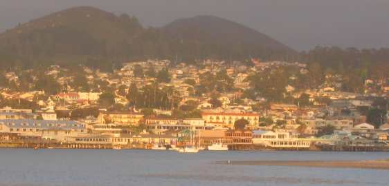
To reach Montana De Oro we just followed signs through the small hamlet of Los Osos. The park entrance is heavily wooded with mature eucalyptus trees. The road climbs through this eucalyptus forest before emerging on the North West side of the mountain to a captivating vista of Morro Bay to the north with Morro Rock an ancient volcanic plug standing sentinel over the channel, while the emerald Pacific splashes against the strand of sandy beach separating Morro Bay from the Pacific Ocean. We feel fortunate to be able to stop here and enjoy the sheer beauty displayed before us. The park is a popular equestrian facility and we watch horses and riders gallivanting on the strand. Many trucks with equestrian trailers are parked in select parking areas. From that first vista point the state park road turns south and follows the coast for several miles. There are parking places for people who want to access the beach as well as those entering the park with horse trailers. Trails lead back into the forest and the chaparral covered coastal mountains as well as down to the beach. At one point we stopped at a large cove where a number of sun bathers were enjoying the day. On a cliff above the beach snuggled in a small grove of Monterrey Cypress trees is the old Spooner Ranch house now performing duties as the state park visitor center. We cover Montana De Oro State Park in another travel log. This one is dedicated to Morro Bay. Don't miss Montana de Oro when you visit Morro Bay or San Luis Obispo. I just threw this picture in so you could see Morro Bay from the south side looking north toward Morro Rock.
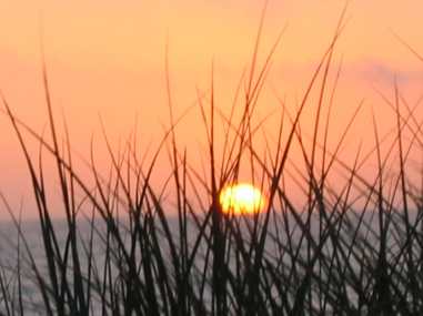
Sunset over the Pacific Ocean near Morro Bay, California
Joyce is getting quiet qood with these sunset pictures. Sunday, May 29: Cypress Bay RV Park Morro Bay, California: $31 FHU-30amp. Paved interior roads & sites. N35° 72.165' W120° 51.044'
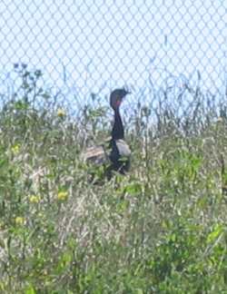
Wild turkey in the city of Morro Bay, California
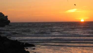
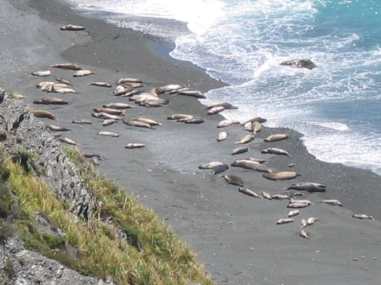
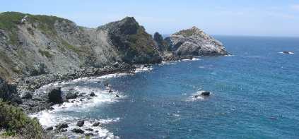
We spent the day exploring the Big Sur on CA-1. As we were on the entrance ramp to CA-1 in downtown Morro Bay I had to stop the Saturn for a hen turkey crossing the road in front of me. I was going slow enough that I was able to stop and take this picture. Morro Bay is a quiet "laid-back" community much like many small communities throughout this great country and this picture shows that. We are literally just two blocks from where we walked through that art show the other day. This is in town. The stretch of CA-1 that traverses the rugged California coast between Monterrey and Morro Bay is considered by most to be the Big Sur. That area of California is roughly located 150-miles south of San Francisco and 300 miles north of Los Angeles. Historically, the name Big Sur, was derived from that unexplored and unmapped wilderness area which hugs the coast south of Monterey. It was simply called El Sur Grande---The Big South. As CA-1 wends its way along the majestic Santa Lucia Mountains flank the eastern side while the rocky Pacific Coast hug the western side. Sea lions sunning along the Big Sur coast in California
Again today we stopped by pulloffs and peered down the cliff to the beach and ocean below where those sea lions were resting. Pioneers began settling in the area in the mid-1800's. Today's landmarks bear the names of many of those early settlers-----Mt. Manuel, Pfeiffer Ridge, Post Summit, Cooper Point, Dani Ridge, Partington Cover and others. Other landmarks are telling as well Jade Cove is known for the jade that can be found on the beach and in the surf. Piedras Blancas Lighthouse --- Spanish for the "white rock" lighthouse---a large rock rises from the Pacific just off the point of land where the light house is located. Sea birds roosting on the prominent rock have coated it in white-guano thus why the Spanish called it white rock. While the turn of the century supported a lively redwood lumbering industry in the northern end of the Big Sur the only link with civilization were steamers transporting goods and supplies. The present highway wasn't completed until 1937 after 18-years of construction. It was declared California's first Scenic Highway and to this day provides a driving experience unsurpassed in natural beauty and scenic variety. Electricity did not arrive in Big Sur until the early 1950's, and still does not extend the length of the coast or into the more remote mountainous area. To say much of the Big Sur is remote would be an understatement. View along the Big Sur south of Carmel, California
The attraction of Big Sur is the scenic qualities and natural grandeur of the coast which result from the imposing geography, rich vegetative compositions, and the dramatic meetings of land and sea. CA-1 along the Big Sur is noted for its sharp curves and step hills. Flat stretches are few and far between. While most RV'ers avoid driving the Big Sur in their RV's rental units were buzzing up and down the entire length. We even saw a few larger Class A motorhomes in addition to one large coach towing a big SUV on a twin axle trailer. It can be done in a motorhome by those so inclined but be aware there are no services and the terrain will severely tax a motorhome drive train.
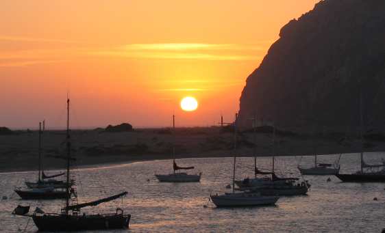
Sunset view of Morro Bay around Morro Rock
We drove to Morro Rock for the sunset event where we took this picture of the small community of Morro Bay across the mouth of the bay.
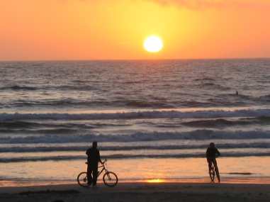
Sunset from beach near Morro Rock
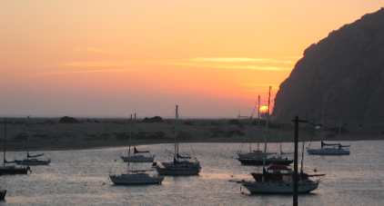
We ended the day by paying homage, once again, to the setting sun. This time we watched from a vantage point on the beach near Morro Rock. It would be hard for life to get any better. On our way back to Morro Bay we stopped by Baywood Park a small community on the southern bank of Morro Bay. Each community along the shore of Morro Bay seem to have park areas where the community can enjoy the bay. Morro Bay reminds us of our childhood homes where we both grew up in estuary settings, me in Panama City, Florida and Joyce in Brunswick, Georgia. Each of the estuaries has so much in common. Sunset over Morro Bay with Morro Rock an ancient volcanic plug
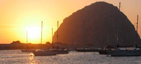
We found yet another location to watch the sun set tonight. This time we chose a bluff overlooking the harbor in town.
Sunset over Morro Bay with Morro Rock an ancient volcanic plug
View across Morro Bay with Morro Rock in the distance.
Sunset over Morro Bay with Morro Rock an ancient volcanic plug
Morro Rock is an ancient volcanic plug.
Until next time remember how good life is. More California AdventuresAdventures by State ** More 2005 Travel Adventures
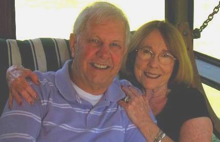
Mike & Joyce Hendrix
Mike & Joyce Hendrix who we are We hope you liked this page. If you do you might be interested in some of our other Travel Adventures: Mike & Joyce Hendrix's home page Travel Adventures by Year ** Travel Adventures by State ** Plants ** Marine-Boats ** Geology ** Exciting Drives ** Cute Signs ** RV Subjects ** Miscellaneous Subjects
We would love to hear from you......just put "info" in the place of "FAKE" in this address: FAKE@travellogs.us Until next time remember how good life is.
|
| ||
|
| |||
|
| |||
|
|