|
Cape Girardeau & Trail of Tears State Park We left Land Between the Lakes, Kentucky and headed to Fort Defiance in Cairo, Illinois before heading across the Mississippi River into Missouri where we stopped in Trail of Tears State Park in Cape Girardeau, Missouri. Tomorrow morning we are heading to Fort Defiance at Cairo, Illinois. Fort Defiance is located at the confluence of the Ohio and Mississippi Rivers. Lewis & Clark spent time at Fort Defiance before heading up the Mississippi to St Louis. Floating down the Ohio River with the current was a piece of cake. Working their craft upstream against the current of the mighty Mississippi will prove to be a bigger task than they had planned for. Sunday July 18, 2004 Trail of Tears State Park--Cape Girardeau, Missouri: N37° 27.257': W89° 27.778' $12.00 for 30amps no water but central dump. Full hookup was available for more $$--nice campground. We slept late then headed to Fort Defiance State Park, Illinois. Our plan was to spend the night in Fort Defiance then head up the Mississippi River toward St Lewis tomorrow. Bridge across the Ohio River at Cairo, Illinois
The bridge across the Ohio River on US-51 was old and made for an exciting drive. Not a bad bridge but much more exciting than the modern 4-lane bridges being constructed today. At the bottom of the bridge, on the Illinois side, there is a stop sign. Fort Defiance State Park is 100 yards or so to the south. We turned into the park and past the campground. It looked to us like there were 30 or so campsites with electricity but nobody was camping there. We drove around the entire park and decided that it was not worth spending the night. It was decision time and we quickly decided to continue on to Trail of Tears State Park around Cape Girardeau, Missouri. On November 14, 1803 Lewis & Clark landed at the confluence of the Ohio & Mississippi River (Fort Defiance), where present day Cairo, Illinois is located. They spent nearly a week here learning how to determine longitude and latitude, a skill they would need on their westward expedition. The Corps of Discovery stayed at Fort Defiance for 6 days one of the longest stops made by the expedition. It was here they saw the Mississippi River for the first time. They noted mistletoe on the large "timber" and caught a 128 pound blue catfish. Their journals say that the area was heavily forested with massive cottonwood and sycamore trees. The floodplain around Fort Defiance still had those "massive" cottonwood trees although we did not note any distinctive sycamore trees. Their stay allowed Lewis to teach Clark how to use the navigational equipment (compass, sextant and chronometer). Because the 3rd Principal Meridian begins at the mouth of the Ohio, astronomical observations at this point were crucial. I read the information about the 3rd Principal Meridian on a kiosk at Fort Defiance. I know that a meridian is a line drawn through the poles of the earth. The prime meridian runs through Greenwich, England. So what is the 3rd Principal Meridian? I checked the GPS and it says the coordinate is west 89° 8.44' that would make it close to 90° (for government work), so a Principal Meridian must be 30° if the 3rd Principal Meridian is around 90°. Anyone that cares to can provide me with some more information on this subject. President Jefferson arranged for Meriwether Lewis to be trained in celestial navigation prior to the trip. That is where he learned how to use the compass, sextant and chronometer. Clark meanwhile was a skilled surveyor and mapmaker. He brought along those skills and tools. At Fort Defiance Lewis was teaching Clark the navigation skills he had only recently learned. Campground at Fort Defiance, Illinois
The campground at Fort Defiance appeared to be free. We did not see anyone to pay and no instruction on paying. They did have electricity connections on poles with the electric boxes 8' to 9' in the air. The campground was obviously on a floodplain. There was a central dump available on the high ground near the entrance to the park. This dump site could be used by anyone anytime as it is not behind any gates to the park. We contemplated how campers managed to get their electric cords plugged in. There may be a "community" ladder that we did not spot, or they may have just stood on picnic tables. There were no campers in the campground when we passed through although it was a pretty place sprinkled with new growth cottonwood trees. From Cairo and Fort Defiance we headed north in Illinois until we were across the Mississippi River from Cape Girardeau where we took the bridge over to Missouri. Cape Girardeau is one of the oldest towns west of the Mississippi, River. In the 1730's a Frenchman named Jean Baptiste Girardot set up a trading post at a rock promontory jutting from the west bank of the River. The site became known as Cape Rock. Girdot was a trader, not a settler, and by the middle 1700's he had moved on. In 1793 the Spanish Government gave another Frenchman Louis Lorimier a land grant. Lorimier established another trading post. By the time Lewis and Clark passed here in 1803 the town boasted a population of 1,111. Do you remember us visiting Locust Grove, the final home of General George Rogers Clark the older brother of William Clark of Lewis & Clark Expedition fame? General George Rogers Clark burned one of Lorimier's trading posts in Ohio in 1781 when he was ridding the "northwest territory" of British. We knew there were some historic things to see in Cape Girardeau so we found a place to pull the motorhome and car over in the downtown waterfront area and took a walking tour of the old historic district and waterfront. They have painted murals on the retaining wall protecting the town from periodic floods. The murals on Paducah, Kentucky's retaining wall were of much better quality but these were interesting also. Another touch we liked about the Paducah murals was a plaque accompanying each that explained the history behind each painting that were missing from the murals here in Cape Girardeau.
Old Coca Cola sign on side of building in Cape Girardeau, Missouri
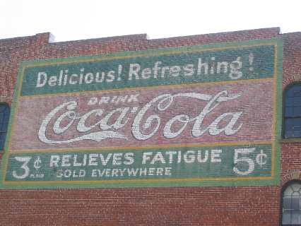
Murals are on prominent buildings as well. One we liked was the Coca Cola mural. It was discovered in 1978 when an old historic building housing a local restaurant was being sand blasted. The local Coca Cola Bottling Company had it restored to its original appearance. Prices were 3 cents for plain and 5 cents to relieve fatigue. Twenty miles up the road we pulled into Trail of Tears State Park. Several friends have stayed in Trail of Tears State Park this year and recommended it. Lon, a virtual friend, also wrote about having enjoyed spending time at the "overlook" in the park from which you can see miles up river and down river.
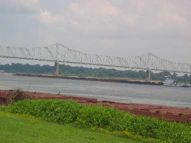
Barge heading upstream on the Mississippi as seen from Trail of Tears State Park
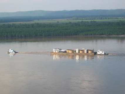
While Lon watched a tug pushing 30 or 35 barges we only saw one barge heading up river with a tug in front pulling while a tug in back pushed. The pushing tug could not see over the containers on the deck of the barge thus the tug out front was probably guiding the tow. Between the two tugs they were only making about 2-knots headway against the current. Wherever they are going is going to take a LONG time to get there. There is a good chance that we would have missed the overlook had it not been for Lon sharing how much he had enjoy spending time on that promontory watching river traffic. I would like to give Lon thanks for that piece of information. Also note in the picture of the barge & two tugs struggling against the current that we are on one of those high promatories of limestone that Lewis described being on the Missouri side of the river along here. Also note the broad floodplain on the Illinois side of the river just as Lewis described it. Larry & Cindy Gobin also stayed in this campground as they made their way north on their way to Alaska this spring. As we speak Larry & Cindy are in Alaska and to them we want to give thanks for reminding us that the RR track runs by the campground. We were ready when that whistle blew and the earth rumbled.
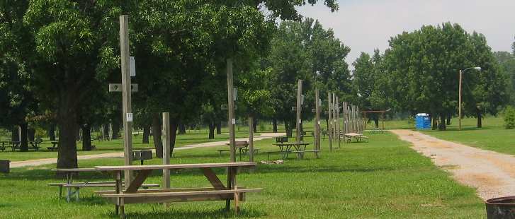
Trail of Tears State Park in Cape Girardeau, Missouri
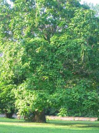
Near the campground in Trail of Tears SP we came upon two of the largest catalpa trees either of us has ever seen. We stopped to take pictures.
Lewis noted in his journal that while the Illinois side of the Mississippi was low and flood prone, the Missouri side "has been generally bold…..but here puts in some high cliffs the summits of which are crowned with pine……….these rocks are nearly perpendicular in many places 60'". It just so happens that the "overlook" we were standing on was at the top of one of those perpendicular cliffs Lewis described in his journal. We could look upstream and see another prominent face of limestone jutting up perpendicular to the river. A native of the area told us that it was a working limestone mine. The limestone was being quarried for use as breakwaters on the river according to him. Across the river in Illinois the land was indeed low and flood prone just as Lewis had described. As I write my journal I am reminded of the difficult assignment the leaders of the Corps of Discovery had. With all they did I can not fathom having enough time to write a journal as detailed as theirs was. Tomorrow we are heading to St Louis. Click here for more Missouri travellogsUntil next time remember how good life is. More Missouri AdventuresSome Key West Adventures ** More 2004 Travel Adventures
Mike & Joyce Hendrix
Mike & Joyce Hendrix who we are We hope you liked this page. If you do you might be interested in some of our other Travel Adventures: Mike & Joyce Hendrix's home page Travel Adventures by Year ** Travel Adventures by State ** Plants ** Marine-Boats ** Geology ** Exciting Drives ** Cute Signs ** RV Subjects ** Miscellaneous Subjects
We would love to hear from you......just put "info" in the place of "FAKE" in this address: FAKE@travellogs.us Until next time remember how good life is.
|
| ||
|
| |||
|
| |||
|
|